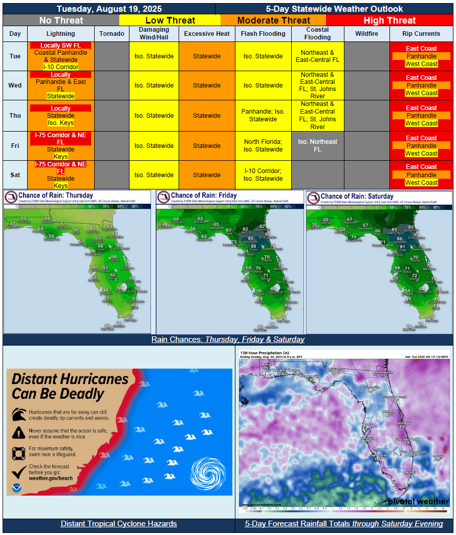
5 Day Statewide Weather Outlook for Tue. 8/19 to Sat. 8/23
Florida Division of Emergency Management sent this bulletin at 08/19/2025 03:49 PM EDT
This update is intended for government and emergency response officials, and is provided for informational and situational awareness purposes only. Forecast conditions are subject to change based on a variety of environmental factors. For additional information, or for any life safety concerns with an active weather event please contact your County Emergency Management or Public Safety Office or local National Weather Service forecast office.
You are subscribed to 5 Day Weather Outlook for Florida Division of Emergency Management. This information has recently been updated, and is now available.
…Distant Hurricane Erin Bringing Breezy Winds Along Florida East Coast Through Midweek…Slightly Drier Air Keeping Shower and Thunderstorm Activity Scattered Tuesday and Wednesday…Approaching Front to Increase Rain Chances Beginning Thursday, But More So Friday and Saturday…Increased Potential for Localized Flash Flooding and Ponding of Water Across North Florida Friday and Saturday As Front Begins to Stall…Triple Digit Heat Index Values Expected Daily; Just Below Heat Advisory Criteria…Life-Threatening and Extremely Dangerous Beach Conditions and Rip Currents Along the Florida East Coast Throughout the Forecast Period Due to Distant Hurricane Erin Remaining Well Offshore…Instances of Minor Coastal Flooding and Beach Erosion Possible Too…