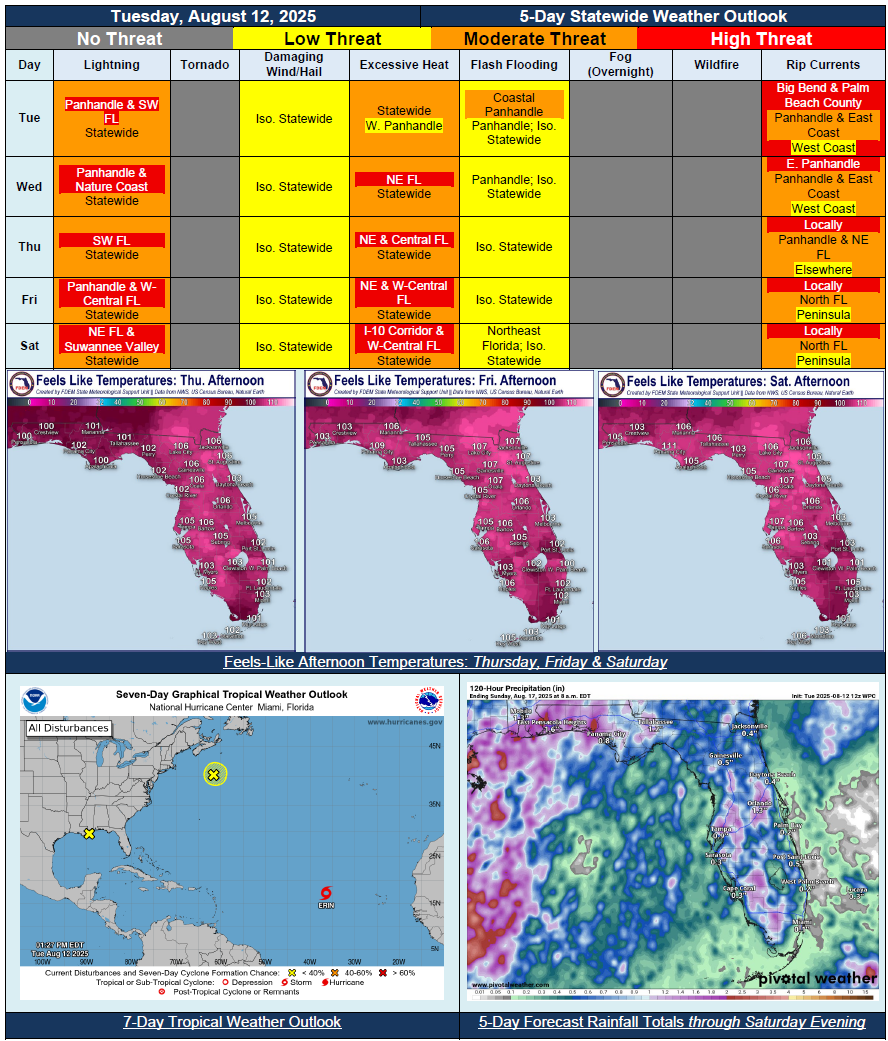
5 Day Statewide Weather Outlook for Tue. 8/12 to Sat. 8/16
Florida Division of Emergency Management sent this bulletin at 08/12/2025 02:20 PM EDT
This update is intended for government and emergency response officials, and is provided for informational and situational awareness purposes only. Forecast conditions are subject to change based on a variety of environmental factors. For additional information, or for any life safety concerns with an active weather event please contact your County Emergency Management or Public Safety Office or local National Weather Service forecast office.
You are subscribed to 5 Day Weather Outlook for Florida Division of Emergency Management. This information has recently been updated, and is now available.
…Upper-Level Disturbance Bringing Repeated Rounds of Heavy Rainfall to Panhandle Midweek…High Pressure Settling Back In Over Western Atlantic and Florida Peninsula To Reinstate Typical Summertime Thunderstorm Pattern…Daily Scattered to Numerous Showers and Thunderstorms Along Sea Breeze Through Rest of the Week and Into the Weekend…Increasing Daytime High Temperatures and Heat Index Values Each Day…Heat Advisories Likely To Return By End of the Week…Heat Index Values Return to Triple Digits Statewide By Thursday…Daily Thunderstorms Could Lead to Localized Ponding of Water with Heavy Downpours…