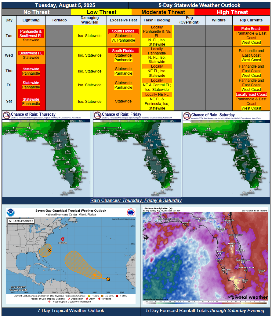
5 Day Statewide Weather Outlook for Tue. 8/5 to Sat. 8/9
Florida Division of Emergency Management sent this bulletin at 08/05/2025 03:43 PM EDT
This update is intended for government and emergency response officials, and is provided for informational and situational awareness purposes only. Forecast conditions are subject to change based on a variety of environmental factors. For additional information, or for any life safety concerns with an active weather event please contact your County Emergency Management or Public Safety Office or local National Weather Service forecast office.
You are subscribed to 5 Day Weather Outlook for Florida Division of Emergency Management. This information has recently been updated, and is now available.
…Wet and Active Weather Pattern With Enhanced Daily Shower and Thunderstorm Activity…Stalled Frontal Boundary and Plenty of Moisture Giving Way to Scattered to Widespread Showers and Thunderstorms…Localized Flash Flooding Threat Possible With Repeated Rounds of Heavy Downpours…Disturbance Off Southeast U.S. Coast to Enhance Daily Shower and Thunderstorm Activity Later in Week and Into Weekend Regardless of Tropical Development…Increased Risk for Flash Flooding Threat Expands Across Peninsula Friday and Into Saturday…Widespread Heat Index Values in Triple Digits Mostly Statewide Through Midweek…Increased Risk for Rip Currents Tuesday, Then Again Later This Weekend Along East Coast Beaches With Offshore Disturbance…