5 Day Statewide Weather Outlook for Tue. 7/29 to Sat. 8/2
Florida Division of Emergency Management sent this bulletin at 07/29/2025 02:14 PM EDT
This update is intended for government and emergency response officials, and is provided for informational and situational awareness purposes only. Forecast conditions are subject to change based on a variety of environmental factors. For additional information, or for any life safety concerns with an active weather event please contact your County Emergency Management or Public Safety Office or local National Weather Service forecast office.
You are subscribed to 5 Day Weather Outlook for Florida Division of Emergency Management. This information has recently been updated, and is now available.
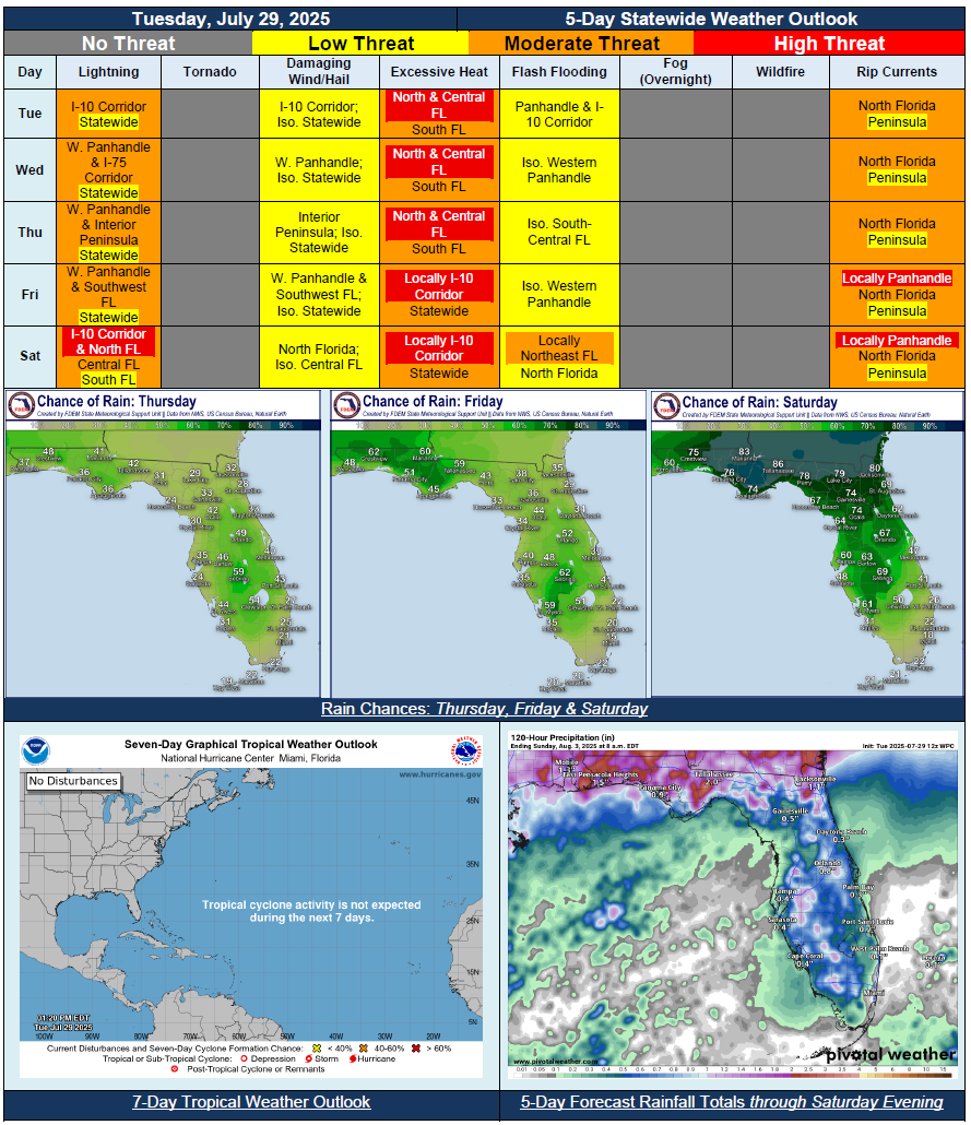
…Dangerous Heat and Humidity Across the State Each Day; Some of The Hottest Conditions of the Summer…Upper-Level Feature Creating Enhanced Shower and Thunderstorm Activity Along I-10 Corridor Tuesday…More Typical Summertime Thunderstorm Pattern Through End of Week…Weak Front Approaches State Late Friday and Into Saturday…Widespread Showers and Thunderstorms Expected Across North Florida Saturday; Scattered Activity for Central Florida…Locally Heavy Downpours and Slow-Moving Thunderstorms Could Lead to Instances of Localized Flash Flooding…Heat Advisories Needed Daily; Excessive Heat Warnings Possible Through Wednesday or Thursday for Portions of the State…Mild Low Temperatures May Prolong Daytime Heat and Humidity Bringing Little Relief Overnight…