5 Day Statewide Weather Outlook for Tue. 7/22 to Sat. 7/26
Florida Division of Emergency Management sent this bulletin at 07/22/2025 01:44 PM EDT
This update is intended for government and emergency response officials, and is provided for informational and situational awareness purposes only. Forecast conditions are subject to change based on a variety of environmental factors. For additional information, or for any life safety concerns with an active weather event please contact your County Emergency Management or Public Safety Office or local National Weather Service forecast office.
You are subscribed to 5 Day Weather Outlook for Florida Division of Emergency Management. This information has recently been updated, and is now available.
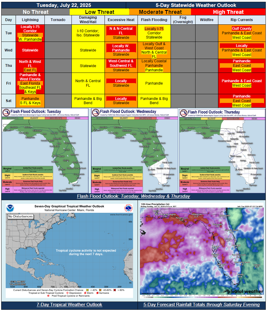
…Wet and Active Weather Pattern Returns Statewide Midweek With Upper-Level Disturbance…Increased Risk for Flash Flooding Each Day With Repeated Rounds of Heavy Rainfall; Marginal Risk (level 1 of 4) for Flash Flooding…Summertime Heat and Humidity Persists; Dangerous Conditions Across Portions of the State Through Midweek and Heat Advisories Likely…Shower and Thunderstorm Chances to Shift Westward Friday and Saturday; Drier Conditions Returning Towards End of Week As Disturbance Moves Away…Triple Digit Heat Index Values Return Statewide By Saturday…