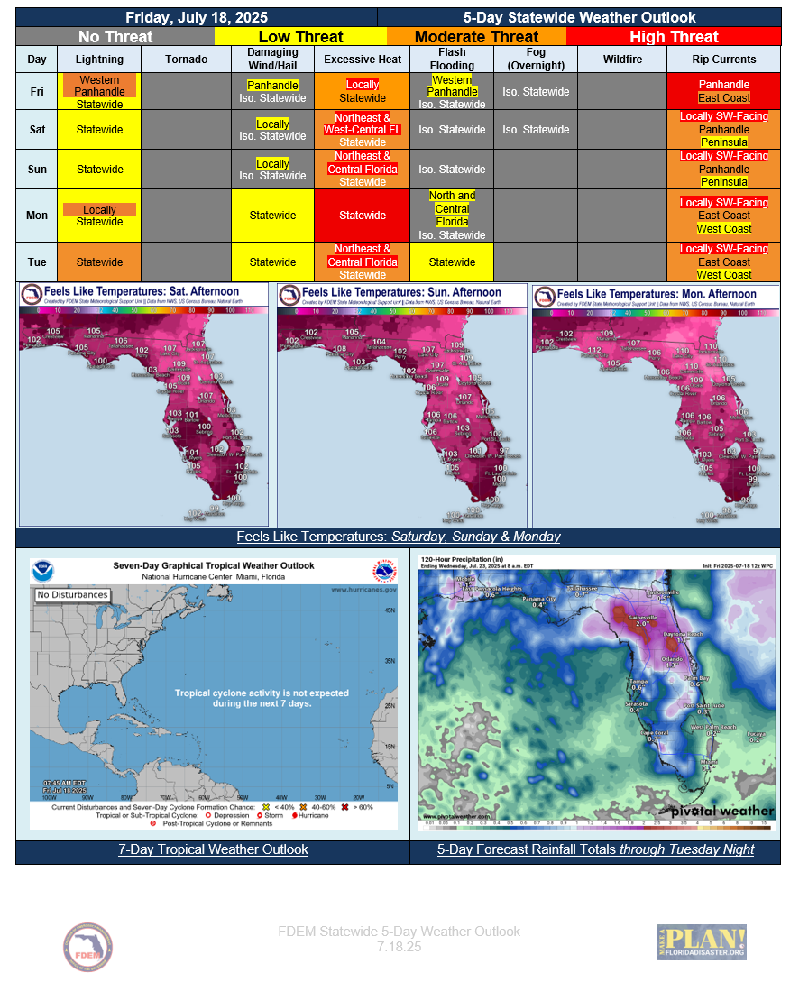
5 Day Statewide Weather Outlook (Fri. 7-18-25 To Tue. 7-22-25)
Florida Division of Emergency Management sent this bulletin at 07/18/2025 02:43 PM EDT
This update is intended for government and emergency response officials, and is provided for informational and situational awareness purposes only. Forecast conditions are subject to change based on a variety of environmental factors. For additional information, or for any life safety concerns with an active weather event please contact your County Emergency Management or Public Safety Office or local National Weather Service forecast office.
You are subscribed to 5 Day Weather Outlook for Florida Division of Emergency Management. This information has recently been updated, and is now available.
Deep Southerly Flow Remains on Friday Bringing Some Rain Chances Statewide and High Rip Current Risk Along the Gulf Coast…Slight Risk for Flash Flooding Over Far Western Florida Panhandle With Greatest Rain Chance… Embedded Thunderstorms Could Produce Localized Flooding for Urban and Low-lying Poor Drainage Areas…Rain Chances Become Isolated Across the State This Weekend…Afternoon High Temperatures Reach Mid-90s to Low 100s Statewide...Feels-like Temperatures Reach Heat Advisory Criteria Over Central and North Florida... Greater Rain Chances Return Monday and Tuesday with an Approaching Upper-Level Disturbance from the East… Flash Flood Concerns Return Early Next Week…