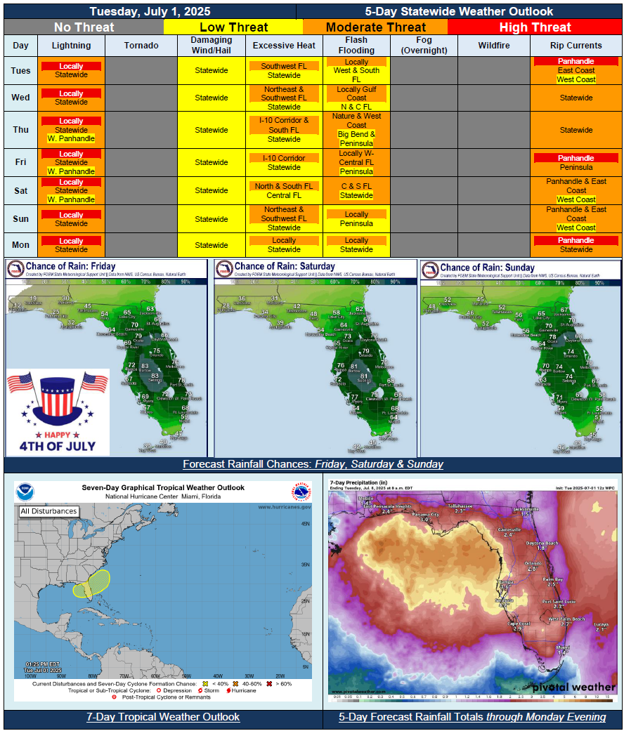
5 Day Statewide Weather Outlook for Tue. 7/1 to Mon. 7/7
Florida Division of Emergency Management sent this bulletin at 07/01/2025 04:34 PM EDT
This update is intended for government and emergency response officials, and is provided for informational and situational awareness purposes only. Forecast conditions are subject to change based on a variety of environmental factors. For additional information, or for any life safety concerns with an active weather event please contact your County Emergency Management or Public Safety Office or local National Weather Service forecast office.
You are subscribed to 5 Day Weather Outlook for Florida Division of Emergency Management. This information has recently been updated, and is now available.
…Wet and Unsettled Pattern Across the State For Next Several Days…Scattered to Numerous to Numerous Showers and Thunderstorms Each Day…Weak Frontal Boundary to Aid Daily Thunderstorm Development…Increased Risk for Flash Flooding With Heavy Downpours and Repeated Rounds of Rainfall…Embedded Strong to Severe Thunderstorms Possible…Low (30%) Chance for Area of Weak Low Pressure to Develop Along Stalling Frontal Boundary Weekend; High Uncertainty and Low Confidence…Seasonable Temperatures and Heat Index Values; Values in Triple Digits Possible for Portions of State…