5 Day Statewide Weather Outlook (Fri. 6/20 - Tue. 6/24)
Florida Division of Emergency Management sent this bulletin at 06/20/2025 04:58 PM EDT
This update is intended for government and emergency response officials, and is provided for informational and situational awareness purposes only. Forecast conditions are subject to change based on a variety of environmental factors. For additional information, or for any life safety concerns with an active weather event please contact your County Emergency Management or Public Safety Office or local National Weather Service forecast office.
You are subscribed to 5 Day Weather Outlook for Florida Division of Emergency Management. This information has recently been updated, and is now available.
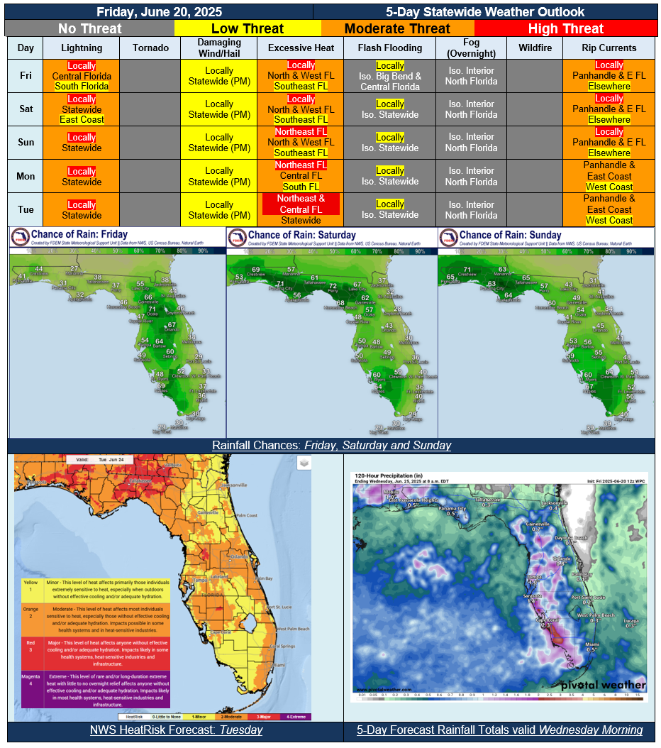
…Summertime Pattern Across Florida Continues Through the Forecast Period…Thunderstorms Each Afternoon May Produce Frequent Lightning, Gusty Winds, and Torrential Downpours…Nuisance Flooding and Ponding Water Possible…Warm and Muggy Conditions Statewide…Triple Digit Heat Index Values Expected Each Afternoon, Near Heat Advisory Criteria Likely for Interior Florida Locations…Onshore Flow to Bring Moderate to High Risk of Rip Currents to Florida Panhandle and East Coast Beaches…Tropical Development is Not Expected in the Atlantic Basin During the Next 7 Days…