5 Day Statewide Weather Outlook for Fri. 6/13 to Tue. 6/17
Florida Division of Emergency Management sent this bulletin at 06/13/2025 01:25 PM EDT
This update is intended for government and emergency response officials, and is provided for informational and situational awareness purposes only. Forecast conditions are subject to change based on a variety of environmental factors. For additional information, or for any life safety concerns with an active weather event please contact your County Emergency Management or Public Safety Office or local National Weather Service forecast office.
You are subscribed to 5 Day Weather Outlook for Florida Division of Emergency Management. This information has recently been updated, and is now available.
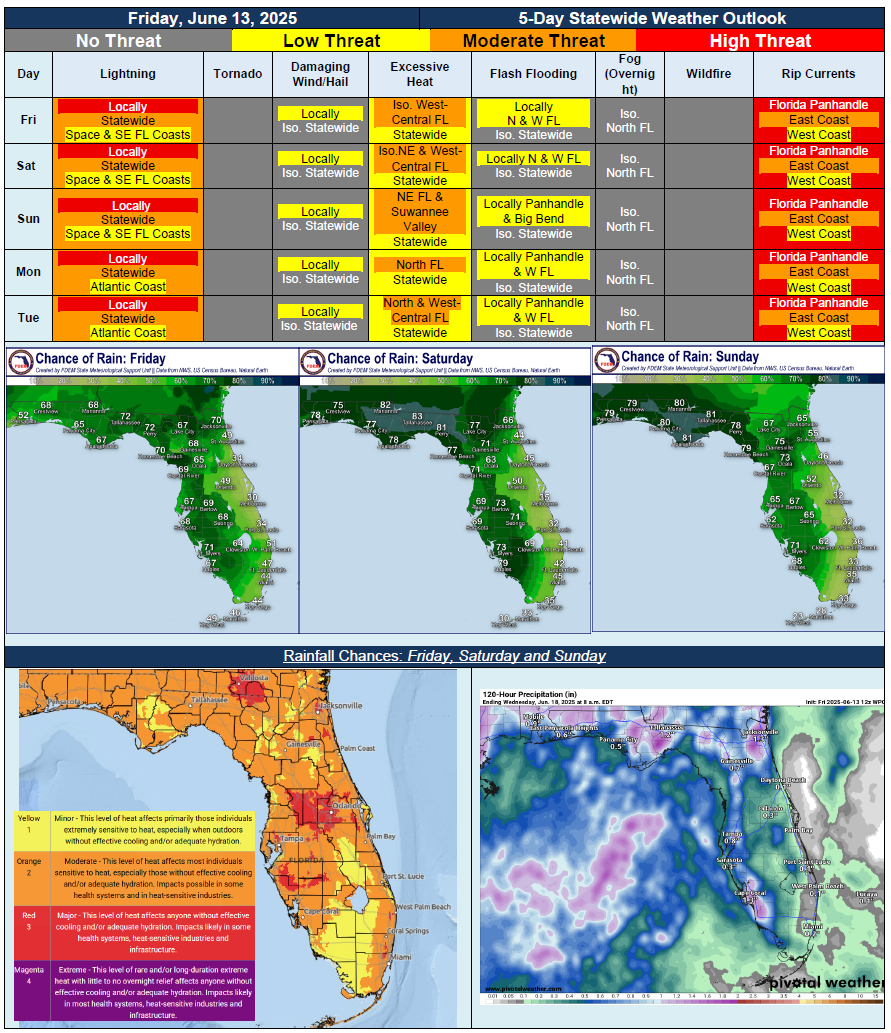
…Little Change in Overall Weather Pattern Over Next 5 Days…Daily Showers and Thunderstorms Driven By Plenty of Moisture, Daily Sea Breeze and Daytime Heating…Locally Strong to Severe Thunderstorms Possible Each Day; Lightning, Gusty Winds and Torrential Downpours…Flash Flooding and Ponding of Water Possible With Repeated Rounds of Heavy Downpours or Slow-Moving Thunderstorms…Summertime Heat and Humidity Expected Each Day; Triple Digit Heat Index Values Approaching Heat Advisory Criteria for Portions of North and West-Central Florida Through Forecast Period…Mostly Calm Conditions Overnight with Lingering Nearby Coastal Shower or Thunderstorm…No Tropical Cyclone Activity Expected Over Next 7 Days…Elevated Waters for Big Coldwater Creek and Escambia River Continue to Decline…Persistent Weather Pattern to Keep Moderate to High Risk for Rip Currents in Place Across Panhandle and East Coast…