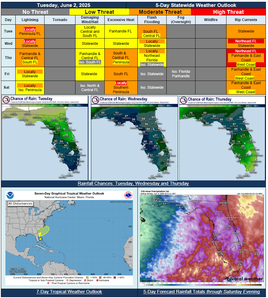
5 Day Statewide Weather Outlook for Tue. 6/3 to Sat. 6/7
Florida Division of Emergency Management sent this bulletin at 06/03/2025 04:49 PM EDT
This update is intended for government and emergency response officials, and is provided for informational and situational awareness purposes only. Forecast conditions are subject to change based on a variety of environmental factors. For additional information, or for any life safety concerns with an active weather event please contact your County Emergency Management or Public Safety Office or local National Weather Service forecast office.
You are subscribed to 5 Day Weather Outlook for Florida Division of Emergency Management. This information has recently been updated, and is now available.
…Unsettled and Active Weather Shifting Northward Each Day Through Midweek…Widespread Rainfall Expanding Into Panhandle By Wednesday and Thursday…Localized Flash Flooding Possible Each Day, Especially With Multiple Rounds of Rainfall Over Urban Areas…Daily Showers and Thunderstorms Along the Sea Breeze Return At the End of the Week…Saharan Dry Air Shifting Eastward Over the State To Bring Slightly Drier Conditions and May Limit Widespread Activity…Warmer Conditions Return Towards the End of the Week With Triple Digit Heat Index Values Returning for Part of State…NHC Outlooking First Area of Development for 2025 Atlantic Season; No Direct Threat to Florida But Will Increase Rain Chances, Surf and Rip Currents Along Atlantic Coast Through Mid-to-Latter Portions of Week…