5 Day Statewide Weather Outlook for Tue. 5/27 to Sat. 5/31
Florida Division of Emergency Management sent this bulletin at 05/27/2025 04:35 PM EDT
This update is intended for government and emergency response officials, and is provided for informational and situational awareness purposes only. Forecast conditions are subject to change based on a variety of environmental factors. For additional information, or for any life safety concerns with an active weather event please contact your County Emergency Management or Public Safety Office or local National Weather Service forecast office.
You are subscribed to 5 Day Weather Outlook for Florida Division of Emergency Management. This information has recently been updated, and is now available.
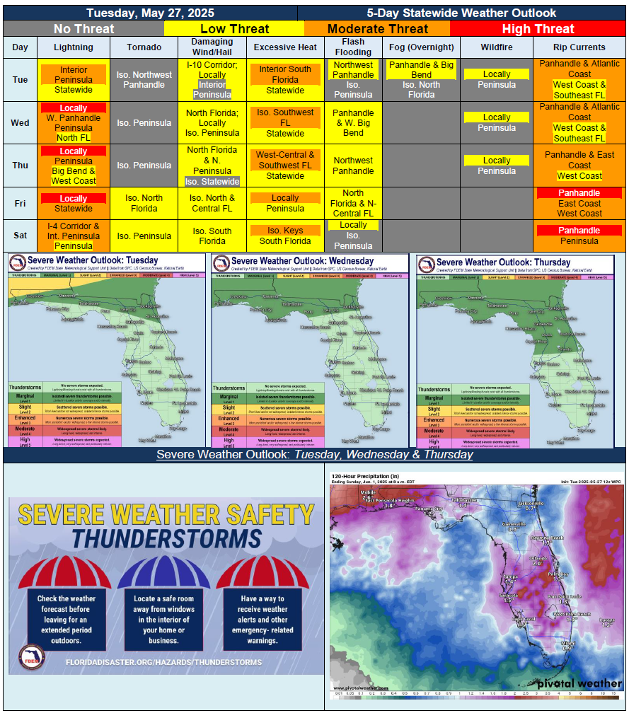
…More Active Weather Pattern Developing Across North Florida Over Next Few Days…Severe Weather Possible Each Day Throughout Portions of North Florida…Beneficial and Widespread Rainfall Arrives Later this Week With Help of Cold Front…Increasing Potential for Flash Flooding Leading Up to Friday…Daily Sea Breeze Shower and Thunderstorm Activity Expected Each Day Throughout Interior Peninsula…Heat Index Values Well Into 90s and Triple Digits Through Midweek…Slightly Reprieve of Conditions Across North Florida and Portions of Central Florida Heading Into the Weekend…Mostly Calm Marine Conditions Throughout Forecast Period; High Risk for Rip Currents Returns to Panhandle By Late Week…