5 Day Statewide Weather Outlook for Tue. 5/20 to Sat. 5/24
Florida Division of Emergency Management sent this bulletin at 05/20/2025 04:54 PM EDT
This update is intended for government and emergency response officials, and is provided for informational and situational awareness purposes only. Forecast conditions are subject to change based on a variety of environmental factors. For additional information, or for any life safety concerns with an active weather event please contact your County Emergency Management or Public Safety Office or local National Weather Service forecast office.
You are subscribed to 5 Day Weather Outlook for Florida Division of Emergency Management. This information has recently been updated, and is now available.
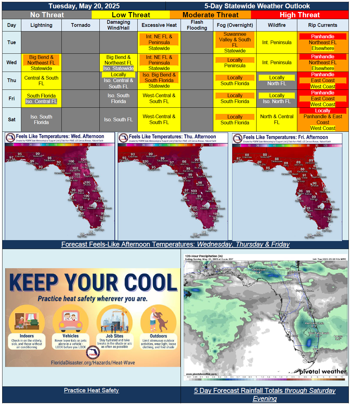
…Mostly Dry Conditions to Start Off Forecast Period…Increasing Shower and Thunderstorm Chances Return Wednesday with Approaching Frontal Boundary; Locally Strong to Severe Thunderstorms Possible for Big Bend and Northeast Florida…Frontal Boundary Lingering Through Rest of Week to Bring Chances of Rain Throughout Central and South Florida; Locally Strong Thunderstorms Possible With Help of Sea Breeze…Summertime Heat and Humidity Continues Through Mid-to-Late Week Before Drier Conditions Return…Improvements to Drought Monitor Following Heavier Rainfall, But Conditions to Likely Worsen on Next Update From Warm and Dry Conditions…Panhandle Beaches Likely to See High Risk for Rip Currents Throughout Forecast Period…