5 Day Statewide Weather Outlook for Fri 4/18 to Tue 4/22
Florida Division of Emergency Management sent this bulletin at 04/18/2025 02:19 PM EDT
This update is intended for government and emergency response officials, and is provided for informational and situational awareness purposes only. Forecast conditions are subject to change based on a variety of environmental factors. For additional information, or for any life safety concerns with an active weather event please contact your County Emergency Management or Public Safety Office or local National Weather Service forecast office.
You are subscribed to 5 Day Weather Outlook for Florida Division of Emergency Management. This information has recently been updated, and is now available.
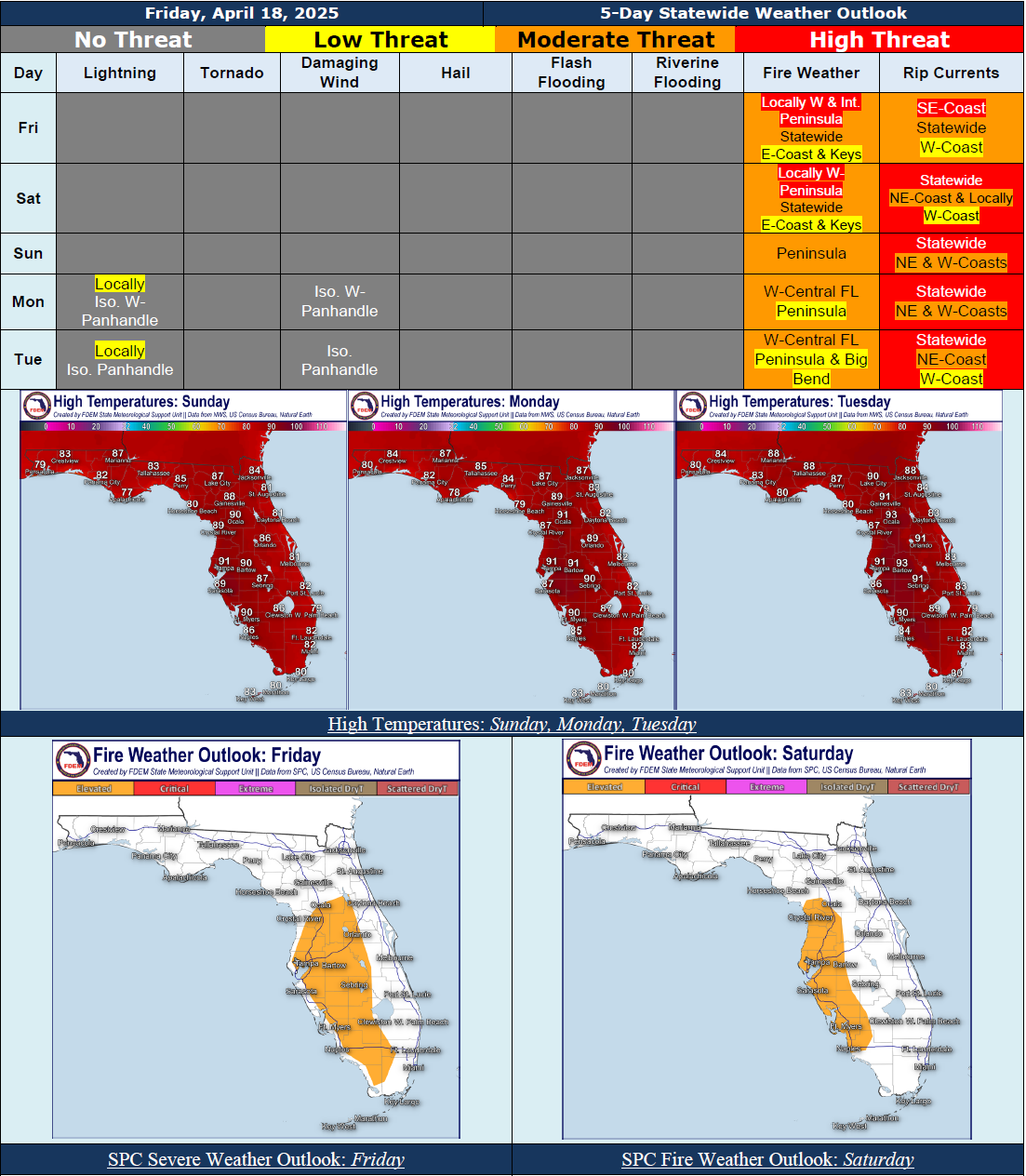
...Mostly Dry Conditions Across the State Over the Next 5 Days Under High Pressure…Isolated Rain Chances Return to the Panhandle Early Next Week As Frontal Boundary Approaches and Stalls to the North of Florida…Winds near 10-15 MPH With Gusts Near 15-25 MPH Expected Through Much of the Weekend, Remaining Near 5-10 MPH With Gusts Near 10-20 MPH Into Early Next Week…Sensitive to Elevated Wildfire Conditions To Persist In the Afternoons and Evenings Over the Next 5 Days As Dry Air Lingers…The Storm Prediction Center (SPC) it Outlooking an Elevated Risk (Level 1 of 3) for Fire Weather Along Portions of the Peninsula Today and Saturday; Low Relative Humidity, Breezy Winds, and Dry Fuels to Create Increased Wildfire Concerns…Red Flag Warnings May Be Issued As Conditions Warrant…Mandatory Burn Bans In Effect For Numerous Peninsula Counties…Moderate to High Risk for Rip Currents Expected Nearly Statewide Through the Weekend Into Early Next Week…Areas of Patchy to Locally Dense Fog Possible Overnight Into the Following Morning Hours Over the Next Few Days…
…Have A Wonderful Weekend!...