5 Day Statewide Weather Outlook for Tue. 4/8 to Sat. 4/12
Florida Division of Emergency Management sent this bulletin at 04/08/2025 04:39 PM EDT
This update is intended for government and emergency response officials, and is provided for informational and situational awareness purposes only. Forecast conditions are subject to change based on a variety of environmental factors. For additional information, or for any life safety concerns with an active weather event please contact your County Emergency Management or Public Safety Office or local National Weather Service forecast office.
You are subscribed to 5 Day Weather Outlook for Florida Division of Emergency Management. This information has recently been updated, and is now available.
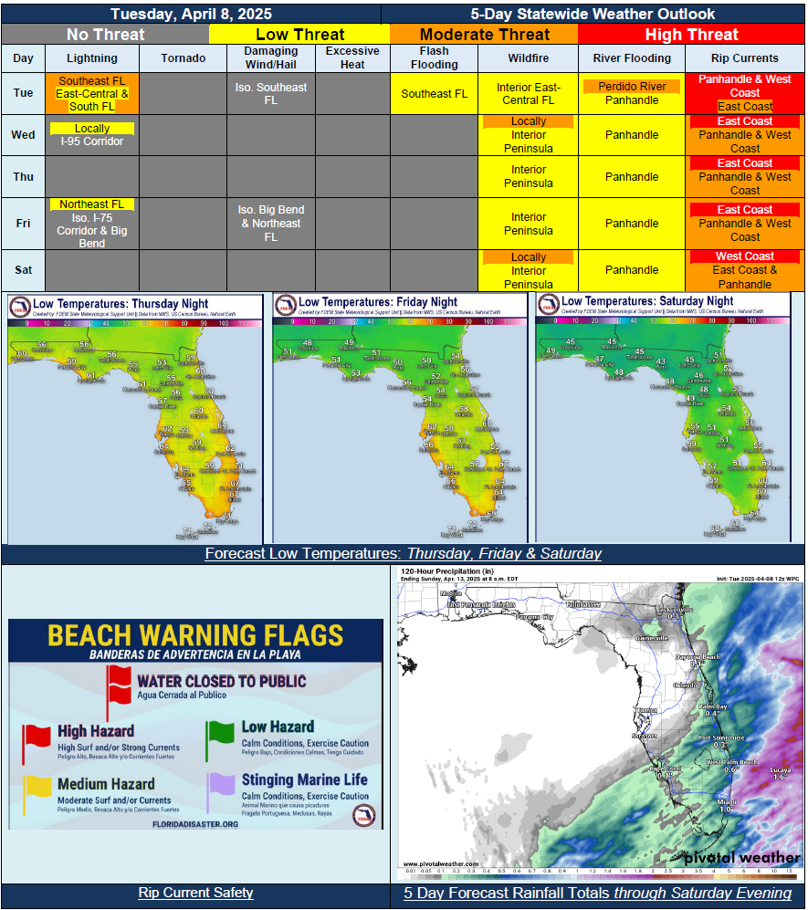
…Cold Front Continuing to Sweep Through South Florida Tuesday Bringing Scattered Showers and Thunderstorms…Mostly Dry Conditions Return Midweek with Chances for Showers Along the Eastern Peninsula and I-95 Corridor…Another Cold Front to Approach and Move Through Later in the Week Bringing Additional Round for Showers and Locally Embedded Thunderstorms Across Big Bend and Northeast Florida…Wildfire Conditions Increase Late this Week and Into Weekend with Reinforcing Dry Conditions Throughout Peninsula…Pleasant Spring Time Temperatures with Cool Down at Nights Across North Florida…Recent Heavy Rainfall Have Led to Water Level Rises Across the Panhandle; River Flood Warnings in Effect for Minor to Moderate Flooding…Moderate to High Risk for Rip Currents Statewide Over the Forecast Period…