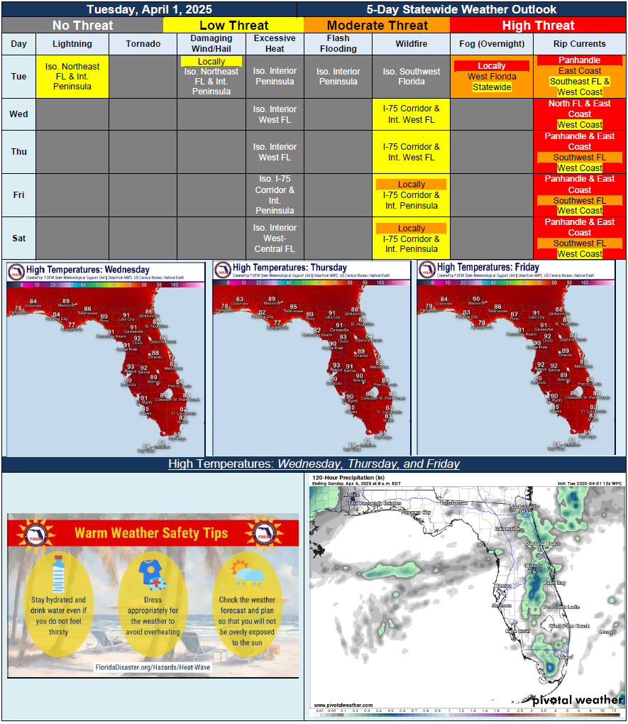
5 Day Statewide Weather Outlook for Tue. 4/1 to Sat. 4/5
Florida Division of Emergency Management sent this bulletin at 04/01/2025 03:27 PM EDT
This update is intended for government and emergency response officials, and is provided for informational and situational awareness purposes only. Forecast conditions are subject to change based on a variety of environmental factors. For additional information, or for any life safety concerns with an active weather event please contact your County Emergency Management or Public Safety Office or local National Weather Service forecast office.
You are subscribed to 5 Day Weather Outlook for Florida Division of Emergency Management. This information has recently been updated, and is now available.
…Isolated to Widely Scattered Showers and Embedded Thunderstorms Along Sea Breeze…Fog Development Likely Overnight Tuesday and Into Wednesday…High Pressure Returns Statewide Wednesday…Above Normal Temperatures in the 80s and Lower 90s Each Afternoon…Possible Showers on Wednesday, But Then a Near-Zero Chance for Rain Returns Statewide By Thursday…Breezy Winds and Dry Conditions to Create Sensitive Wildfire Conditions Throughout Peninsula…Panhandle and East Coast Beaches Likely See a High Risk for Rip Currents Through the Next 5 Days With Breezy Onshore Winds…