5 Day Statewide Weather Outlook for Tue. 3/25 to Sat. 3/29
Florida Division of Emergency Management sent this bulletin at 03/25/2025 04:31 PM EDT
This update is intended for government and emergency response officials, and is provided for informational and situational awareness purposes only. Forecast conditions are subject to change based on a variety of environmental factors. For additional information, or for any life safety concerns with an active weather event please contact your County Emergency Management or Public Safety Office or local National Weather Service forecast office.
You are subscribed to 5 Day Weather Outlook for Florida Division of Emergency Management. This information has recently been updated, and is now available.
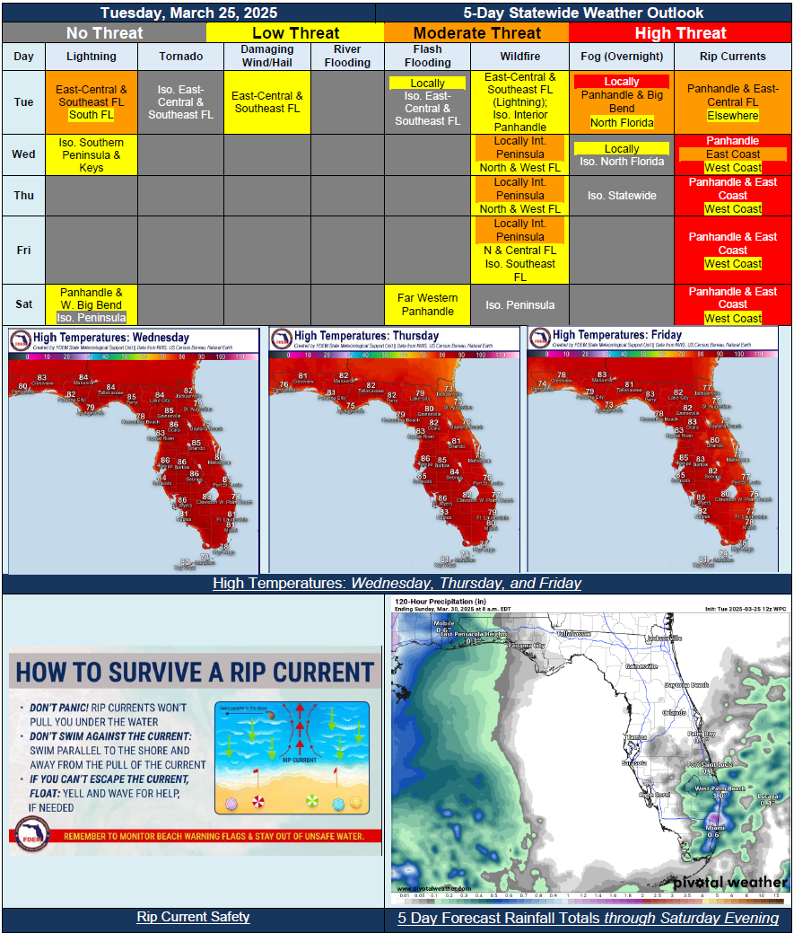
…Sea Breeze Showers and Thunderstorms Across Portions of Southeast Florida on Tuesday…Mostly Dry Conditions Extend Across the State Beginning Midweek Through End of Work Week; Chance for Showers and Embedded Thunderstorms Wednesday for Southernmost Peninsula Regions and Keys…Increasing Chance for Showers and Possible Thunderstorms this Weekend; Forecast Remains Uncertain But Could Bring Locally Heavy Rainfall Across the Panhandle Saturday…Temperatures in the 70s and 80s Each Day…Instances of Fog Possible…Wildfire Conditions Return Midweek and Persist Through Friday…No Active Riverine Flooding…Expansion of Moderate Drought Into Southeast Florida Amid Increased Wildfire Conditions and Lack of Rainfall…High Risk for Rip Currents Likely Each Day Across Panhandle Through Forecast Period; Increasing Rip Current Chances Late this Week and Weekend Along East Coast…