5 Day Statewide Weather Outlook for Tue. 3/11 to Sat. 3/15
Florida Division of Emergency Management sent this bulletin at 03/11/2025 04:19 PM EDT
This update is intended for government and emergency response officials, and is provided for informational and situational awareness purposes only. Forecast conditions are subject to change based on a variety of environmental factors. For additional information, or for any life safety concerns with an active weather event please contact your County Emergency Management or Public Safety Office or local National Weather Service forecast office.
You are subscribed to 5 Day Weather Outlook for Florida Division of Emergency Management. This information has recently been updated, and is now available.
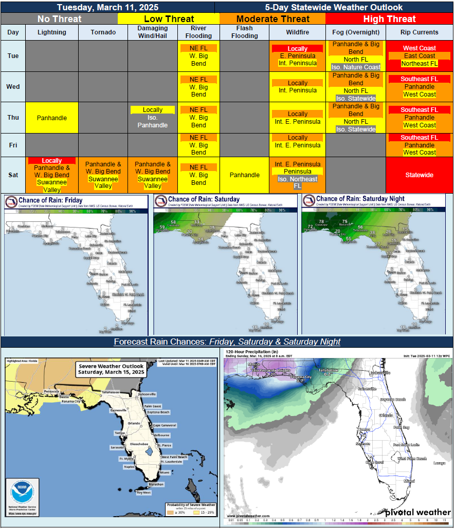
…Dry Conditions Return Across Sunshine State Tuesday and Persist Through Midweek…Rain Chances Briefly Return Along Panhandle with Cluster of Showers and Thunderstorms Possible; Locally Strong to Severe Cannot Be Ruled Out…Break Between Weather Systems on Friday…Increasing Chances for Severe Weather Across Florida Panhandle Saturday and Into Saturday Night with Developing Low Pressure System Over Gulf Coast States…All Hazards Associated with Severe Weather Possible; Uncertainty Continues Regarding Exact Details…Sensitive to Locally Elevated Wildfire Conditions Possible Each Day Across Interior Regions of Peninsula; Greater Chance Along Eastern Peninsula…River Flood Warnings Return for Aucilla and St. Mary’s River Basins Following Recent Heavy Rainfall Across Big Bend and Northeast Florida…High Risk for Rip Currents Likely Statewide on Saturday…