5 Day Statewide Weather Outlook for Tue. 3/4 to Sat. 3/8
Florida Division of Emergency Management sent this bulletin at 03/04/2025 04:46 PM EST
This update is intended for government and emergency response officials, and is provided for informational and situational awareness purposes only. Forecast conditions are subject to change based on a variety of environmental factors. For additional information, or for any life safety concerns with an active weather event please contact your County Emergency Management or Public Safety Office or local National Weather Service forecast office.
You are subscribed to 5 Day Weather Outlook for Florida Division of Emergency Management. This information has recently been updated, and is now available.
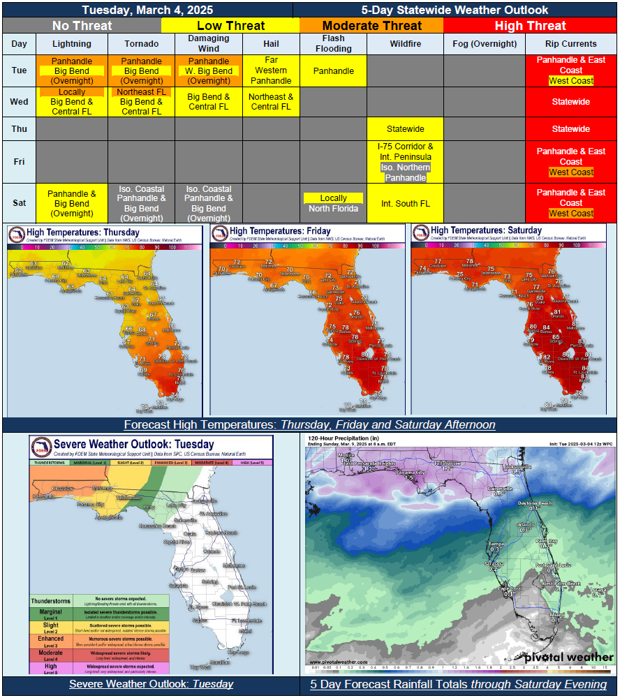
…Multi-Hazard Severe Weather Event Overnight Tuesday and Into Wednesday Throughout North Florida and Towards the I-4 Corridor…All Hazards of Severe Weather Possible; Frequent Lightning, Damaging Wind Gusts, Embedded Tornadoes, Large Hail and Heavy Downpours…Gusty Winds Before and After Cold Front Passage Expected Through Mid-Week…Sensitive Wildfire Conditions Return Across the State Thursday with Elevated Winds and Dry Conditions…Active Weather Pattern Likely to Return Across North Florida Saturday and Saturday Night; Low Confidence With Shower and Thunderstorm Activity…Moderate to High Risk for Rip Currents to Persist Statewide Through the Rest of the Week…