5 Day Statewide Weather Outlook for Fri 2/28 to Tue 3/4
Florida Division of Emergency Management sent this bulletin at 02/28/2025 02:01 PM EST
This update is intended for government and emergency response officials, and is provided for informational and situational awareness purposes only. Forecast conditions are subject to change based on a variety of environmental factors. For additional information, or for any life safety concerns with an active weather event please contact your County Emergency Management or Public Safety Office or local National Weather Service forecast office.
You are subscribed to 5 Day Weather Outlook for Florida Division of Emergency Management. This information has recently been updated, and is now available.
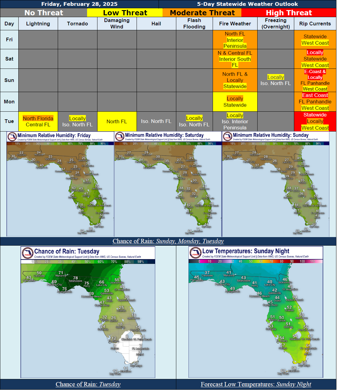
...Mostly Dry and Sunny Conditions Expected This Weekend Into Early Next Week…Rain Chances Return Early to Mid-Next Week Ahead of the Next Cold Front…Strong to Severe Thunderstorms May be Possible; However, There Is Uncertainty In the Forecast and Updates Can Be Expected…Breezy Winds to Gradually Strengthen Later This Weekend Into Next Week…Temperatures Remain Relatively Cool Across Much of the State Through the Forecast Period…Elevated Wildfire Conditions Expected Across North Florida With Sensitive to Locally Elevated Wildfire Conditions Southward Across the Peninsula Through the Weekend; Red Flag Conditions Not Expected At This Time…Sensitive to Locally Elevated Wildfire Conditions Linger Nearly Statewide Into Early Next Week…Hazardous Beach and Boating Conditions Expected to Develop Nearly Statewide Early Next Week…Low to Moderate Risk For Rip Currents Statewide Today and Saturday, Increasing to A Moderate to High Risk Along the Florida Panhandle and East Coast Late This Weekend Into Early Next Week…
…Have A Wonderful Weekend!...