5 Day Statewide Weather Outlook for Fri 1/24 to Tue Tue 1/28
Florida Division of Emergency Management sent this bulletin at 01/24/2025 02:07 PM EST
This update is intended for government and emergency response officials, and is provided for informational and situational awareness purposes only. Forecast conditions are subject to change based on a variety of environmental factors. For additional information, or for any life safety concerns with an active weather event please contact your County Emergency Management or Public Safety Office or local National Weather Service forecast office.
You are subscribed to 5 Day Weather Outlook for Florida Division of Emergency Management. This information has recently been updated, and is now available.
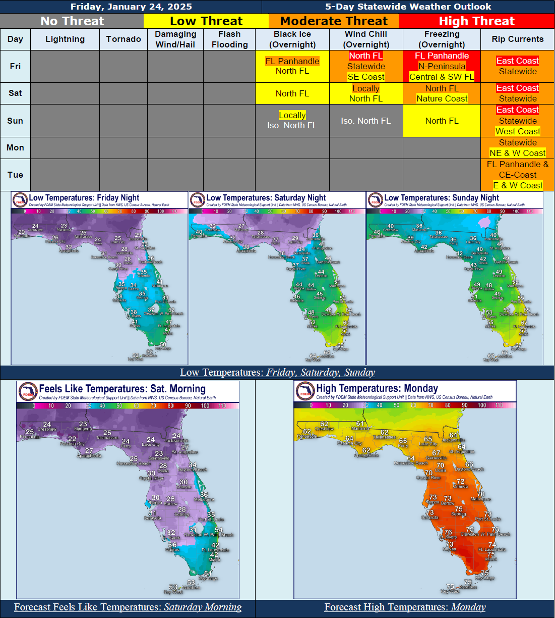
...Mostly Dry and Sunny Skies to Help Aid in Melting Off the Remaining Snowpack Across North Florida Over the Next Few Days…Roadways That Remain Shaded Throughout the Day Will Continue to Have Black Ice Issues at Least Through Tonight As Any Partially Melted Snow, Ice, or Wet Surfaces Will Refreeze.…Extra Caution Should Be Exercised Over Bridges, Hilly Terrain, and Tree-Covered and Shaded Roadways That Have Not Fully Melted…With Warming Temperatures the Threat of Black Ice Will Quickly Be Subsiding Into the Weekend...Low Temperatures To Fall into the 20s Across North Florida Tonight, With 30s Expected Through Central and Into Southwest Florida...Wind Chills In the 20s Across North and Central Florida With Near Or Below Freezing Wind Chills Stretching Into Southwest Florida...Freeze Warnings and Cold Weather Advisories Go into Effect for Portions of North and Central Florida Tonight; Additional Warnings and Advisories May Be Issued...Dangerous Beach and Boating Conditions Expected for Many Florida Beaches Today and Into the Weekend; Elevated Wave Heights Along Florida Atlantic Coast...Moderate to High Risk of Rip Currents Nearly Statewide Today and Into the Weekend, Returning to a Low to Moderate Risk Early Next Week...
…Have A Wonderful Weekend!...