
5 Day Statewide Weather Outlook (Tue. 9/24 - Sat. 9/28)
Florida Division of Emergency Management sent this bulletin at 09/24/2024 04:55 PM EDT
This update is intended for government and emergency response officials, and is provided for informational and situational awareness purposes only. Forecast conditions are subject to change based on a variety of environmental factors. For additional information, or for any life safety concerns with an active weather event please contact your County Emergency Management or Public Safety Office or local National Weather Service forecast office.
You are subscribed to 5 Day Weather Outlook for Florida Division of Emergency Management. This information has recently been updated, and is now available.
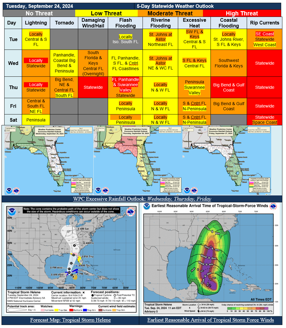
...Attention Turns to the Gulf of Mexico as Strengthening Helene Approaches the Apalachee Bay Coastline...Likely to Strengthen into a Major (Category 3) Hurricane on Thursday...Deteriorating Conditions Expected to Spread from South to North through the Wednesday Overnight Hours into Thursday Along the Florida Gulf Coast...Multi-Hazardous Significant Impacts to Extend Well Away from the Center & Outside the Forecast Cone...Helene is Forecast to be a Large and Powerful System, Impacts to Advance Further Inland...Life-Threatening Storm Surge, Dangerous Winds, Considerable Flash Flooding, and Isolated Tornadoes Expected...