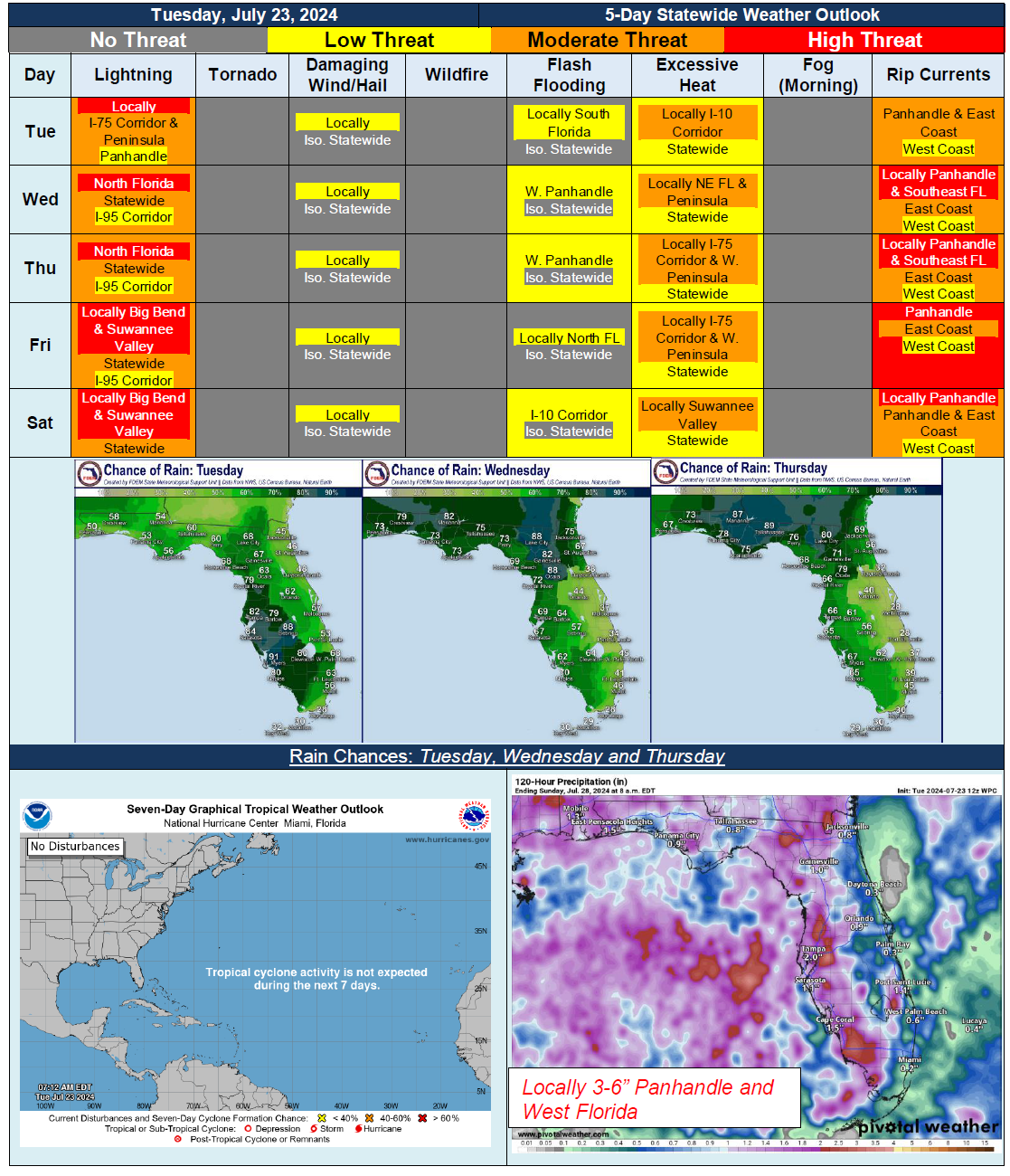
5 Day Statewide Weather Outlook for Tue. 7/23 to Sat. 7/27
Florida Division of Emergency Management sent this bulletin at 07/23/2024 12:46 PM EDT
This update is intended for government and emergency response officials, and is provided for informational and situational awareness purposes only. Forecast conditions are subject to change based on a variety of environmental factors. For additional information, or for any life safety concerns with an active weather event please contact your County Emergency Management or Public Safety Office or local National Weather Service forecast office.
You are subscribed to 5 Day Weather Outlook for Florida Division of Emergency Management. This information has recently been updated, and is now available.
…Persistent High Pressure Over Bermuda and Western Atlantic To Bring Daily Showers and Thunderstorms…Tropical Wave Approaching From Bahamas Over Next Couple of Days To Bring Earlier Onset of Showers and Thunderstorms Before Daytime Heating Allows for More Widespread Activity…Pockets of Drier Air Along and East of I-95 Corridor Could Keep Activity More Isolated to Scattered…Locally Strong to Severe Thunderstorms Possible Each Day; Frequent Lightning, Gusty Winds and Heavy Downpours…Tropical Moisture To Bring Potentially Heavy Downpours and Localized Flooding Along Panhandle and North Florida Several Days This Week…Heat Index Values Near or Just Below Heat Advisory Criteria Each Day; Locally Brief Periods of Heat Advisory Criteria Before Cloud Cover or Thunderstorms Move Overhead…