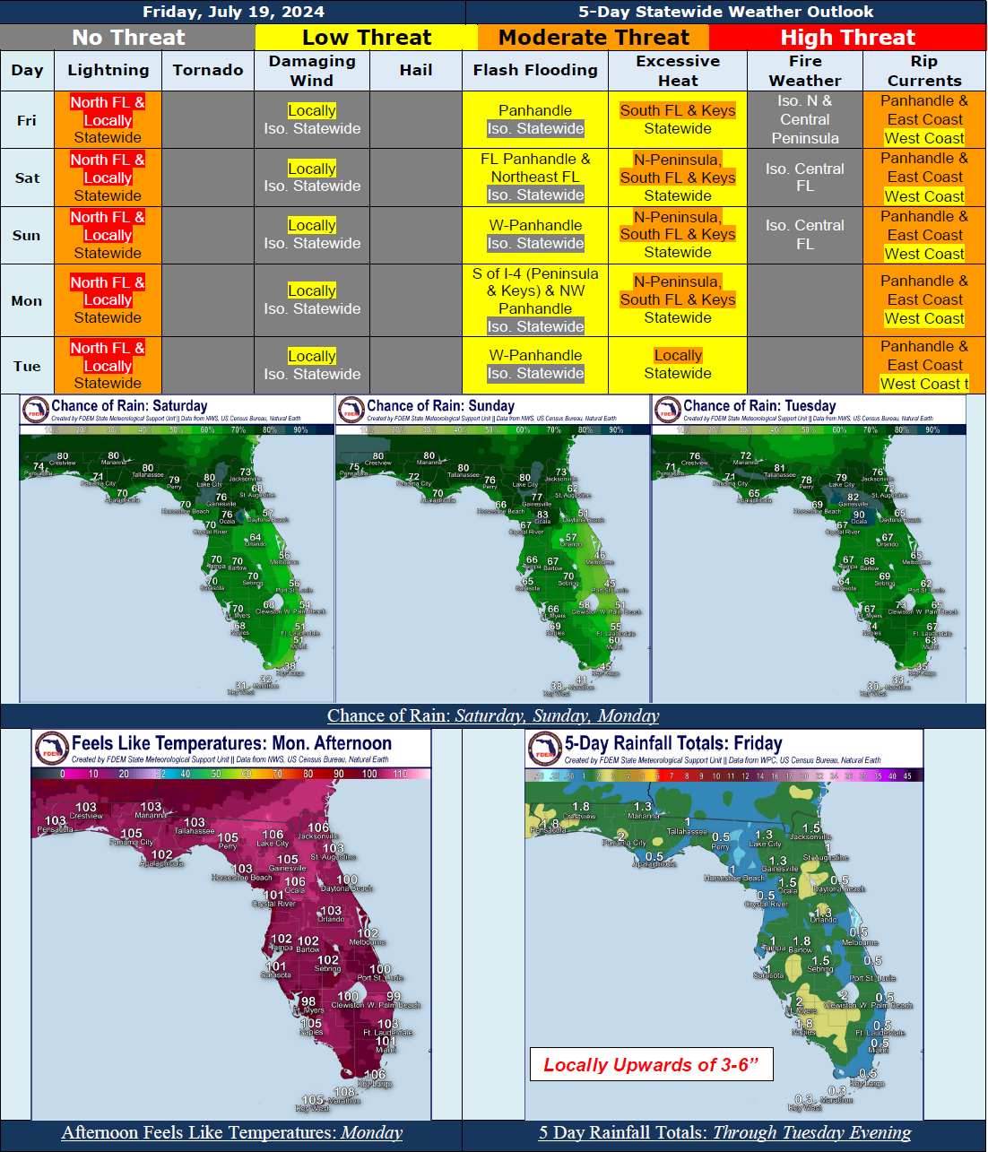
5 Day Statewide Weather Outlook for Fri 7/19 to Tue 7/23
Florida Division of Emergency Management sent this bulletin at 07/19/2024 02:30 PM EDT
This update is intended for government and emergency response officials, and is provided for informational and situational awareness purposes only. Forecast conditions are subject to change based on a variety of environmental factors. For additional information, or for any life safety concerns with an active weather event please contact your County Emergency Management or Public Safety Office or local National Weather Service forecast office.
You are subscribed to 5 Day Weather Outlook for Florida Division of Emergency Management. This information has recently been updated, and is now available.
...Scattered to Numerous Showers Anticipated Statewide Over the Next 5 Days Thanks to High Pressure, Abundant Moisture, and Upper-Level Disturbances…Locally Strong to Severe Thunderstorms Producing Frequent Lightning, Gusty Winds, and Heavy Downpours Possible…Localized Flooding Possible Over Urban and Low-Lying Poor Drainage Areas As Deep Tropical Moisture Gives Way To Heavy Downpours; Marginal Risk For Flash Flooding Along the Panhandle Today, The Florida Panhandle and Northeast Florida Saturday, The Western Panhandle Sunday, South of I-4 Through The Peninsula And Keys And Along the Northwestern Panhandle Monday, and Along The Western Panhandle Tuesday…Heat Indices In The Upper 90s and Triple Digits (100-108)…Heat Advisories In Effect For South Florida And The Keys Today; Additional Heat Advisories Likely to Be Issued As Needed This Weekend and Early Next Week…Low to Moderate Risk For Rip Currents to Generally Persist Statewide; Locally High Risk Possible Along Florida Panhandle Early Next Week…
…Have A Great Weekend!...

