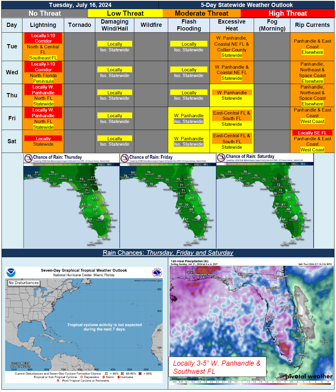
5 Day Statewide Weather Outlook for Tue. 7/16 to Sat. 7/20
Florida Division of Emergency Management sent this bulletin at 07/16/2024 02:46 PM EDT
This update is intended for government and emergency response officials, and is provided for informational and situational awareness purposes only. Forecast conditions are subject to change based on a variety of environmental factors. For additional information, or for any life safety concerns with an active weather event please contact your County Emergency Management or Public Safety Office or local National Weather Service forecast office.
You are subscribed to 5 Day Weather Outlook for Florida Division of Emergency Management. This information has recently been updated, and is now available.
…Scattered to Numerous Showers and Thunderstorms Developing Each Day During Afternoon and Evening Hours…Slightly Drier Conditions Keeping Thunderstorm Activity More Scattered Across Central and South Florida During Midweek…Return to More Widespread Activity Later In the Week…Triple Digit Heat Index Values Expected Nearly Statewide Every Day…Heat Advisories Possible…Abundant Moisture Ahead of Approaching Frontal Boundary To Bring Locally Heavy Rainfall At Times Later this Week Along Western Panhandle…