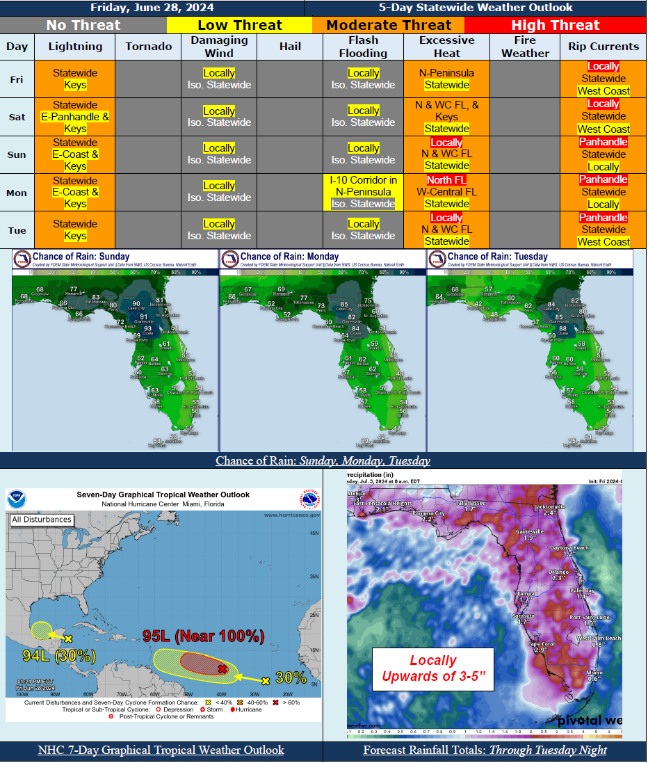
5 Day Statewide Weather Outlook for Fri 6/28 to Tue 7/2
Florida Division of Emergency Management sent this bulletin at 06/28/2024 02:39 PM EDT
This update is intended for government and emergency response officials, and is provided for informational and situational awareness purposes only. Forecast conditions are subject to change based on a variety of environmental factors. For additional information, or for any life safety concerns with an active weather event please contact your County Emergency Management or Public Safety Office or local National Weather Service forecast office.
You are subscribed to 5 Day Weather Outlook for Florida Division of Emergency Management. This information has recently been updated, and is now available.
...Enhanced Shower and Thunderstorm Activity Will Persist Across North Florida Thanks to Upper-Level Disturbances, Frontal Boundaries, and Sea Breezes…Scattered Showers and Thunderstorms Along the Peninsula With Sea Breezes…A Few Strong to Severe Thunderstorms Capable of Producing Frequent Lightning, Gusty Winds, and Heavy Downpours May Be Possible Statewide…Heavy Downpours and Slow-Moving Storms May Result In Instances of Localized Flooding Over Urban and Low-Lying/Poor Drainage Areas…Marginal Risk For Flash Flooding Along the I-10 Corridor In the Northern Peninsula Tuesday…Heat Indices Will Continue to Rise Into the Upper 90s To Triple Digits (100-112) Nearly Statewide…Heat Advisories In Effect Across South Florida Today…Heat Advisories And Excessive Heat Warnings May Be Issued For Portions Of The State This Weekend and Early Next Week… Moderate to High Risk For Rip Currents Along Panhandle and East Coast…Invest 95L Has A High (Near 100%) Chance of Development Through 48 Hours; No Direct Threat to Florida Over The Next 7-10 days But Will Continue To Monitor…Invest 94L and A Tropical Wave In the Eastern Tropical Atlantic Have a Low (30%) Chance of Formation Through 7 Days…
…Have A Wonderful Weekend!...

