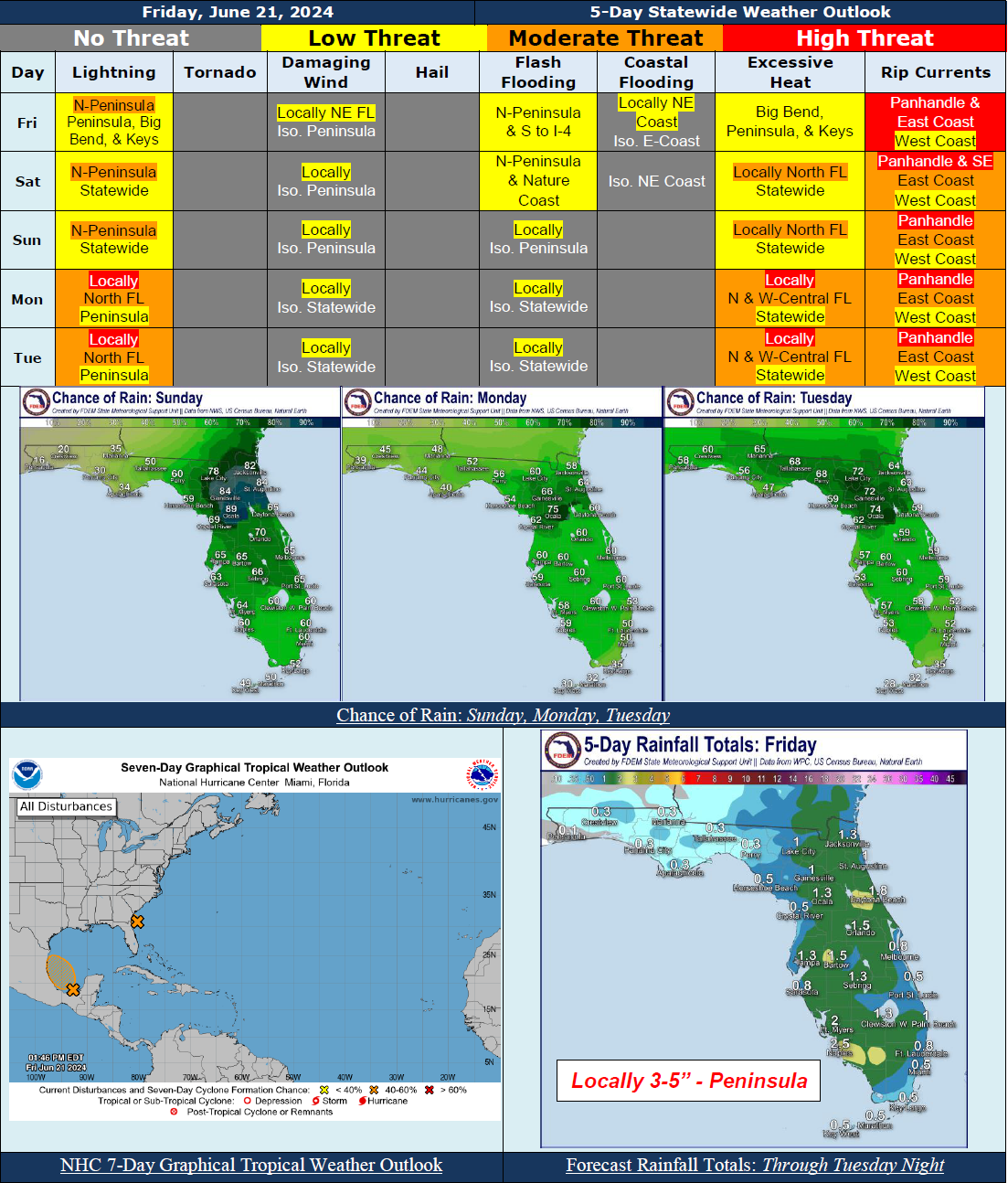
5 Day Statewide Weather Outlook for Fri 6/21 to Tue 6/25
Florida Division of Emergency Management sent this bulletin at 06/21/2024 02:34 PM EDT
This update is intended for government and emergency response officials, and is provided for informational and situational awareness purposes only. Forecast conditions are subject to change based on a variety of environmental factors. For additional information, or for any life safety concerns with an active weather event please contact your County Emergency Management or Public Safety Office or local National Weather Service forecast office.
You are subscribed to 5 Day Weather Outlook for Florida Division of Emergency Management. This information has recently been updated, and is now available.
...Invest 92L To Reach the Northeast Florida/Southeast Georgia Coast Tonight; A Short-Lived Tropical Depression May Develop (60% Chance of Development)…Regardless of Development, Heavy Rainfall, Gusty Winds, and Coastal Impacts Possible…Scattered Showers and Embedded Thunderstorm Across the Northern Peninsula Today and Tonight…Marginal Risk For Flash Flooding Across the Northern Peninsula…Relatively Drier Conditions Elsewhere Today…High Surf Advisories In Effect Along the Northeast Coast Through This Afternoon…Localized Minor Coastal Flooding and Coastal Erosion Possible Along the East Coast…Wet Weather Pattern Anticipated This Weekend and Early Next Week…Scattered to Numerous Showers Expected Nearly Statewide…Marginal Risk For Flash Flooding Across The Northern Peninsula and Nature Coast Saturday…Instances of Localized Flooding and Ponding of Water May be Possible In The Peninsula Over the Next 5 Days…Heat Indices In The Upper 90s and Triple Digits (100-112) Statewide…Moderate to High Risk For Rip Currents Along Florida Panhandle and East Coast Over the Next 5 Days…
…Have A Wonderful Weekend!...

