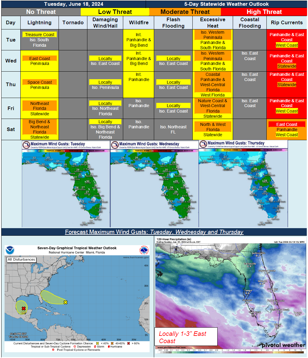
5 Day Statewide Weather Outlook for Tue. 6/18 to Sat. 6/22
Florida Division of Emergency Management sent this bulletin at 06/18/2024 04:26 PM EDT
This update is intended for government and emergency response officials, and is provided for informational and situational awareness purposes only. Forecast conditions are subject to change based on a variety of environmental factors. For additional information, or for any life safety concerns with an active weather event please contact your County Emergency Management or Public Safety Office or local National Weather Service forecast office.
You are subscribed to 5 Day Weather Outlook for Florida Division of Emergency Management. This information has recently been updated, and is now available.
…Increasing Rain Chances and Gusty Winds Starting Midweek…Scattered Showers and Thunderstorms Moving Inland Along East Florida…Wind Gusts Strengthening to 25-30 MPH With Locally Stronger Gusts Possible…Hot and Humid Conditions Building Later This Week and Over the Weekend…Triple Digit Heat Index Values Anticipated for Much of North and West Florida on Saturday…High Risk for Rip Currents Expected for All Panhandle and East Coast Beaches Due to Breezy Onshore Winds and Dangerous Surf…