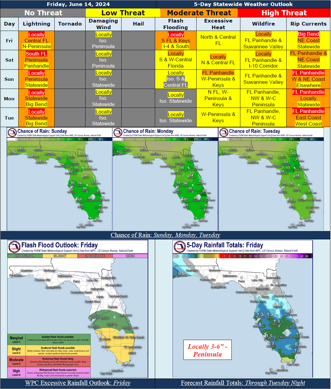
5 Day Statewide Weather Outlook for Fri 6/14 to Tue 6/18
Florida Division of Emergency Management sent this bulletin at 06/14/2024 02:36 PM EDT
This update is intended for government and emergency response officials, and is provided for informational and situational awareness purposes only. Forecast conditions are subject to change based on a variety of environmental factors. For additional information, or for any life safety concerns with an active weather event please contact your County Emergency Management or Public Safety Office or local National Weather Service forecast office.
You are subscribed to 5 Day Weather Outlook for Florida Division of Emergency Management. This information has recently been updated, and is now available.
...Wet Weather Pattern to Continue Along the Peninsula Today and Saturday…Marginal to Slight Risk for Flash Flooding South of I-4 Today With a Marginal Risk Saturday…More Typical Summertime Pattern To Return Late This Weekend And Early Next Week As High Pressure Builds…Scattered Showers and Thunderstorms Expected to Develop Statewide With The Sea Breezes…Instances of Flooding May Still Be Possible…A Few Strong to Severe Thunderstorms Cannot Be Ruled Out During Peak Heating Hours Over the Next 5 Day…Heat Indices Continue to Reach the Middle 90s to Triple Digits (100-108) Over the Next 5 Days…Sensitive to Locally Elevated Wildfire Conditions Along the Florida Panhandle and Suwannee Valley Today and Saturday; Sensitive Conditions Continue Into Early Next Week…Breezy Winds and Ocean Swells Expected Monday and Tuesday As An Area of Low Pressure Moves Through the Southwestern Gulf of Mexico…Moderate to High Risk for Rip Currents Along Panhandle; Low to Moderate Risk Elsewhere…
…Have A Wonderful Weekend!...

