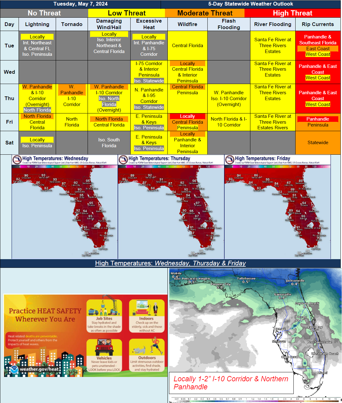
5 Day Statewide Weather Outlook for Tue. 5/7 to Sat/ 5/11
Florida Division of Emergency Management sent this bulletin at 05/07/2024 04:54 PM EDT
This update is intended for government and emergency response officials, and is provided for informational and situational awareness purposes only. Forecast conditions are subject to change based on a variety of environmental factors. For additional information, or for any life safety concerns with an active weather event please contact your County Emergency Management or Public Safety Office or local National Weather Service forecast office.
You are subscribed to 5 Day Weather Outlook for Florida Division of Emergency Management. This information has recently been updated, and is now available.
…Warm and Dry Conditions Building Statewide…Record Heat and Near Triple Digit Heat Index Values…Increasing Shower and Thunderstorm Activity Across Panhandle and North Florida Late Thursday and Into Friday Ahead of Cold Front Sweeping Through…Strong to Severe Thunderstorms Possible Bringing Isolated Tornadoes, Damaging Wind Gusts and Heavy Downpours…Localized Flash Flooding Possible Within Heavy Downpours…Elevated Wildfire Conditions Developing Across Central and Interior Peninsula Later in the Week Due to Warm, Dry and Breezy Conditions…