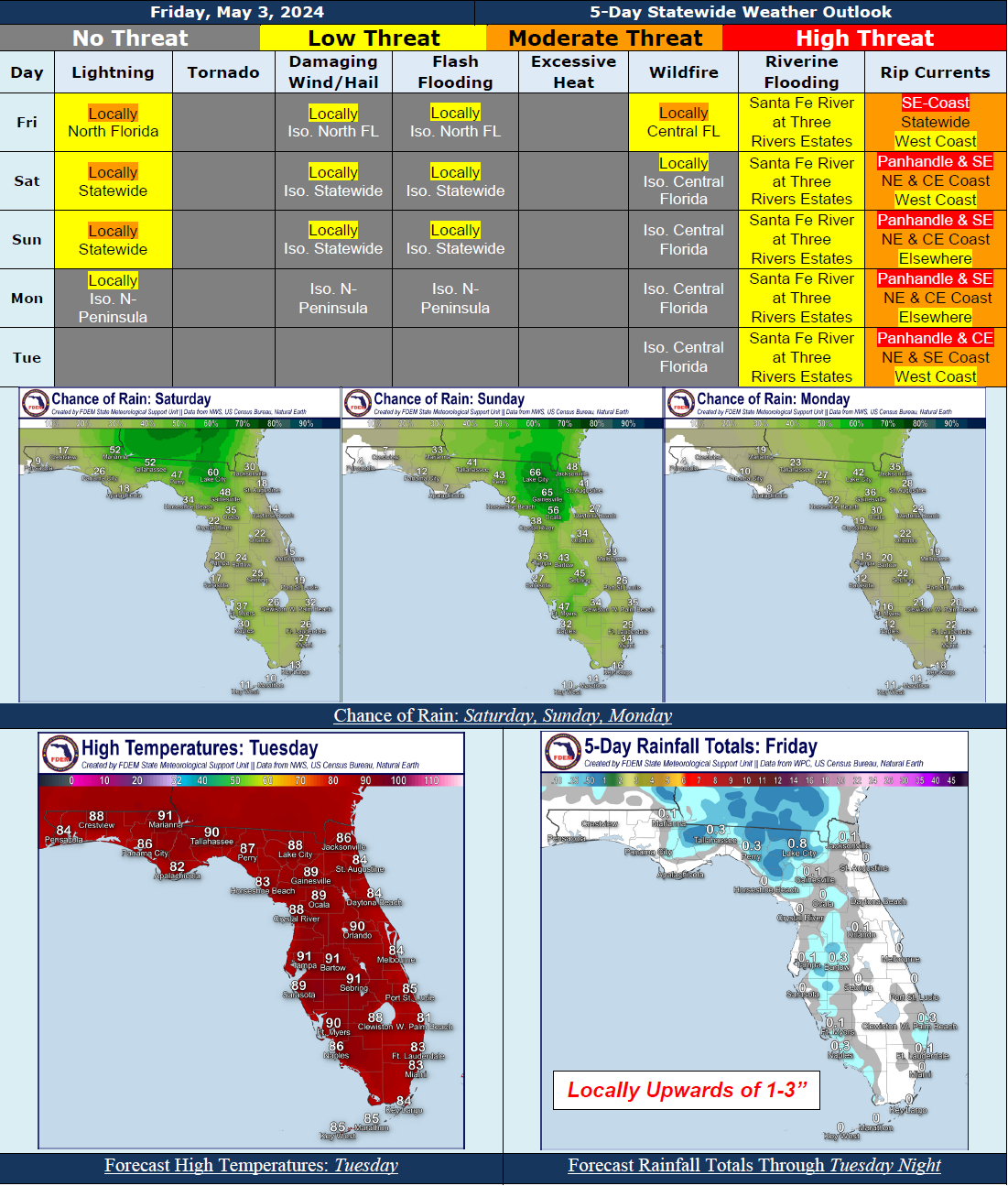
5 Day Statewide Weather Outlook for Fri 5/3 to Tue 3/7
Florida Division of Emergency Management sent this bulletin at 05/03/2024 02:40 PM EDT
This update is intended for government and emergency response officials, and is provided for informational and situational awareness purposes only. Forecast conditions are subject to change based on a variety of environmental factors. For additional information, or for any life safety concerns with an active weather event please contact your County Emergency Management or Public Safety Office or local National Weather Service forecast office.
You are subscribed to 5 Day Weather Outlook for Florida Division of Emergency Management. This information has recently been updated, and is now available.
...Isolated to Scattered Showers and Thunderstorms Nearly Statewide Over the Next 5 Days Thanks to Afternoon Sea Breezes and Upper-Level Disturbances Moving Through the Southeast U.S....Isolated Strong to Severe Thunderstorms Cannot Be Ruled Out During Peak Heating Hours…Localized Instances of Flooding and Ponding of Water Possible In Locally Heavy Downpours…Drier Conditions Begin to Return Tuesday As High Pressure Builds Back In…Warm Temperatures Persist Through the Period…Wind Gusts of 15-25 MPH Possible With Sea Breezes Each Day…Sensitive to Locally Elevated Wildfire Conditions In West-Central Florida Today; Locally Sensitive Wildfire Conditions Through the Weekend…Moderate to High Risk For Rip Currents Along Florida Panhandle and East Coast…A River Flood Warning Remains In Effect For the Santa Fe River At Three Rivers Estates…Patchy to Locally Dense Fog Possible Across North and Central Florida Through the Weekend…
…Have A Great Weekend!...

