5 Day Statewide Weather Outlook for Tue. 2/20 to Sat. 2/24
Florida Division of Emergency Management sent this bulletin at 02/20/2024 02:56 PM EST
This update is intended for government and emergency response officials, and is provided for informational and situational awareness purposes only. Forecast conditions are subject to change based on a variety of environmental factors. For additional information, or for any life safety concerns with an active weather event please contact your County Emergency Management or Public Safety Office or local National Weather Service forecast office.
You are subscribed to 5 Day Weather Outlook for Florida Division of Emergency Management. This information has recently been updated, and is now available.
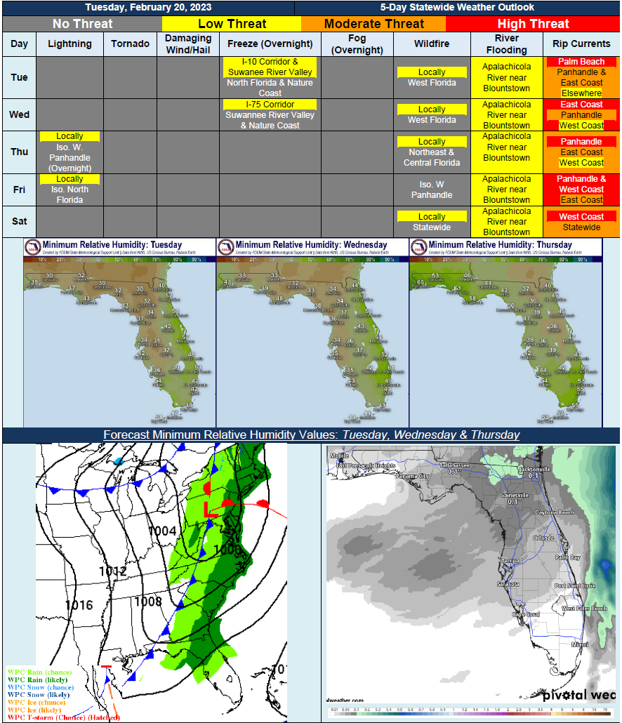
…Mostly Dry Conditions Throughout the Week…Cold Front Later In the Week Bringing Next Best Chance of Rain, But Will Remain Minimal…Locally Sensitive Wildfire Conditions Developing During Afternoon; Recent Rainfall and Light Winds to Keep Overall Threat Low…Areas of Patchy Frost Possible Along I-10 Corridor and Suwannee River Valley Overnight Tuesday and Wednesday…Minor Riverine Flooding Continues for Apalachicola River near Blountstown Through Rest of Week…Abnormally Dry to Moderate Drought Conditions Hold Steady Along Western Peninsula…