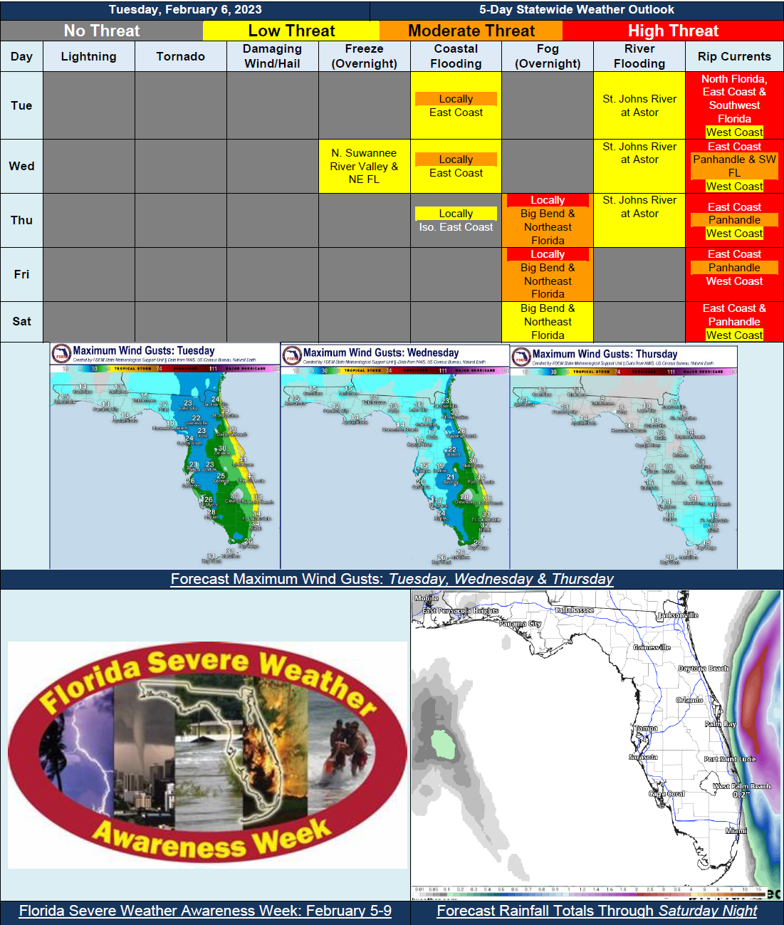
5 Day Statewide Weather Outlook for Tue. 2/6 to Sat. 2/10
Florida Division of Emergency Management sent this bulletin at 02/06/2024 03:51 PM EST
This update is intended for government and emergency response officials, and is provided for informational and situational awareness purposes only. Forecast conditions are subject to change based on a variety of environmental factors. For additional information, or for any life safety concerns with an active weather event please contact your County Emergency Management or Public Safety Office or local National Weather Service forecast office.
You are subscribed to 5 Day Weather Outlook for Florida Division of Emergency Management. This information has recently been updated, and is now available.
…Gusty Winds and Dangerous Beach and Boating Conditions for East Coast Through Mid-Week…Wind Advisories In Effect Through Overnight Tuesday Due to Possible Wind Gusts of 40-45 MPH…Mostly Dry Conditions Through the Rest of the Work Week Across the State…Next Best Chance of Rain on Saturday Ahead of Approaching Frontal Boundary…Areas of Fog and Low Clouds Possible Overnight Thursday and Friday Across Big Bend and Northeast Florida…Minor Coastal Flooding Along East Coast Due to Elevated Wave Heights and Tides…Trapped Tides Within St. Johns River to Lead to Water Level Rises and Minor Flooding…