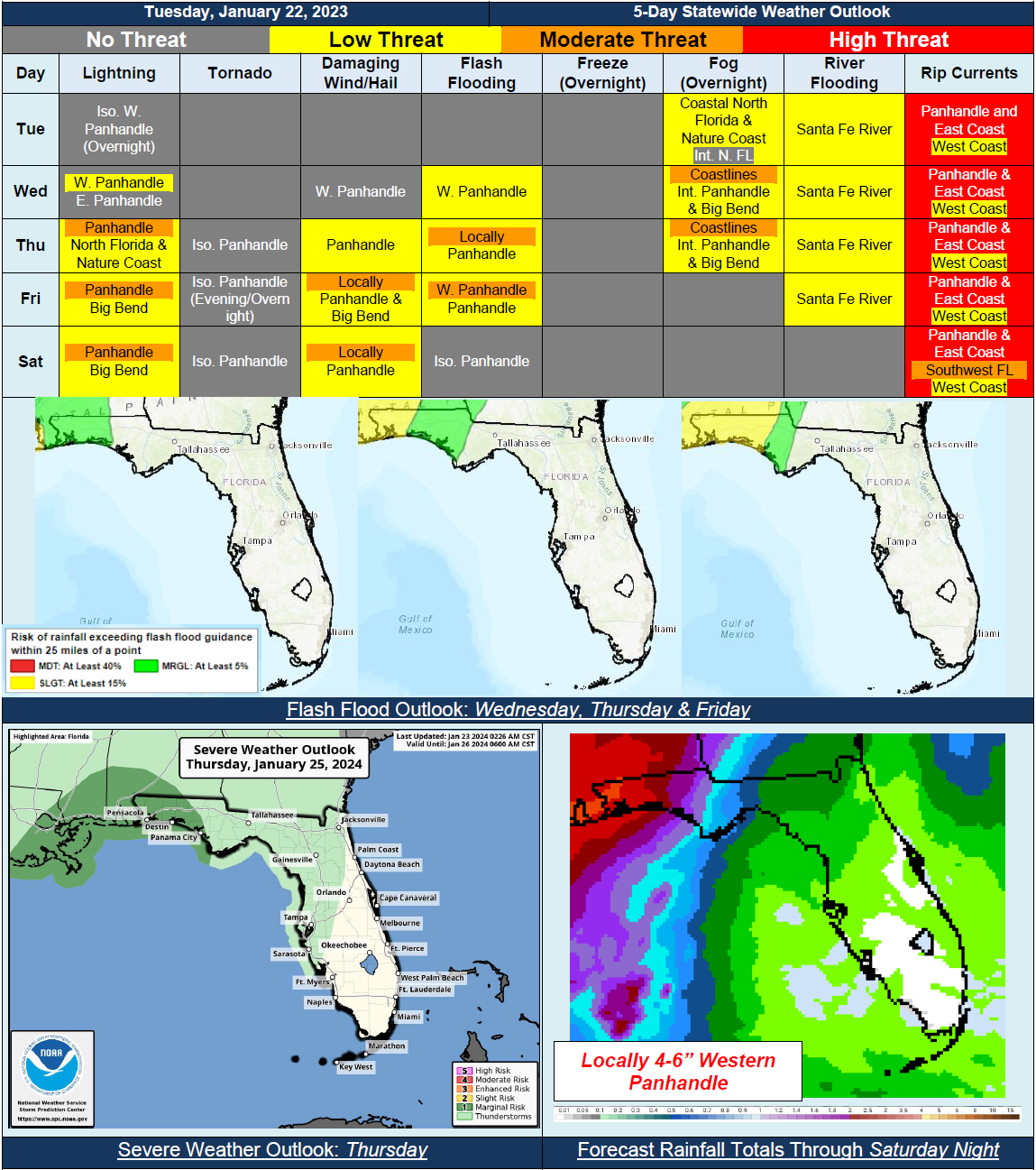
5 Day Statewide Weather Outlook for Tue. 1/23 to Sat. 1/27
Florida Division of Emergency Management sent this bulletin at 01/23/2024 02:38 PM EST
This update is intended for government and emergency response officials, and is provided for informational and situational awareness purposes only. Forecast conditions are subject to change based on a variety of environmental factors. For additional information, or for any life safety concerns with an active weather event please contact your County Emergency Management or Public Safety Office or local National Weather Service forecast office.
You are subscribed to 5 Day Weather Outlook for Florida Division of Emergency Management. This information has recently been updated, and is now available.
…Unsettled Weather Pattern Developing Across Panhandle and Big Bend Throughout the Week…Possible Isolated Strong to Severe Thunderstorms Later This Week and Into the Weekend…Next Cold Front Moving Through Over the Weekend…High Pressure Over Western Atlantic to Keep Conditions Mostly Dry Across Peninsula…Possible Record-Breaking High Temperatures Later This Week for Some Areas…Widespread Rainfall Along Panhandle to Increase Risk for Flash Flooding Beginning Wednesday…High Risk for Rip Currents Along All Panhandle and East Coast Beaches Over Next 5 Days…