Welcome to the DC 2050 Insider! Get the latest on what we’ve been up to and what’s coming up.
The DC Office of Planning (OP) has been working alongside DC residents, community organizations, businesses, and elected officials to develop DC 2050, the District's next Comprehensive Plan.
In this edition:
 |
|
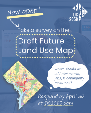
At recent public workshops, we shared a draft future land use map and sought feedback. The future land use map is one component of the comprehensive plan, which will be paired with policy language. For those unable to attend the workshops, we have published an online participation option.
The virtual workshop will be open through April 30.
|
This feedback tool lets you view information on proposed land use changes, for the full District and each individual ward, and respond to questions to tell us what you think. We are also seeking input for our new approach to small area plans.
We recently published a draft future land use map that shows where we recommend changes in land use policy to accommodate the growth in people and jobs we estimate for the next 25 years.
The map is one part of the comprehensive plan. It sets forth land use policy for every area of the city, directing the use, density, and height of what can be built there, as well as guidance on connectivity and public spaces. It will be paired with policy language, which is the next step in the DC 2050 process.
Changes proposed on the map are designed to:
-
Increase opportunities for more housing along high-frequency bus routes and metro stations to allow more density in areas well-served by transit
-
Distribute housing opportunities across DC’s wards to ensure fair and balanced housing development across the District
-
Allow for more types of housing and amenities to meet the diverse needs of DC’s current and future residents
As with the 2021 Comprehensive Plan development process, we understand that many people have strong opinions about land use. We are committed to documenting input from as many residents as possible over the next few months and revising the map in a transparent way to reflect that feedback.
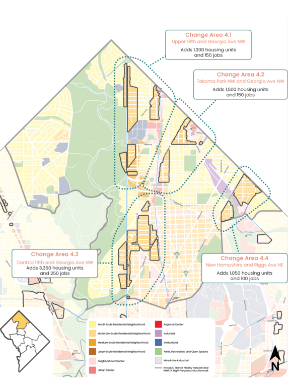
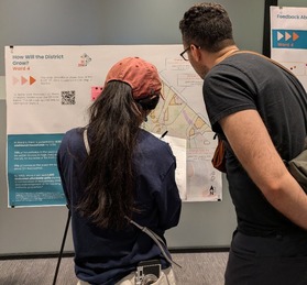
Pictured: Snapshot of Ward 4 from the draft future land use map, with areas highlighted that are proposed for increased density (all ward snapshots can be found in the future land use map survey at DC2050.com).
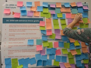
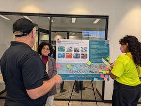
On March 18 and 21, we hosted public workshops at MLK Library designed to get feedback on initial proposals for future land use and related topics.
We asked for thoughts on the eight goals we’ve identified for DC 2050.
 |
|
These include adding more housing choices, reducing displacement risk, increasing access to jobs near transit and housing, supporting retail, honoring historic places, designing safe streets and public spaces, improving access to community spaces, and keeping our environment clean. |
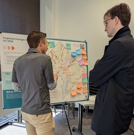
We shared an initial draft of a future land use map, explained the analysis and assumptions behind it, and spoke with people about their questions and concerns.
|
|
 |
 |
|
We zoomed in on proposed density increases for each ward, along with the estimated housing and job increases, and asked for people’s reactions.
|
We are also preparing for the next iteration of our agency’s neighborhood planning program. To help us develop a proposed approach, we asked attendees what components should be included and how we should prioritize locations among all the areas of the city.
|
|
 |
 |
|
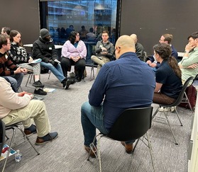
We also brought people together in 19 small group conversations led by our staff to wade through tradeoffs involved with balancing growth and preserving affordable housing. If you joined one, let us know what you thought about the format at DC2050@dc.gov (subject: “March workshop feedback”).
|
We are grateful for the 275 attendees who gave their time, asked thoughtful questions, and gave feedback. We’re working to consolidate and analyze your feedback as we gather more input through the virtual workshop.
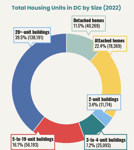
Check out our latest resource on DC’s current housing landscape, told through charts and statistics. The StoryMap looks at the factors that make up a complete community, which is a community that balances residents’ housing needs with access to everyday amenities, services, and destinations like jobs, schools, stores, and parks. Click the image below to explore more information like this on the city’s current housing mix and the level of access residents have to housing and everyday resources.
Pictured: chart of total housing percentage in DC by size, as of 2022, which includes: 11.5% detached homes, 22.4% attached homes, 3.4% 2-unit buildings, 7.2% 3-to-4-unit buildings, 16.1% 5-to-19-unit buildings, and 39.5% buildings of 20 or more units.
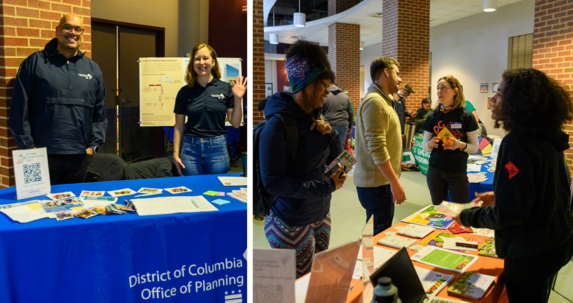
Pictured: OP staff talk with residents about DC 2050 and food policy at Rooting DC (Mar. 7)
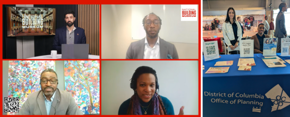
Pictured, left to right: Director Cozart speaks about DC 2050 and other topics on a National Building Museum Future Fridays panel (Mar. 6); OP staff table at DMPED's March Madness (Mar. 19)
 In this section of our newsletter, we share questions we've heard from residents.
Question: How realistic are the estimates of new housing capacity in the draft future land use map?
Answer: Estimates of how much new housing we can support with the proposed changes on the future land use map go beyond zoning capacity to account for realistic development patterns. Few, if any, DC neighborhoods have been built out to the maximum allowable density, so we came up with a way to estimate likely development of new homes and offices.
To develop the estimate for each place type, we looked at existing buildout of neighborhoods that are comparable to the place type. We then averaged dwelling units per acre to develop an assumption. Using Metropolitan Washington Council of Governments estimates for future growth, we further calibrated our projected development assumptions.
If you have a question on DC 2050, please email it to us at dc2050@dc.gov.
|