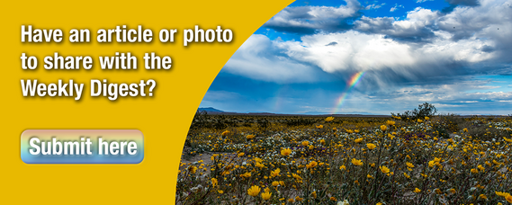
ADVENTURE OF THE MONTH
Prairie City State Vehicular Recreation Area Is a Place to Learn the Off-Highway Vehicle Recreation Ropes
Story from: Andreas Agocs, Communications and Marketing Division
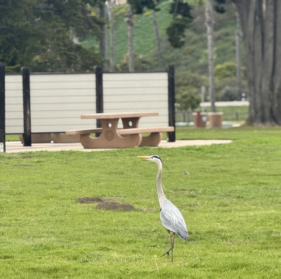
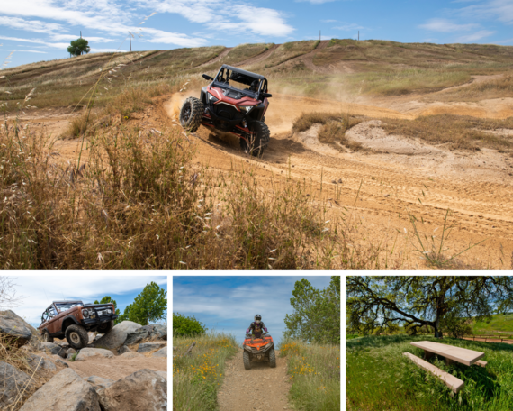 Top: A recreational off-highway vehicle in action. Bottom left: The park's 4x4 obstacle course is one of the park's many specialty tracks. Bottom middle: An all-terrain vehicle rider amid wildflowers. Bottom right: The park features picnic spots for quieter recreation. Photos from Brian Baer, Communications and Marketing Division.
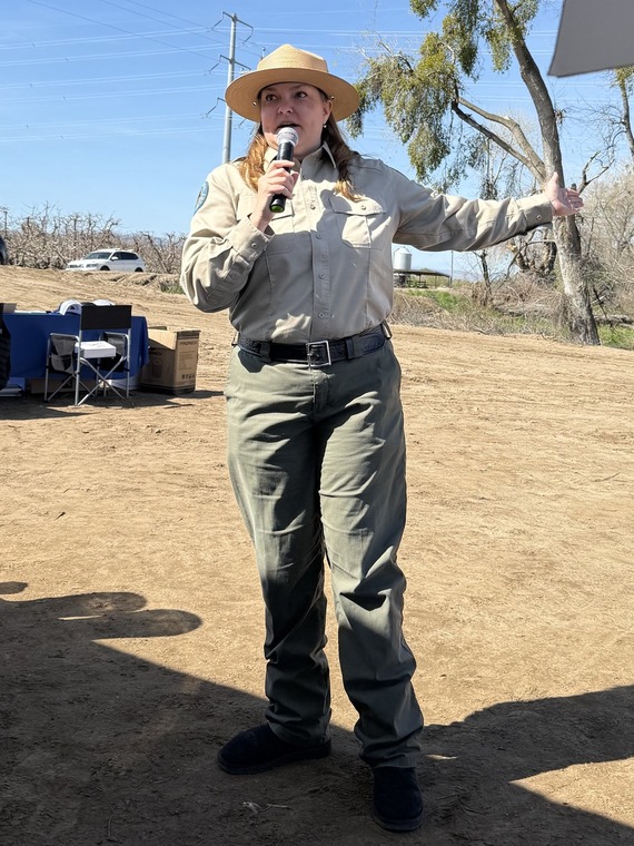
For off-highway vehicle (OHV) enthusiasts in the greater Sacramento region, Prairie City State Vehicular Recreation Area (SVRA) is a premier destination. Interpreter Joleen Ossello emphasizes that Prairie City is a park for visitors of all ages and skill levels. "You won’t have trouble finding an area that suits your level of experience,” Ossello said. “You can even be trained for free.”
The park’s more than 1,300 acres include a range of trails, training facilities and specialty tracks for recreational off-highway vehicles (ROVs), all-terrain vehicles (ATVs), motorcycles and karts, as well as picnic areas and natural resources like vernal pools and native blue oaks. While the annual Hangtown Motocross Classic receives the most publicity, the park also hosts many local, regional and state events that pack its calendar with up to 300 event days per year.
Through its Environmental Training Center, Prairie City offers more OHV safety training opportunities than any other of the State Park System’s nine SVRAs. While state fire crews and other emergency services use the park’s terrain to practice for real-world challenges, recreational riders can hone their OHV skills at a number of facilities, including motorcycle and ATV practice tracks, the Quarter Midget Track and the concession-operated Kart Track and Pro-Am MX Track. The 4x4 area and obstacle course is for drivers who love challenges. And the youngest riders (under 14 years) can get their OHV feet wet on the Intermediate or Kids MX tracks.
Instructed by Ossello and Environmental Scientist Taylor Espenshade, Communications and Marketing Division members visited the park to gain a firsthand impression of the OHV experience, which at Prairie City can include riding a motorcycle, an ATV or an ROV. (ATVs have four wheels and handlebars, and are straddled similar to the way a motorcycle is ridden, while ROVs, such as utility terrain vehicles (UTVs)—also known as side-by-sides (SxS)—are designed for multiple passengers and have a car-like chassis with a steering wheel and pedals.)
Appropriate gear is as important as correct acronyms in an SVRA. Outfitted with gloves, helmets, goggles and over-the-ankle boots, we were ready for a ROV ride on the park’s trails—whose surface partially consists of old mining tailings, a legacy of the area’s gold rush history. The ride over Prairie City’s rolling hills is bumpy, noisy and exciting—at speeds of up to 30-35 mph, though, you want to keep your distance from the dust cloud of the vehicle in front.
With Ossello and Espenshade giving explanations over headsets while maneuvering our vehicles, it was also an opportunity to learn more about the park’s history and ecology. The drainage of the Cosumnes and American rivers served for thousands of years as a meeting place for Native American tribes, including Plains Miwok and Valley Nisenan, which have inhabited the area up to the present day. After the 1850s, gold miners claimed the area, leaving the dredge tailings that provide much of the or grassy mounds—and bumps— on Prairie City’s trails. In the more recent past, Aerojet General Corporation developed the land for rocket engine testing. In 1988, after several more changes in private and public ownership, the land was turned over to State Parks’ Off-Highway Motor Vehicle Recreation Division.
“The park staff works diligently to preserve natural and cultural resources to make future riding possible,” said Ossello. This includes guided tours of the Vernal Pool Management Area, which will continue in April. Under the park’s new Road and Trail Management Plan, the park will open up 400 acres of new riding area for OHV-minded visitors—just don’t forget the goggles, it gets dusty out there.
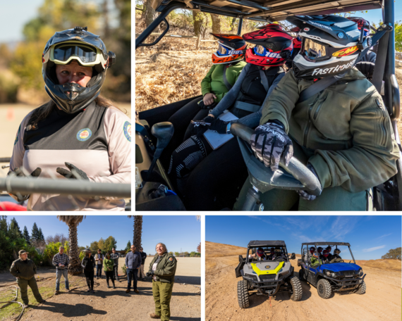 Top left: Interpreter Joleen Ossello gives a demonstration of her ATV-riding skills. Top right: Information officers Jo Biswas (left) and Adeline Yee are in goods hand with Environmental Scientist Taylor Espenshade (right) on the wheel of the park's Kawasaki UTV. Bottom left: Taylor (left) and Joleen (right) get the Communications and Marketing Division members up to speed for a ride in the park's UTVs (bottom right). Photos from Brian Baer, Communications and Marketing Division.
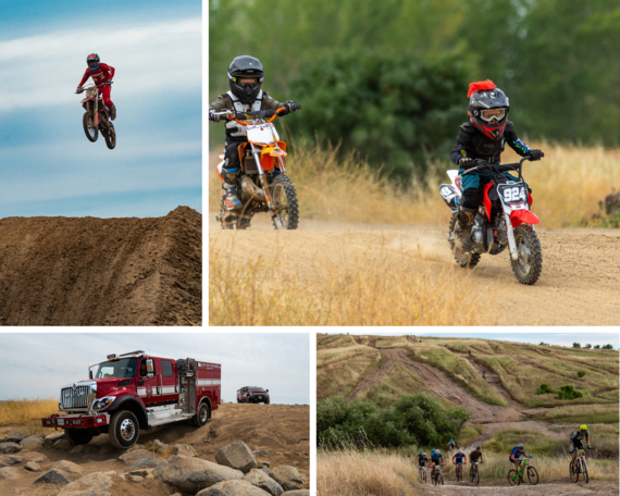 Top left: Prairie City gives motorcycle riders the chance to get airborne, while the youngest OHV enthusiasts practice on 70cc motorbikes (top right). Bottom left: Local and state fire and emergency crews use the park's specialty tracks for practice. Bottom right: While mountain bikes are otherwise not allowed during normal operating days, Prairie City hosts a 10-week mountain bike race series in the spring, one of the numerous events at the park throughout the year. Photos from Brian Baer, Communications and Marketing Division.

Topanga State Park Trails Reopen: A Step Forward for Outdoor Recreation
Story and Photos from: Cassandra Chavez, Angeles District
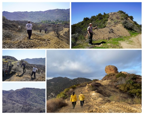 Top and middle left: State Parks Natural Resources staff and trail crew work on cleaning the trails. Top right: State Parks Public Safety Superintendent Jeff Langley standing in front of a contingency line. Bottom right: State Parks Natural Resources staff walking a contingency line. Bottom left: A visible fire line at Topanga SP.
Angeles District announced the reopening of several trails within Topanga State Park (SP) on March 21. After months of dedicated work following the Palisades Fire in January, visitors will once again have the opportunity to enjoy the beauty of this cherished natural area, including all hiking trails in unburned areas west of Eagle Springs Fire Road and west of East Topanga Fire Road and west of the Winnetka Ridge Trail and north of Dirt Mulholland. The reopening marks a significant milestone in restoring areas impacted by recent challenges.
State Parks staff continue to work tirelessly to repair damage and enhance the trails to ensure the safety and enjoyment of all visitors. While the excitement to return is understandable, visitors are reminded to stay on designated trails to preserve the park’s delicate ecosystem and maintain safety.
It’s important to note the reopened trails are outside the Palisades Fire burn scar. Any trails or fire roads not listed as open remain closed and State Parks rangers will strictly enforce these closures to protect ongoing recovery efforts. This includes trails that were not directly affected by the fire but will take additional time to reopen.
As part of the firefighting effort, firefighters created fire lines using dozers and hand crews. Some of these lines were created as contingencies. Although these areas did not burn, they were still affected and need healing as trail experts take the time to properly remediate these areas. In addition to these areas, visitors are also asked to stay out of any areas without designated open trails. Please check the park webpage prior to visiting for current trail information. Please direct questions or concerns to angelesinfo@parks.ca.gov.
Whether exploring on foot, bike, or horseback, we look forward to welcoming visitors back to Topanga SP. Together, we can keep this incredible outdoor space safe and sustainable for generations to come.
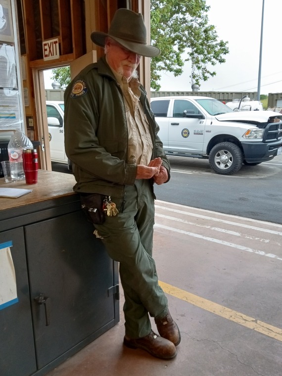
Off-Highway Motor Vehicle Recreation Commission to Meet in West Sacramento on April 2
Story from: Kevin Murphy, Communications and Marketing Division
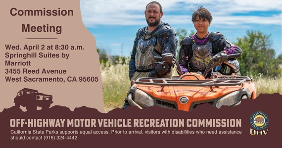 The California Off-Highway Motor Vehicle Recreation Commission will host its first meeting of 2025 on Wednesday, April 2, beginning at 8:30 a.m. in West Sacramento. Agenda items include planning and legislative updates. The full agenda and additional details are available on State Parks’ public notices webpage. Members of the public unable to attend the Commission meeting in person may watch it broadcast live at CAL-SPAN.org.
For information about the Off-Highway Motor Vehicle Recreation Division, including a list of SVRAs and available grant programs, visit ohv.parks.ca.gov. California State Parks supports equal access. Prior to arrival, visitors with disabilities who need assistance should contact (916) 324-4442.
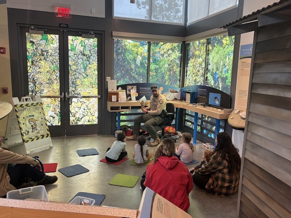
PORTS Live from the Annual CUE Conference!
Story and Photos from: Garrett Fuhrman, Inland Empire District
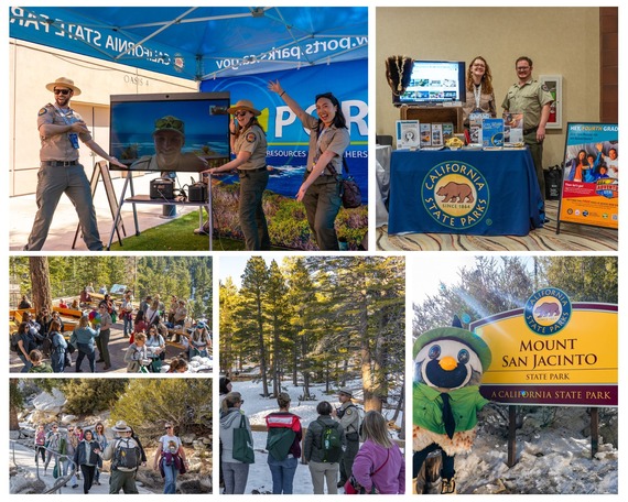 Top left: PORTS Program Coordinator Brandon Caskey, State Park Interpreter Specialist Max Ignatyev (on screen), PORTS Program Coordinator Lydia Stinson and K-12 Access Project Coordinator Kara Lu share a PORTScast live from San Elijo State Beach. Top right: Inland Empire District Museum Curator Alexandra Jonassen and K-12 Access and PORTS Program Coordinator Ian Bernstein working the State Parks booth at the CUE conference. Middle left: Educators arrive at CUE Outdoors. Bottom left and bottom middle: CUE attendees explore Mount San Jacinto State Park. Bottom right: Cali the Quail posing in front of Mount San Jacinto State Park’s iconic entry sign.
This past week, the PORTS (Parks Online Resources for Teachers and Students)® Program and southern California State Parks interpreters hit the road to Palm Springs for the annual Spring CUE Conference, an event that draws thousands of educators to share insights, best practices and inspiration.
Throughout the week, educators from across the state learned how PORTS brings California's state parks into classrooms through free virtual field trips and curriculum-based programming. Live presentations from interpreters across the state highlighted the power of connecting students with nature, even from a distance.
On Friday, participating educators ascended the Palm Springs Aerial Tramway to Mount San Jacinto State Park for CUE Outdoors, a hands-on field experience led by California State Parks staff. Thanks to Parks California, the evening featured themed prizes, light snacks and drinks, and a special appearance by California State Parks’ very own Cali the Quail. Teachers also had the opportunity to hike through Long Valley with State Park Interpreter Nicholas Garduño, learning about the park’s unique ecology and natural beauty.
A huge thank you to all the educators who stopped by to connect, learn, and explore. We can't wait to bring California’s state parks into even more classrooms this year!
Office of Community Involvement’s Partner Organization Loves Desert State Parks
Story from: Sam Bell, Office of Community Involvement
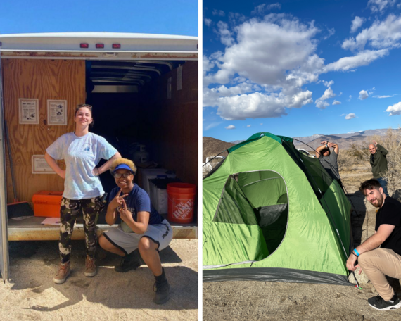 Left: Desert Recreation District adventure instructors Amanda Curtin and Les Bertrand pose with a FamCamp trailer at Anza-Borrego Desert State Park. Right: Community camping participants pitching a tent for the first time. Photos from Sarah Baltazar, Desert Recreation District.
At the Office of Community Involvement (OCI), we work with community-based organizations that we certify through our Outdoor Recreation Leadership (ORL) training. A benefit of completing ORL training courses is a certification for the FamCamp® program, allowing organizations to lead their own camping programs for their communities. One of our most active partners has been Desert Recreation District (DRD).
The largest park and recreation district in California, DRD covers 1,865 square miles and serves over 380,000 residents across the greater Coachella Valley. Its mission is to work closely with municipalities to ensure every community, regardless of economic status, has access to quality recreation services. DRD has used its certification to take trips to several state parks, including Cuyamaca Rancho State Park (SP), Malibu Creek SP, Leo Carillo SP, Anza-Borrego Desert SP and Castaic Lake State Recreation Area. The certification allows the organization to explore a variety of what California state parks have to offer.
DRD Outdoor Adventure Specialist Sarah Baltazar loves to share their group adventures with us. After her last trip to Anza-Borrego Desert SP, Sarah wrote: “Our group had a serene desert escape into Anza-Borrego [Desert SP] this past weekend! Although there weren't any wildflowers, the desert was beautiful! We braved the winds while setting up our basecamp Friday. The next morning, our campers got to walk across a creek and follow the water up to a cascading palm grove oasis. In the nighttime, we gazed at the dark sky and shared stories around a campfire. We discussed the value in escaping into nature for our health and happiness, and the importance of protecting these spaces by leaving no trace and recreating [responsibly].”
It is testimonies like this that really demonstrate the impact of the program and fosters collaboration between OCI and our partners.
 PARTNER NEWS
Parks California’s Staffer Visits 103 State Parks, Finds Hundreds More Reasons to Love Our State
Story from: Elizabeth Kubey, Parks California
 Veronica Silva Miranda at Castle Rock State Park, just one of 103 state parks she visited in 2024 as a Parks California staff member. Photo from Veronica Silva Miranda.
Spring is here! Longer days and warmer weather make it even more fun to plan your next visit to California state parks. How many do you think you will go to in 2025? During 2024, Parks California team members took up the challenge to use the OuterSpatial app and visit as many state parks as each could schedule. Some planned entire weekends traveling to multiple parks.
Veronica Silva Miranda led the pack in unique park visits—103 in total. While she returned to old favorites like Prairie Creek Redwoods State Park in Humboldt County, she also traveled across California to explore new ones like Refugio State Beach in Goleta and Trinidad State Beach north of Eureka. Read this interview to see how she prepares for enjoyable trips to California’s state parks.

|