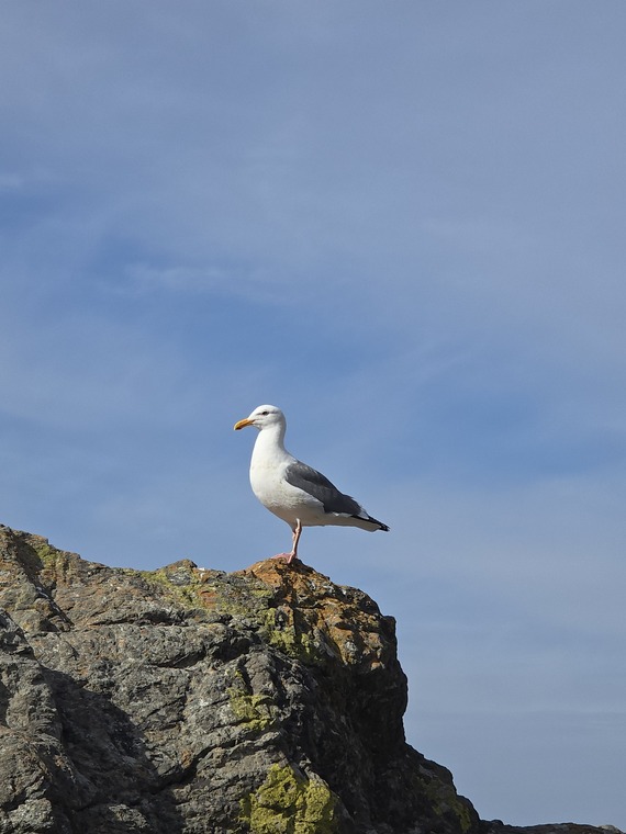
Crews Treat Over 900 Acres of Calaveras Big Trees State Park's South Grove with Prescribed Fire
Story from: Amber Sprock, Central Valley District
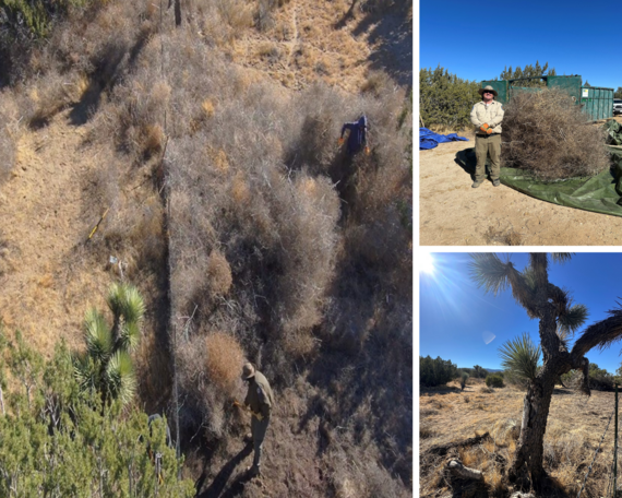
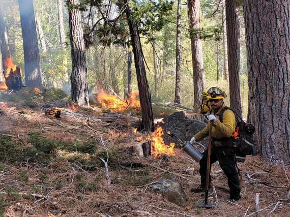 David Garcia (foreground) and Ashton Call assist in hand-firing a prescribed burn at Calaveras Big Trees State Park that was years in planning. Photo from Richard Rappaport, Central Valley District.
After years of planning, crews began ignition on a prescribed burn in the South Grove of Calaveras Big Trees State Park (SP) on Oct. 29. The broadcast ignition lasted four days and initially treated 914 acres with beneficial fire. This is the first time aerial ignition and drone technology were used within the park to reach difficult terrain. Unfortunately, due to weather conditions, much of the burn still needed to be hand-fired to meet project goals.
Led by Central Valley District, the team spent years organizing interagency collaboration to bring fire to the South Grove and prepare the area for the large-scale prescribed burn. Preparation for the burn included removing large fuels a certain distance from the surrounding fire road and using hand tools to remove large material from the base of over 700 mature giant sequoias. With help from North Coast District, the statewide trail crew, and Northern Service Center, the team installed a required bailey bridge two years ago, put in place one-way traffic control, and completed other emergency bridge repairs to maintain access to the burn site.
When the test burn finally began on the first day of ignition, everyone was eager to see the project through. There was a clear buzz around the park and during briefings that fueled the momentum of the project. Even with rain, wind, and snow flurries, more than 150 dedicated park staff and CAL FIRE crews remained on site to work throughout the week on 12-plus- hour shift rotations. The burn continues to spread through the unit interior and is expected to ultimately treat over 1,000 acres. The entire South Grove Natural Preserve spans over 1,300 acres, so future prescribed fire treatments are already being planned for the remaining acres to bring back fire to the entire landscape.
Calaveras Big Trees SP is the only state park home to giant sequoias. The South Grove is the park's largest grove of giant sequoias and contains over 1,000 monarch sequoias. These trees depend on regular intervals of beneficial fire. Fire is the only disturbance mechanism that brings on rapid change in the ecosystem vital for giant sequoia regeneration. Fire opens cones to release seeds, creates a mineral soil seed bed, and opens the canopy to allow in sunlight, which seedlings need to thrive. Beneficial fire also maintains a complex forest community, increases wildfire resilience, improves wildlife habitat, and protects park infrastructure.
This prescribed burn was a true team effort led by Burn Boss Ben Jacobs and the Calaveras Big Trees SP staff, funded by the State Parks Wildfire and Forest Resilience Program. Central Valley District could not have done this critical work without the help of CAL FIRE, U.S Forest Service, Diablo Range, San Luis Obispo Coast, Sierra, and North Coast Redwoods districts, and State Parks Natural Resources Division. For more information about the prescribed burn, visit the park's Prescribed Fire webpage.
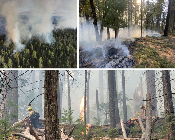 Top left: An aerial view of the prescribed burn from high above Calaveras Big Trees State Park's South Grove. Top right: The edge of the prescribed burn. Photos from: Nathanial Wigington, Central Valley District. Bottom: Crews ignited by hand much of the area due to weather conditions. Photo from Richard Rappaport, Central Valley District.
'Live With Kelly and Mark' from Mount San Jacinto State Park
Story from: Garrett Fuhrman, Inland Empire District
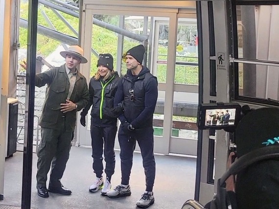 Interpreter Nicholas Garduno, Kelly Ripa, and Mark Consuelos boarding the Palm Springs Aerial Tramway. Photo from Donnell Norwood, Inland Empire District.
Live from sunny Palm Springs, New York’s own Kelly Ripa and Mark Consuelos, hosts of ABC’s "Live with Kelly and Mark," took an unforgettable journey up the Palm Springs Aerial Tramway to Mount San Jacinto State Park as part of the show's Greater Palm Springs tour.
Led by State Park Interpreter I Nicholas Garduno, the crew immersed themselves in the natural beauty of the park, hiking the 1.5-mile Desert View Trail to visit five breathtaking scenic overlooks. Along the way, the crew marveled at panoramic views of the Coachella Valley, learned about the unique flora of the San Jacinto Mountains, and captured unforgettable moments amid the towering pines and rugged cliffs. The journey offered an up-close look at one of Southern California’s most stunning mountain landscapes, making it a truly memorable segment of the show’s Greater Palm Springs tour.
You can watch a clip from the live segment here.
Preserving Veterans Day in Mitchell Caverns
Story and photos from: Andrew Fitzpatrick, Inland Empire District
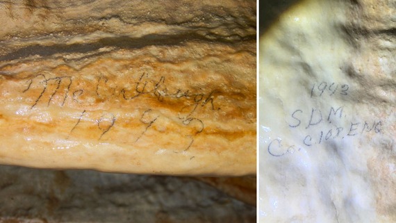 Names and identifying information written by soldiers touring Mitchell Caverns in Providence Mountains State Recreation Area in 1943. NOTE: Please do not leave graffiti or deface park resources in any way. This instance of writings left by soldiers in pencil is an exception as it is a glimpse into a timeless piece of history.
Veterans Day has a special significance at Providence Mountains State Recreation Area (SRA), the home of Mitchell Caverns. The valley that spreads out below this state park was once the training area for thousands of men preparing for World War II, and some of them left their inscriptions in Mitchell Caverns.
More than 18,000 square miles of remote desert in southeastern California and western Arizona became the Desert Training Center in early 1942, the brainchild of the famous General George Patton. For around two years, 13 infantry divisions and seven armored divisions went through maneuvers and practiced the coming campaigns from well over a dozen bases and airfields. One of these was Camp Clipper, visible from the shoulders of the Providence Mountains, where the Mitchell Resort was situated, now the heart of this state park.
Agreements between resort owner Jack Mitchell and the camp’s commanders made the resort a component of the training for the resident soldiers. The families of officers were lodged in the hand-built stone buildings constructed by Jack and his wife Ida. The resort itself became the destination for a 16-mile march with 2,500 feet of elevation gain. When the footsore troops reached the resort, the Mitchells served them refreshments and they got to shower and recreate. As Jack Mitchell recalled these events in his memoir, "The march to Mitchell Caverns was the final conditioner required of all troops before they left Camp Clipper ... Early on the morning that the first group was expected, Ida and I watched the cloud of dust created by two hundred pairs of army boots, and made preparations to entertain the boys who would be dragging those boots to our doorstep. Ida made gallons of lemonade and huge plates of sweet-smelling cookies."
Fittingly, the soldiers were also taken on tours of Mitchell Caverns, the highlight of this location now and then. And this is where they really left their mark, in a very physical sense. While in the cave, some soldiers wrote their names and identifying information on the stalactites, stalagmites, and other ancient calcium carbonate formations. It is important to remind everyone that defacing natural resources with graffiti is never acceptable even though the writings of these soldiers with a pencil left us a stunning and timeless piece of history.
While most of the inscriptions in Mitchell Caverns are simply names and years--it is worth noting that because of gasoline rationing and the sensitive nature of Camp Clipper, the only visitors into the caves in 1942 and 1943 were military--one soldier with the initials S.D.M. also left his unit designations, Company C, 108th Engineers Battalion, in pencil on a stalactite tucked away from normal view. This extraordinary inscription was quite faded, and went unnoticed by staff until last winter, when water trickling in from our heavy seasonal rains and snows made it shine.
Soldiers of this battalion, part of the 33rd Infantry Division, trained for desert warfare in the harsh Mojave conditions, and later received jungle warfare training in Hawaii. By May 1944, these troops were on New Guinea and shortly thereafter dispatched to the Philippines, where they saw extensive combat in the liberation of those islands. 2,246 servicemen of the 33rd Division were casualties throughout the war. No doubt many had been hosted by Jack and Ida.
Although protected for decades by the preservative qualities of this subterranean world, some of these remarkable inscriptions are hard to read, faded, or appear incomplete. Steps to conserve them are in motion, steps that start with questions, research, and consultation.
Tours of Mitchell Caverns take one into a time capsule. Items left in caves can last for hundreds, thousands, and even tens of thousands of years. For instance, Mitchell Caverns preserved intact and delicate material culture from native peoples, some which can be seen at the State Indian Museum State Historic Park in Sacramento. The 30,000-year-old limb bones of a giant Shasta ground sloth (Nothrotheriops shastensis) were found by archeologists and reside at the Phoebe Hearst Museum of Anthropology at UC – Berkeley. Add to these the inscriptions of the young men capture in graphite who went off 80 years ago to fight and, in some cases, perish far overseas.
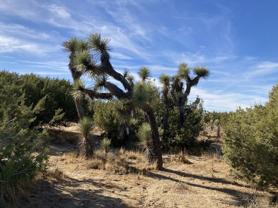
Fuel Reduction Project at Arthur B. Ripley Desert Woodland State Parks Aims to Preserve Rare Habitat
Story and photos from: Luis De Vera, Great Basin District
 Left: Senior Environmental Scientist Chris Hon and Skilled Laborer Justin Bahn brushing and removing huge piles of tumbleweed. Top right: Laborer Jon Bechtel with a pile of tumbleweeds. Bottom right: The result from brushing and clearing.
With the support from California State Parks Foundation, the Great Basin District was able to initiate their first fuels reduction project for Arthur B. Ripley Desert Woodland State Park, located in Lancaster, in the Antelope Valley. This unique California juniper-Joshua tree desert woodland is a sensitive community not otherwise represented in the State Park System. Due to the increasing rate of climate change, drought, and more frequent wildfires in the Antelope Valley, the fuels reduction project will not only reduce the spread of wildfires to the park but will protect the Western Joshua trees (Yucca brevifolia) – a candidate specie of special concern.
Western Joshua trees are considered at high risk from the effects of climate change, which is why the Great Basin District are grateful for the support from California State Parks Foundation. Several wildfires have swept across areas of the park in recent years, such as the Lake Fire in 2020 that impacted approximately 55 acres of the southwest corner of the park, destroying a small desert habitat that consists of wildlife, insects, reptiles, and vegetation that thrive in the park. Additionally, nearby properties and smaller communities that surround the park have been experiencing illegal dumping and mulching, which poses threats to the park since they can either ignite or introduce invasive species.
With the tremendous support from State Parks staff, Transition Habitat Conservancy (THC), and local volunteers from the Poppy Reserve/Mojave Desert Interpretive Association, we were able to remove piled tumbleweeds and invasive species crowding the juniper and Joshua trees and fill up two 40-yard bins—corresponding to 80 yards of potential fire fuels. This was a collaborative effort since THC shares a fence with the park; however, both parties shared the common goal to clear and remove potential fire fuels. The Natural Resources team will continue to monitor the conditions at the park to prevent the accumulation of ladder fuels and invasive species encroaching in the park.
The Great Basin District extends their appreciation to everyone who was involved in the project and would like to acknowledge California State Park Foundation for sponsoring us in efforts to withstand the effects of climate change.
Multiple Counties Partner with State Agencies to Collect Expired Marine Flares
Story from: Vivian Matuk, Division of Boating and Waterways and California Coastal Commission
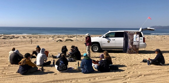
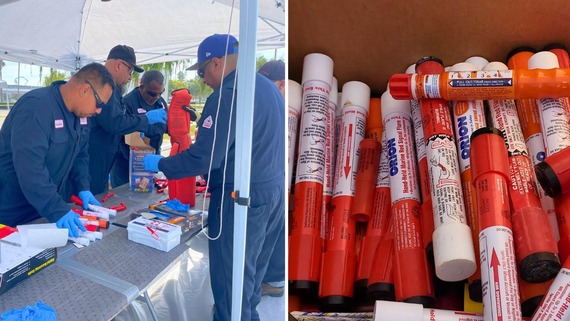 Left: A collection event in Los Angeles. Photo from the Port of Los Angeles. Right: Flares collected at a collection event in Marin County. Photo from Vivian Matuk, California State Parks and California Coastal Commission.
The Port of Los Angeles, the Port of San Diego, the City of Morro Bay, the counties of Marin, Alameda, West Contra Costa, and the California Product Stewardship Council partnered with State Parks, CalRecycle, and the California Coastal Commission’s Boating Clean and Green Program to collect expired marine flares and educate residents and boaters about marine flare management safety, including the advantages of reusable distress signals.
To protect California communities and the local environment, 528 participants disposed of 8,596 expired marine flares (approximately 3,757 pounds) collected at these events. Partners educated residents on the advantages of switching to a reusable Coast Guard-approved electronic visual distress signal device (eVDSD) and distributed over 250 of these devices to help boaters make the switch from single-use marine flares to reusables. The California Dockwalker Program attended some of the collection events, where they distributed California Boater Kits and shared clean boating information.
The U.S. Coast Guard requires boaters to carry several unexpired visual distress signals on board day and night. Pyrotechnic marine flares are a common type of distress signal, but they are explosive hazardous waste and contain toxic chemicals, like perchlorate, that pose human health risks. Marine flares only work once and expire 36 to 42 months after the manufacture date.
For safety and environmental reasons, it is essential to manage single-use pyrotechnic marine flares carefully. Residents should never throw flares overboard into the environment or out in household trash. However, California resident boaters do not have access to an ongoing expired marine flare disposal program, and recreational vessels generate about 174,000 pyrotechnic marine flares every year, according to the California Expired Marine Flare Working Group as estimated in 2012.
In the absence of safe disposal options locally, the partners encourage resident boaters to consider an eVDSD as a reusable distress signal alternative to the single-use pyrotechnic marine flare. Find more information about expired marine flares here. To learn more, check out our podcast.
State Historical Resources Commission Approves Eight Nominations for National Register of Historic Places
Story from: Kevin Murphy, Communications and Marketing Division
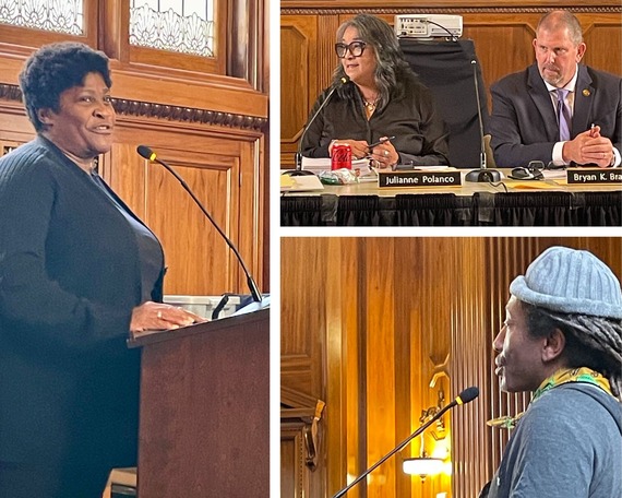 Left: Feleciai Favroth, treasurer for Oakland Heritage Alliance, speaks in favor of historic status for the Southern Pacific 16th Street Rail Station and Tower in West Oakland. Top right: State Historic Preservation Officer Julianne Polanco briefs meeting attendants on recent activities by the Office of Historic Preservation while current State Historical Resources Commission Chairperson Bryan Brandes listens. Bottom right: Ronnie Shaw, president of Old North Sacramento Community Association, addresses the importance of historic status for properties that may qualify for preservation under the new African Americans in California (1850-1974) Multiple Property Submission.
The State Historical Resources Commission (Commission) met in Sacramento on Nov. 7 and recommended eight nominations to be forwarded to the Keeper of the National Register of Historic Places (National Register). Several types of historic properties were approved by the Commission, including a former Southern Pacific Railroad station and signal tower in West Oakland and a historic complex of mines, buildings, and railroads in the Mojave Desert. The Keeper, an official within the National Park Service, makes final determinations for all nominations.
Southern Pacific Railroad’s 16th Street Station in West Oakland is a 21,000-square-foot reinforced concrete Beaux Arts passenger depot designed by Chicago architect Jarvis Hunt. This depot served the city of Oakland from 1912 and is directly associated with the life and work of C.L. Dellums, who became one of the leaders of the Brotherhood of Sleeping Car Porters union. Nearby residents and preservation advocates hope historic status may pave the way for funding to reimagine the area and provide a much-needed cultural center for the neighborhood.
Ryan Historic District, located in eastern Death Valley, is an area that includes a central core of buildings, two mine complexes, the remains of two railroads, a network of trails and roads, and archaeological deposits associated with borax mining, all sitting at 3,000 feet elevation on the western slopes of the Greenwater Range. Other approved nominations included St. Paul African Methodist Episcopal Church, associated with the oldest African American congregation in Santa Barbara, and the U.S. Postal Office’s Main Street Branch in Placerville, which was constructed in 1939 as part of the Work Projects Administration and retains the Forest Genetics mural created by Tom E. Lewis in 1941 under the auspices of the Federal Works Treasury Section of Fine Arts.
During the meeting, State Historic Preservation Officer Julianne Polanco reported on the African Americans in California (1850-1974) Multiple Property Submission, which establishes a framework to identify and designate places in California associated with African American communities. This historic context statement, under the National Register, was aided by the efforts of a community-based advisory board of members from around the state. It addresses contributions by African American citizens to the rich mosaic of the state’s collective history. With the passage of this multiple property submission, the vision of Five Views: An Ethnic Historic Site Survey for California, a project that began in the 1980s to survey the histories of underrepresented communities, is more comprehensive.
The Commission also heard a report from Eric Allison, from State Parks’ Information Technology Division, on progress made in the development of an updated database framework for organizing the inventory and associated data and documents for cultural resources and historical properties in California. The Commission conducted its election for chairperson and vice chairperson, electing Janet Hansen and René Vellanoweth, respectively. Commissioner Hansen, from Palm Springs, has over 30 years of experience in the field of heritage preservation and served as deputy manager of the City of Los Angeles’ Office of Historic Resources. Commissioner Vellanoweth, of Sierra Madre, has been dean of the College of Natural and Social Sciences at California State University, Los Angeles, since 2021 and was a professor and chair of the Anthropology Department from 2008 to 2020. For more information about past and future meetings, including meeting recordings and properties nominated to the National Register of Historic Places, please visit the Office of Historic Preservation.
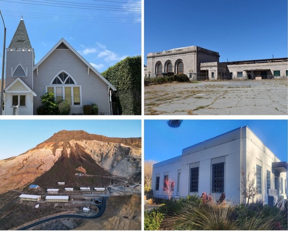 Nominations to be forwarded to the National Register included (clockwise from top left): St. Paul African Methodist Church in Santa Barbara. Photo courtesy of Robert Ooley. The Southern Pacific Railroad’s 16th Street Station and Tower in Oakland. Photo courtesy of Naomi Schiff for Oakland Heritage Alliance. U.S. Post Office – Main Street Branch in Placerville. Photo courtesy of Nancy Kam. Ryan Historic District in eastern Death Valley. Photo courtesy of Jessica Smith and Scott Smith, Death Valley Conservancy.
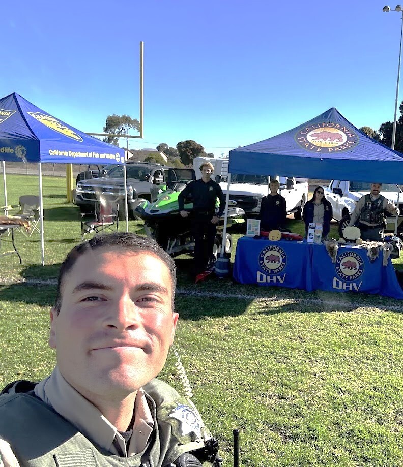
Boating and Waterways Commission Joins Conference for Key Discussions on Boating Trends, Safety, and Sustainability
Story and photos from: Melissa Miranda, Division of Boating and Waterways
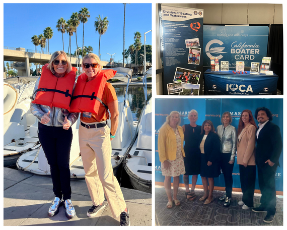 Left: Captain Sandy from Bravo’s hit show "Below Deck" next to Education and Outreach Coordinator Sara Kennedy. Top right: Division of Boating and Waterways (DBW) booth display at the Marine Recreation Association tradeshow. Bottom right (l to r): Commissioner Maggie Hallahan, Commission Chair Katie Hawkins, DBW Deputy Director Ramona Fernandez, Captain Sandy, State Parks Chief Deputy Director Liz McGuirk, and Commissioner Jose Gonzalez. Photos from Melissa Miranda, Division of Boating and Waterways.
The California Boating and Waterways Commission (Commission) held its public meeting as part of the 2024 Marina Recreation Association (MRA) Conference and Tradeshow in Long Beach. This coordination allowed the Commission a professional development day to meet with industry leaders, marina owners, operators, and stakeholders gathered to discuss the latest trends, regulations, and innovations in recreational boating and marina management. The conference featured a series of workshops, networking opportunities, and a tradeshow showcasing products and services for marina operations.
The Commission's public meeting was largely attended by boating stakeholders and industry members. The Commission participated in key topics related to boating infrastructure and waterway management. The meeting addressed project updates for recreational boating facilities and ongoing efforts to enhance boating safety and environmental stewardship in California’s waterways.
The conference and the Commission meeting underscored the collaborative efforts between governmental agencies and private sector stakeholders in promoting safe, sustainable, and accessible boating opportunities in California. Attendees gained valuable insights into emerging issues facing the marina industry and had the opportunity to engage directly with Division of Boating and Waterways (DBW) staff and fellow industry professionals.
DBW was also able to collaborate with the MRA conference keynote speaker Captain Sandy of Bravo’s hit television show "Below Deck" on a fun and education social media reel that has already engaged thousands of views. Check it out on the Boat California Instagram profile!
Meet the Commissioner: Maggie Hallahan from the California Boating and Waterways Commission
Story from: Kevin Murphy, Communications and Marketing Division
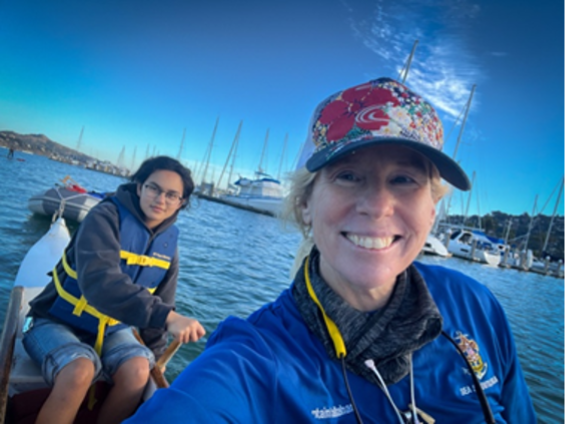 Captain and Commissioner Maggie Hallahan on Richardson Bay with student Imani Ezzat during a San Francisco Sea Scouts’ outrigger canoe event. Photo from Maggie Hallahan.
Ahoy there! Meet the Commissioner continues with a profile of the newest member of the California Boating and Waterways Commission (Commission). Maggie Hallahan was appointed to the Commission earlier this year by Governor Gavin Newsom. She resides in San Francisco and is a captain licensed by the U.S. Coast Guard. She is also board president of the San Francisco Wahine Outrigger Canoe community, a Makani skipper leader for the San Francisco Sea Scouts, and a member of the Peralta Squadron of America's Boating Club Northern California.
The new commissioner is chief executive officer of Maggie Hallahan Photography and Video in San Francisco. She has been a photographer and director since 1990 and has served as a motivational speaker for the United Nations Commission on the Status of Women since 1991.
Four commissions under the Department of Parks and Recreation provide guidance to the department director and staff, including the State Park and Recreation Commission, State Historical Resources Commission, and the California Off-Highway Motor Vehicle Commission. The California Boating and Waterways Commission is mandated by the Harbors and Navigation Code to advise and comment on all Division of Boating and Waterways (DBW) matters within its jurisdiction. The Commission must also advise and comment on all boating facilities loans and grants proposed by the division.
We asked Commissioner Hallahan five questions to learn more about her:
1. Why did you apply for the Commission?
Some of the best days of my life are when a youth yells out while on a canoe or boat, "This is so awesome!" Being on the water brings such healing and joy to communities. Many captains and steerspersons see less community access to the water. I wanted to see how I could help ramp and dock developments to be designed by and for communities, while taking into account historic inequality to water access.
2. Since joining the Commission, what’s one thing that has surprised you?
How much DBW does on such a tight budget. I am also surprised how each county or city must carefully organize to request boat ramps and waterway developments.
3. Why do you think it is essential for the public to engage with the Commission?
There is not a state requirement that every county must build water access system for its population. If members of the public became more involved with the Commission and DBW, they could help build bridges between their city and/or county governments to repair or build marine infrastructure, keep their waterways clean, receive boating education, and so much more for their communities.
4. What is your favorite form of recreation, and do you have a favorite state park to visit?
California has 280 state parks, which cover 1.5 million acres of land and water. I cannot even begin to pick out my favorites but there are a few I love to visit, including Angel Island State Park (SP), Franks Tract State Recreation Area, Malibu Creek SP, and Point Dume State Marine Reserve.
5. What would someone be surprised to learn about you?
When I was young, I struggled with dyslexia and a speech impediment. But during our regular family trips to California’s coast to play in the surf, I gained the courage to never give up. These difficulties helped me find the wisdom to become disciplined and the heart to be compassionate. For four decades I have been volunteering to create safe places for youth on and in the water. Protecting these important places where youth can challenge themselves and become competent leaders is not always easy. Public water parks and public waterways need to be protected and kept available for all Californians.
State Parks and Community Volunteers Restore Trails at Baldwin Hills Scenic Overlook Volunteer Day
Story from: Facilities Development Team, Angeles District
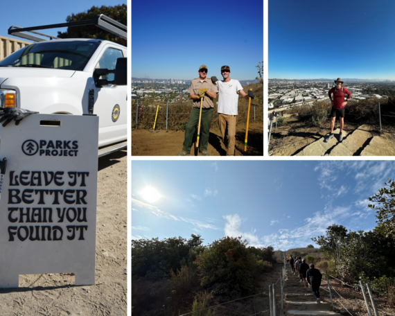 Clockwise from left: The State Parks and Parks Project welcome area for volunteers. Park Maintenance Supervisor Jason Finlay and Parks Project CEO Keith Eshelman. Culver City Vice Mayor Dan O’Brien at the top of the Culver City Stairs. How many steps are there at the Culver City Stairs? Photos from Cassandra Chavez, Angeles District.
California State Parks, Culver City Vice Mayor Dan O’Brien, and Culver City-based Parks Project partnered for a Volunteer Day to work on trails at Baldwin Hills Scenic Overlook, part of Kenneth Hahn State Recreational Area, on Nov. 9. Around 20 to 25 volunteers, including Parks Project members and community volunteers, worked together to restore the trails.
The team’s day began promptly at 9 a.m. with brush clearing. The team then used special machinery to remove the old trail surface before applying a durable soil mixture to create a flatter walking path. As trail work was in progress, O’Brien was going up and down the 282 steps of the famous Culver City Stairs, raising $850 through a fundraiser for Nature Nexus, a State Park partner that works to remove invasive plants and restore native vegetation at the park.
These ongoing collaborative efforts through partnerships are part of a larger initiative to maintain and improve trails within California’s vast state park system. Read more about the event here.
Cali Quail Brings Halloween Cheer to Idyllwild’s Great Pumpkin Carnival
Story and photos from: Garrett Fuhrman, Inland Empire District
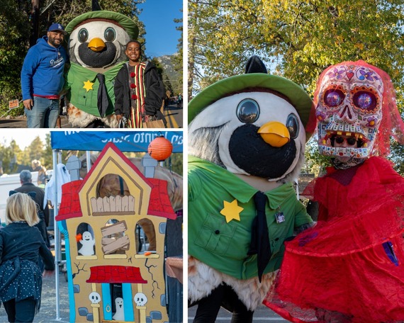 Clockwise from top left: Mount San Jacinto State Park manager Donnell Norwood and his son Kayden Washington-Norwood with Cali Quail. Cali poses for a photo with a parade participant. A child competing in the Haunted House Bean Bag Toss.
Cali Quail, California State Parks’ beloved mascot, made a festive appearance at Idyllwild's annual Great Pumpkin Carnival on Halloween. This cherished local event is the mountain town’s unique take on Halloween, offering kids and families a safe and fun alternative to traditional trick-or-treating.
The festivities kicked off with a lively costume parade down North Circle Drive, where Cali joined in the fun, sparking cheers and smiles along the way! Families and adults took turns posing for pictures, while Cali’s playful gestures, joyful waves, and lively dance moves engaged the crowd.
At the end of the parade, Cali took center stage at the Mount San Jacinto State Park (SP) booth, where State Parks staff greeted guests with interactive games and information about the park. The highlight of the booth was the Haunted House Bean Bag Toss, created by Ranger Stephen James, where kids aimed bean bags at ghostly cutouts for a chance to win candy. Cali’s presence made the experience even more memorable, cheering on each participant as they competed.
The evening not only filled the air with Halloween spirit and fun but also highlighted the strong bond between Mount San Jacinto SP and the Idyllwild community. Cali’s appearance at the Great Pumpkin Carnival proved to be a fantastic opportunity for the park’s staff to engage with visitors, foster connections, and celebrate the unique traditions that make Idyllwild so special.
 PARTNER NEWS
Arts in California Parks Presents [Placeholder: Swallowtail] Exhibit at State Indian Museum State Historic Park
Story from: Marissa Duenas, Placeworks
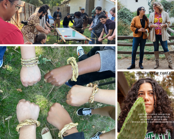 Top left: Students creating tule cordage under the guidance of Petee Ramirez, senior Traditional Ecological Knowledge specialist with the Shingle Springs Band of Miwok Indians. Photo from Emma Silverman, Capital District. Top right: California State University, Sacramento (CSUS), professors Amy Elkins and Eliza Gregory. Photo from Imani Jack, CSUS student. Bottom left: Students wearing tule cordage as bracelets. Photo from Emma Silverman, Capital District. Bottom right: “Environmental Portrait” artwork, created by CSUS student Yoselyn Can Mendoza. Photo from Emma Silverman.
The [Placeholder] exhibit emerges out of a novel collaboration with the Design Department at California State University, Sacramento (CSUS). Thirty-five senior photography program students research and photograph the landscape of the State Indian Museum State Historic Park (SHP) and Sutter’s Fort SHP. The resulting artwork will be on display concurrently at State Indian Museum SHP and the Verge Center for the Arts (625 S St., Sacramento) between Nov. 22 and Dec. 8.
For this iteration of [Placeholder], the local state historic parks offered students a rich opportunity to grapple with core class concepts. Throughout the fall semester, students made repeated visits to the parks as well as the off-site archival collections center, learning from State Parks staff about the histories of the sites as well as their present-day interpretation.
Local artists and Traditional Ecological Knowledge practitioners introduced students to Native American perspectives on, and relationships with, the landscape in which these parks are enmeshed. Jacky Calanchini and Petee Ramirez, members of the Shingle Springs Band of Miwok Indians, presented a land-based history of the region and taught students how to create tule cordage. Tule is a water plant used to weave baskets and much more. Sound artist Amy Melissa Reed led students in an exercise that involved headphones and special microphones to listen to the pond, the trees, the plants and the walls of the fort. Moreover, a group of artists who have been involved with the Native community and State Parks for many years contributed ongoing educational support. Digital artist and curator Meyo Marrufo, Karuk Tribe cultural practitioner and traditional basket weaver Dixie Rogers, and flutist and author Al Striplen met with students throughout the fall and provided crucial guidance on the developing art projects.
In response to these dynamic and varied experiences, students were asked to make artworks that reflect the complexity of the site and its history. They scanned plant cuttings from the site, identified native and non-native plant species in “yard portraits,” and made environmental portraits of people who move through the park, from strangers to State Parks employees. They produced zines for fourth graders, with images of trees, and visualizations of the site as it has evolved over time.
Admission to the exhibit is free of charge and open to the public during normal operating hours at both locations. In addition, receptions to mark the exhibit opening and closing will be held at both sites on Friday, Nov. 22, and Saturday, Dec. 7, from 5 to 8 p.m.
[Placeholder: Swallowtail] is supported by the Arts in California Parks initiative, a partnership between California State Parks, Parks California, the California Arts Council, the donors of the Photography Special Projects Fund at CSUS, and by the California Indian Heritage Center Foundation.
 Email photos to the WeeklyDigest@parks.ca.gov.
|