ADVENTURE OF THE MONTH
Keeping the Coast—and Its Visitors—Safe at Half Moon Bay State Beach
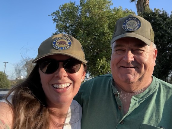
Story from: Andreas Agocs, Communications and Marketing Division
 Visitors strolling at Montara State Beach, north of Half Moon Bay. Photo from Brian Baer, Communications and Marketing Division.
A father and his 12-year-old son being carried out by a rip current and rescued in 50-degree-cold water. CPR administered on a paddleboard after a kayak flipped over 400 yards offshore. A vessel in distress, unable to drop its anchor, having to be kept in place by a lifeguard with a rescue tube for 30 minutes to prevent it from running aground.
These are just a few of the recent rescue operations performed by State Parks lifeguards along the San Mateo Coast in recent months. Half Moon Bay State Beach (SB) and its nearby beaches are great summer recreation sites for the urbanized, larger San Francisco Bay Area, with opportunities for camping, sunbathing, strolling, and birdwatching. The concerted efforts of State Parks' employees and volunteers make this coastal environment safe and enjoyable for visitors and sustainable for its natural resources.
In 2023 alone, 42 people were rescued by State Parks lifeguards along the San Mateo coastline. State Park Peace Officer (SPPO) Supervisor LT (Lifeguard) Micah Moore supervises about 24 seasonal lifeguards in the San Mateo Sector. Moore explained that State Parks works in tandem with other agencies, including the Half Moon Bay Harbor Master, CAL FIRE, and the California Highway Patrol’s helicopter operations. Yet, along more than 40 miles of coastline, Moore said, State Parks is “the only entity to go into the water.”
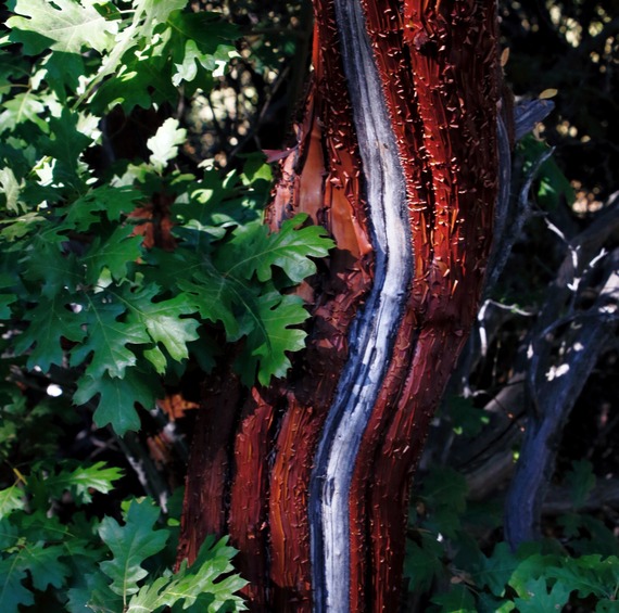
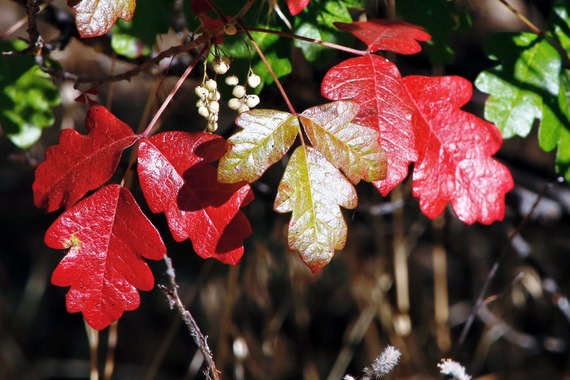
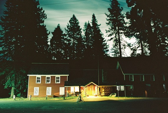
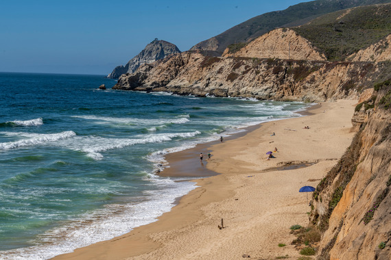
Half Moon Bay SB consists of two miles of fine white sand beaches, with the slopes of the Santa Cruz Mountains to the east as background. Its main hub, Francis Beach, includes the campground with 52 accessible campsites and the visitor center, which is open on summer weekends. At the adjacent plant nursery, volunteers like Judy Wheeler and Terry Piccolotti seed native lupines, yarrow, and other native dune vegetation. “Our volunteers are incredible,” said State Park Interpreter Elexis Padrón. “They’ve met every week since COVID to work on invasive plant removal, sheet mulching, and habitat restoration” - painstaking work with results that are visible in the blooming native clarkia and evening primroses greeting visitors on their way to the beach.
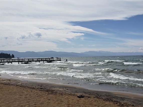
Just a short drive north of Half Moon Bay, Montara SB offers fewer amenities but beautiful beach and ocean views and a perfect spot for picnicking and beach strolling. A little more secluded and accessible by a steep stairway is Gray Whale Cove SB, with its picturesque Monterey cypresses and moss-covered rocks. Flocks of brown pelicans indicate upwellings with abundant fish life in the waters offshore.
The lifeguards who operated the tower at Francis Beach on a recent August day have almost all come through the “pipeline” of State Parks’ Junior Lifeguard Program and value the fundamental skills their lifeguard training provided them. For example, Nico Simrock, the lifeguard who recently kept a distressed vessel from running aground, is preparing for a career in fire fighting. Elias Richter and Luke Polachek - whose rescue of the dad and his son in March earned them a congratulatory tweet from Governor Gavin Newsom - demonstrated their lifeguard skills during a “mock rescue.” With Luke as the “mock victim” 50 yards from shore, Elias swam out swiftly and fastened a rescue tube around the “victim’s” torso. With the tube’s strap wrapped around his shoulder, Elias then used backstroke to tow the victim back towards shore. In real-life situations, the lifeguard would potentially have to deal with breaking waves or a victim’s panic- or hypothermia-induced incapacity to cooperate.
In addition to keeping visitors safe, State Parks is engaged in keeping the coast sustainable for its natural resources. State Parks Climate Resiliency Program Manager Erika Delemarre explains that the mean high tide line at the far south of Montara SB marks the beginning of Montara State Marine Reserve, part of California’s network of 124 connected marine protected areas (MPAs) that protect more than 16% of the state’s coastal waters. MPAs balance the protection of marine habitat with human recreational and educational uses. State Parks SPPOs like Moore play their role by conducting night patrols and issuing citations for violations like the poaching of Dungeness crabs during breeding season.
As the San Mateo Coast’s beaches make for a perfect getaway this Labor Day weekend, the countless large and small efforts to keep California's coast - and its visitors - healthy do not go unnoticed.
You can contribute to keeping California’s coast sustainable by reporting poachers or polluters anonymously through the California Department of Fish and Wildlife’s CALTIP hotline.
If you are caught in a rip current, stay calm and swim parallel to the shore until you’re out of the current.
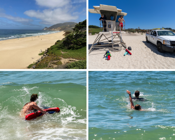 Top left: Francis Beach is the main hub of Half Moon Bay SB. Photo from Andreas Agocs, Communications and Marketing Division. Top right: Lifeguards Luke Polachek and Nico Simrock in the lifeguard tower at Francis Beach. Bottom left: Lifeguard Elias Richter swims out with his rescue tube during a mock rescue. Bottom right: Richter uses backstroke to tow “mock victim” and fellow lifeguard Luke Polachek to shore. Photos from Brian Baer, Communications and Marketing Division.
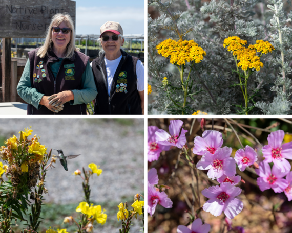 Top left: Volunteers Judy Wheeler (left) and Terry Piccolotti at the Francis Beach nursery restore native dune vegetation. Top right: Seaside woolly sunflowers. Bottom left: Anna’s hummingbird feeding on evening primroses. Bottom right: Ruby chalice clarkia. Photos from Brian Baer, Communications and Marketing Division.
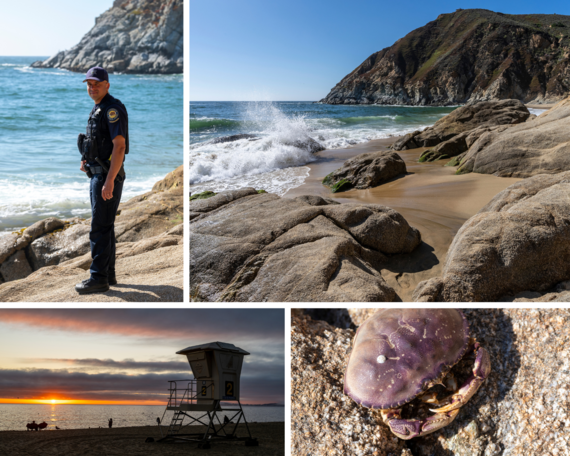 Clockwise from top left: SPPO Sgt. Micah Moore is the supervising lifeguard of the San Mateo Sector. Tide coming in at Gray Whale Cove SB. A Dungeness crab at Gray Whale Cove SB. Sunset at Francis Beach, Half Moon Bay SB. Photos from Brian Baer, Communications and Marketing Division.

FamCamp Program Empowering Access for the Visually Impaired With Trip to Leo Carillo State Park
Story from: Sam Bell, Office of Community Involvement
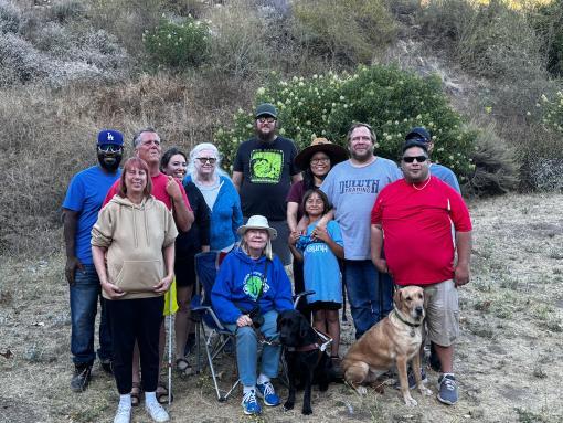 Sports and Recreation for the Blind (SRB) members enjoying their first FamCamp at Leo Carrillo State Park. SRB Members include: Tommy Ashby, Pei-Chun Chen, Drashawn Clay, Mathew Hernandez, Toni Lelless, Shirley Manning, Tommy Rash, Keith Rash, Veronica Rash, Rolando Romero, and Brittany Walker. Photo from Rolando Romero, SRB.
The Office of Community Involvement (OCI) would like to give a big shoutout to two of our community-based organizations, Hearts for Sight and Sports and Recreation for the Blind (SRB). These two organizations focus on recreation for the visually impaired and went on their first FamCamp trips during Disability Pride Month in July.
Hearts for Sight aims to break down the barriers to health and fitness that restrict the visually impaired to pursue physical, mental and emotional wellness. While this may be their first trip of 2024, Hearts for Sight has been an active participant in OCI programs for the past few years. SRB had its first ever FamCamp trip to Leo Carillo State Park. The president of SRB, Rolando Romero, used knowledge he gained during the Outdoor Recreation Leadership (ORL) training to set up tents, cook outdoors, and lead songs around an evening campfire.
Those who participate in an ORL training gain two-year access to the FamCamp program, which provides camp sites and equipment for up to 30 campers. This allows organizations like Hearts for Sight and SRB to connect their members with State Parks without investing in equipment and storage to create meaningful experiences.
For additional information on how you can start a FamCamp Program in your district, contact our office at (916) 902-8830 or send an email to Lovella.Sein-Colon@parks.ca.gov.
Casa Gutierrez Community Art Gallery Debuts at Monterey State Historic Park Thanks to Arts in California Parks
Story and photos from: Lisa Maldonado Bradford, Monterey District
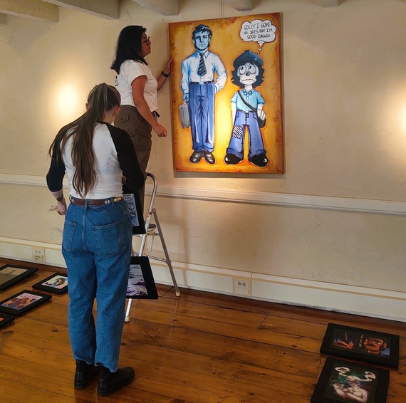 Marissa Serna, Youth Arts Collective program director (on ladder) and student artist hang exhibit art at Casa Gutierrez.
Saturday, Aug. 24 marked the culmination of more than a year of work and planning to create a community art gallery in one of the historic adobe buildings at Monterey State Historic Park (SHP). The Casa Gutierrez Community Art Gallery debuted as a creative and artistic adaptive reuse for a historic building that has served in several different capacities over the years, including as a family home, Mexican restaurant, and office space for a former member of the California State Assembly, but has remained closed to the public in recent years, until now.
The goal for State Parks for this adaptive reuse project is to seek local, nonprofit student art-focused groups and provide gallery exhibit space for student work. The first collaboration for Saturday’s exhibit was a much-anticipated partnership with the local non-profit, Youth Arts Collective (YAC), and featured art pieces created by students for their show, “Animated Antics – The Young Animators and Illustrators of Youth Arts Collective.”
YAC is a nonprofit, after-school art studio and mentorship program for high school and college artists; artists who are brilliant and struggling, confident and fringe, multi-ethnic, multi-tempered, and many financially challenged. The artists learn art, job- and life skills and gain a healthy dose of self-esteem and gratitude along the way. “YACsters” learn to believe in themselves, take creative risks, and give back. YAC provides supplies, studio space, art training, exhibition and commission opportunities, individual mentoring, and a community unlike any other. YAC’s tagline is “Do art. Be Kind.” To learn more about YAC visit yacstudios.org.
The new Casa Gutierrez Community Art Gallery space, located at 590 Calle Principal in Monterey, will be open to the public, free of charge, on Saturdays and Sundays, 11 a.m. to 4 p.m., through Oct. 20. The gallery is supported by Arts in California Parks. The purpose of the program is to support artists, culture bearers, California Native American tribes, and local communities in creating artwork that offers perspective on our past and present. The program establishes art installations and programming in state and local parks. For more information about Arts in California Parks visit parkscalifornia.org/arts.
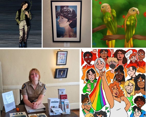 Clockwise from top left: Examples of student art from the recent opening of Casa Gutierrez Community Art Gallery included "Fishing," "Jeunesse," "Green Parrots," and "All the Colors of Pride II." Bottom left: Monterey SHP Guide Trainee Jay Funaro welcomed visitors to the art exhibition.
Using Light Detection and Radar to Uncover a Mystery at Colonel Allensworth State Historic Park
Story from: Steven Ptomey, Great Basin District
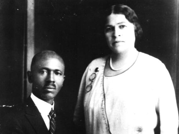 Reverend E.E. Bickers and Mrs. Mary Jane Bickers. Photo from Colonel Allensworth State Historic Park.
The Great Basin District cultural resources program recently began working with a Ph.D. student from University of California, Los Angeles, on a remote-sensing survey of Colonel Allensworth State Historic Park. Working under an archaeological permit, the student is conducting a survey utilizing a drone using the latest in light detection and ranging (LiDAR) technology.
LiDAR is a remote sensing method that uses light in the form of a near infrared pulsed laser to measure ranges, which are variations in the surface of the earth. This method can essentially see through vegetation. These light pulses – combined with other data recorded by the airborne system – generate precise, three-dimensional information about the shape of the Earth and its surface characteristics. It has been used effectively in the rainforests of Central America to find entire cities that have been covered by vegetation for centuries.
In his proposed research, the student is studying how commercial agriculture has changed the landscape of the Tulare Lake Basin. State Parks cultural staff is working with the student to collect information on the historic town of Allensworth during this process to expand the known inventory of ground features that are difficult to see while at ground level, including berms, canals, and foundations. One key interest of cultural staff is discovering the foundations of buildings from the town’s historic period. Of particular interest is the location of the general store owned by Mary Jane Bickers, thought to be located near the Allensworth Hotel and the demonstration garden.
Mary Jane Bickers was born in Yorkville, Ala., in 1877. She came to California with her parents Willis and Jane Hall, eventually settling in Bakersfield. She moved to Allensworth with her son Thomas after she separated from her husband, Reverend Edward Everett Bickers. Mary heard Colonel Allen Allensworth speak at a church in Bakersfield. Her brother, W.H. Hall, and his family were already living in Allensworth when she moved to the rural community.
Mrs. Bickers established both Allensworth's first business and the town's original post office. She operated a small general store in a building that she leased from the Pacific Farming Company and was appointed postmaster on Sept. 25, 1909. She passed away in 1918 at the age of 41 and is buried in the Allensworth Cemetery.
A preliminary analysis of the raw LiDAR data shows several "anomalies” in the area that is suspected of being the location of the Bickers Store. Additional research will be needed to determine if this is the location.
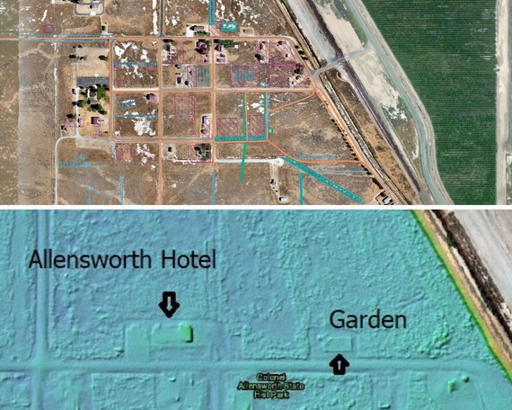 Top: A composite shows a 1952 aerial photo of Allensworth overlaid with data from LiDAR study. Pink and orange features are from 1952 and include buildings. Green and blue features are the multispectral and LiDAR features, respectively. Bottom: a closeup image of the LiDAR raw data with labels showing the locations of the Allensworth Hotel and demonstration garden. Photos from Robin S. Meyer-Lorey, Ph.D. student.
Curatorial Park Aides Complete Archaeological Inventory of Materials at State Indian Museum
Story from: Ileana Maestas, Capital District
 Clockwise from left: Curatorial Park Aides Theresa LaRose, Lèo Rivera, Madisyn Swengel (intern), and Nathan Wentz. Photos from Taylor Moore, Capital District.
The State Indian Museum received Cultural Resource Management Program funding to inventory its archaeology collections. The collections consisted exclusively of Native American stone archaeological materials (lithics) and were more than likely collected in the 1950s using “pot-hunting” practices, which are now illegal under federal and state laws. The inventory was done to fulfill State Parks' responsibility under the federal Native American Graves Protection and Repatriation Act (NAGPRA) and its state counterpart, the California Native American Graves Protection and Repatriation Act.
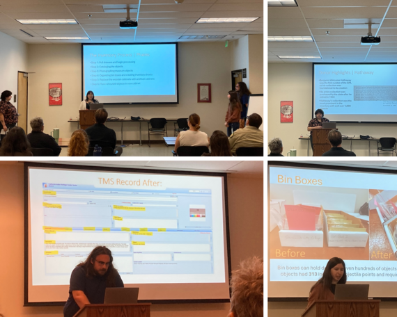
This project was done by curatorial park aides Lèo Rivera, Nathan Wentz, Theresa LaRose, and Madisyn Swengel. Overseen by State Indian Museum Curator Taylor Moore, the team spent nine months researching, cataloging, photographing, digitizing records, and updating The Museum System (TMS) database records and eventually rehousing the objects in archival cabinets. In addition, they updated condition reports for each object, which consists of noting any damage or past repair efforts. Ultimately, 1,769 object records were updated, 4,047 images were taken (including front and back of each lithic) and added to TMS.
On Aug. 19, the curatorial park aides presented their inventory project and its results to Capital District and Statewide Museum Collections Center staff. The team created a PowerPoint presentation, which laid out the reason for and process of the inventory project. They also presented some very personal stories behind their experiences of working with NAGPRA collections and how their own understandings prepared them for this type of work. Their accomplishments are a major part of State Parks’ repatriation efforts.
  Email photos to the WeeklyDigest@parks.ca.gov.
|