|
Follow Us:
|


|
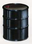
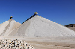 Construction aggregate mining operation.
By Chamois Andersen
As the saying goes, “money
makes the world go ‘round.” But in a
society that requires roads to go places, houses to live in and buildings for
work and school, it might actually be construction aggregate that makes the
world go ‘round. From crushed stone to sand and gravel, aggregates are used in
our everyday lives. Read more...
The WSGS has a new report and website on Wyoming’s Construction Aggregate Resource.
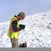
WSGS geologist Jacob Carnes conducts fieldwork on zeolites. Photo by Robert Gregory.
WSGS geologists completed
their latest field season conducting mineral
investigations on iron, zeolites, rare earth elements, and lithium. These
projects are being funded by the Wyoming Legislature, and will conclude in June
of 2016 with final reports provided to the Minerals Committee and made
available on the WSGS website.
The focus of these investigations
is to track, sample, and map the potential for development of these resources
in Wyoming.
Iron
Geologists Wayne Sutherland and Elizabeth Cola are in the final
stages of a report of investigation on Wyoming’s iron resources. This will be
the first comprehensive study of iron for the state since a summary report by
the U.S. Geological Survey published in 1976. Recent foreign and domestic
interest in iron for manufacturing led to some exploration and claim staking in
Wyoming in 2012. Information on iron occurrences throughout Wyoming, along with
maps and other information on the state’s iron resources, will be included in
the report.
Zeolites
Geologist Robert Gregory
is conducting the research for the zeolites study, with assistance from geologist
Jacob Carnes. They have collected field samples of several different naturally-occurring zeolite minerals. Currently, they are now in the process of analyzing those samples to determine
their crystallography, geochemistry, and purity.
Lithium
Geohydrologist Karl Taboga
is the lead on the lithium study, which is an evaluation of the state’s potential
resources. Taboga’s team is analyzing lithium concentrations in selected rock formations,
groundwater brines associated with existing oil and gas wells, and groundwater
associated with geothermal and playa deposits.
Rare Earths
Minerals geologists Wayne
Sutherland and Elizabeth Cola are conducting a study on Wyoming’s rare earth
elements. This is a continuation from a legislative-funded study, Rare Earth Elements in
Wyoming, completed in 2013. The goal of this research is to provide
additional geological analysis on potential rare earth element and other
mineral deposits and to map, characterize, and catalog these deposits and their
occurrences found throughout Wyoming.
Reports for rare earths, zeolites,
and lithium will be published in 2016.
The report of investigation for iron will be available this June.
Coal geologist Chris
Carroll and oil and gas geologist Ranie Lynds are conducting research on the
Fort Union Formation in the eastern Greater Green River Basin. This basin holds
potential coal and oil and gas reserves. Coal companies actively mine the Fort
Union coals near Rock Springs, and the U.S. Department of Energy coal
gasification pilot studies have been conducted in this area. In addition, there
are thousands of existing gas wells within the basin. More than 16,000 wells
are proposed to be drilled over the next few years, some of which are targeting
the Fort Union Formation.
Carroll and Lynds are
gathering data and creating a stratigraphic model of the Fort Union Formation
to gain a better understanding of the coal, sandstone, and shale clastic
setting. This study will consider existing oil and gas exploration targets
within the Paleocene-age strata and suggest new ideas for future exploration.
This project is intended as original research to gain knowledge of the
stratigraphic architecture for the potential for future coal, and oil, and gas
resource development.
Photo: Coal geologist Chris Carroll is knee deep in coal spoils collecting a sample at the
Black Butte Coal Mine, Sweetwater County, Wyo.
|
WSGS is soon to publish
its annual Summary Report series on Wyoming’s energy resources. From production to new developments, these reports are a snapshot in time on energy
commodities produced in the state and for the nation’s consumption.
Four-pager summary reports also being developed on Wyoming’s groundwater resources and
geologic hazards. These reports will be posted on the WSGS website in late February.
|
Water Atlas
Geohydrologist Karl Taboga
is beginning work on the development of a groundwater atlas for Wyoming. The internet-map
server will include descriptions of the locations, extent, and the geologic and
hydrologic characteristics of aquifers in the state. This project will also
include a Wyoming map of groundwater recharge.
Geologic Hazards
Hazards geologist Martin Larsen is currently developing a public
information report on geologic hazards in Wyoming. Geologic hazards vary from sudden events – earthquakes,
landslides, and volcanic eruptions – to slow processes such as windblown
deposits and expansive soils. This report will include earthquake
basics, a general description of the geologic hazards found
in Wyoming, the locations and magnitude of significant earthquakes that
have occurred across the state and in Yellowstone, as well as geologic
hazard maps of landslides, windblown deposits, and expansive soils.
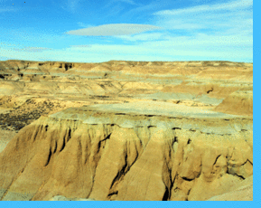
Stratified sediments of the Eocene age lower Bridger Formation. This outcrop is at Blue Rim, in the northeastern portion of the Green River Basin. Photo by Jacob Carnes.
(Click here for statewide
map of color stratigraphy columns according to Wyoming uplifts and basins.)
Stratigraphy is a branch
of geology that studies rock layers (strata) and rock layering (stratification).
It is used to understand the geometric relationship between different rock
layers and to interpret the depositional history represented by those layers.
This knowledge is an important exploration tool for the energy and minerals
industry and for water resource management.
Some history…Nicholas Steno (1638-1686) was a Danish pioneer of geology and is
considered to be the father of stratigraphy. Steno’s observations of rock
layers suggested geology is not totally chaotic. Rock layers preserve a
chronological record of Earth’s history and past life. He developed three
principles of stratigraphy, known as Steno’s Laws:
-
Law of
Original Horizontality, beds of sediment deposited in water form as horizontal
layers due to gravity.
- Law of
Superposition, oldest layers lie at the bottom.
- Law of Lateral
Continuity, horizontal strata extend laterally.
The WSGS website has been
designed as a clearing-house of information on Wyoming’s energy and mineral
resources with a host of information on the state’s geology. The agency routinely
updates information, including energy and mineral production numbers, as they
become available.
The website contains
searchable data and maps as well as the increasingly popular free downloadable
(pdf) reports and map products. According to Google Analytics, the Wyoming Oil and Gas map was the most
popular WSGS product in 2014 with more than 1,600 downloads. The Geologic Map of Wyoming was also in high
demand with nearly 1,500 pdf downloads.
The top pages of the WSGS website
include Gemstones, Wyoming Jade, GIS data, Stratigraphy index, and the web
pages on Diamonds and Coal.
|
|