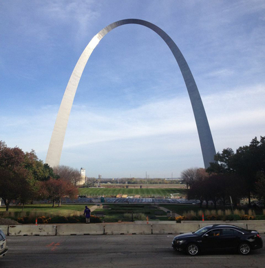
 A view of the Gateway Arch from downtown St. Louis
In St. Louis, Missouri, the National Park Service (NPS) is
collaborating with the city to improve connectivity between downtown St. Louis,
the Jefferson National Expansion Memorial park (JEFF), and the Mississippi
River as part of the City Arch River 2015 Initiative (CAR). Volpe is supporting the NPS Denver Service
Center (DSC) with a conceptual transit feasibility study as part of this
effort.
JEFF, the location of the famous Gateway Arch, is in the
midst of a major redesign to better connect it with the city. Together, NPS and
St. Louis will build a park over Interstate 44 to connect JEFF to downtown,
redesign a riverside boulevard to include a multi-use path, and replace a large
parking garage at JEFF with park land. This project will alter how visitors
access JEFF, which led to consideration of a transit circulator to ensure
visitors’ continued access and mobility to and around JEFF.
For the conceptual circulator feasibility study, NPS DSC and
Volpe analyzed existing conditions and circulator options and interviewed
stakeholders. Volpe’s technical work on the project included review and
analysis of existing transportation systems in St. Louis, draft route
scenarios, vehicle analysis and recommendations, and operational and
capital cost estimates. The project team organized a stakeholder workshop on
November 6, 2014, to present circulator scenario ideas and collect feedback.
More than 20 people from 10 organizations attended the workshop. The workshop
discussion resulted in a redesign of the potential circulator route and, more
importantly, greater stakeholder consensus on the need for a transit service.
Volpe helped NPS DSC finalize a report recommending that NPS conduct a thorough
feasibility study to assess a potential circulator route and vehicle options.
Project contact: Heather
Richardson
Public lands agencies have unique challenges communicating
their projects and programs. Internally, agencies need to communicate with
staff throughout the country with a range of job responsibilities and at
different scales (national, regional, and local). Externally, agencies must
reach potential partners, stakeholders, and the general public.
How can public lands agencies reach these diverse audiences,
in a way that catches their attention? This is especially challenging because
agency staff and stakeholders are very busy, with many different claims on
their attention.
Volpe has been working with its public lands sponsors to
develop communications materials that address these challenges. Recently,
Volpe’s public lands team has created a number of short, engaging videos that
are part of larger outreach strategies. For example:
-
NPS Staff Outreach on Novel Funding
Opportunities: Volpe staff developed a five-minute video that provides
staff throughout NPS with information about funding opportunities such as the
Federal Lands Access Program (FLAP) and Transportation Alternatives Program
(TAP). This video complements a series of white papers and program information
as part of a larger outreach strategy to regional and unit-level NPS staff.
-
Pacific Northwest Federal Lands
Collaborative Long-Range Transportation Plan Outreach Video: Working with the multi-agency project
team for the Pacific Northwest Federal Lands Collaborative Long-Range
Transportation Plan (CLRTP), Volpe created a video that explains the goals and
purpose of the CLRTP in a concrete, easy-to-understand way. The video is meant
to support outreach to the general public, interested stakeholders, and
internal agency audiences. The video particularly focuses on the tangible ways
that federal lands transportation systems matter to visitors and residents in
the Pacific Northwest.
The Public Lands Team believes that these communications are
an important part of its work and is encouraging Volpe staff and sponsors to
think more creatively about how to communicate projects. Volpe recently purchased
two small video cameras for staff to bring on site visits and hopes to bring
more public lands work to life through future communications support.
Project contacts: Alex
Linthicum and Ryan Yowell
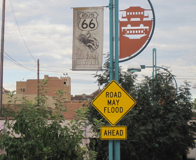 Sign warning of potential road flooding on the historic Route 66 in Albuquerque, New Mexico.
Planning for a growing region – especially an arid one like
Albuquerque, New Mexico – requires regional collaboration to address challenges
of congestion, sprawl, energy use, vehicle emissions, water scarcity, and climate
change. How can agencies incorporate climate change into their planning despite
uncertainty in climate, population growth, and other local conditions? The
Federal Highway Administration (FHWA) asked Volpe to help coordinate the Central
New Mexico Climate Change Scenario Project (CCSP) to provide insights on
this challenge.
A follow-up to a
similar scenario planning pilot on Cape Cod, the Central New Mexico CCSP
considered climate change in an arid, non-coastal setting, within the context
of the region’s metropolitan transportation planning process. Volpe coordinated
this multi-agency collaboration between FHWA, the Mid-Region Council of
Governments (MRCOG), the NPS, the U.S. Fish and Wildlife Service (FWS), the
Bureau of Land Management (BLM), the Bureau of Reclamation (BOR), and other
local and federal partners.
Project
Accomplishments
Through the CCSP, project participants achieved the
following outcomes:
- Climate
Futures Analysis: In collaboration with NPS and BOR, Volpe developed a tool
to create multiple possible scenarios for temperature and precipitation changes
in the region based on the BOR’s downscaled climate change projections. The
project team used this tool to create multiple possible “climate futures” for
the Albuquerque region. This tool can also be used at other locations in the
U.S.
-
Metropolitan
Transportation Plan Integration: MRCOG used the “climate futures” results
and analysis of the potential impacts of climate change on local transportation
and land use to inform the development of Futures 2040, its long-range
transportation plan update.
-
BLM
Unit-Level Analysis: Volpe adapted the CCSP’s regional climate change
analysis to assess the implications for the BLM’s Rio Puerco Field Office. The resulting
report was designed to inform the BLM’s current travel and transportation
management planning process at this unit.
-
FWS Case
Studies: Volpe supported FWS by developing two short case studies for
internal and external audiences on how the Valle de Oro National Wildlife
Refuge is collaborating
with regional partners and preparing
for climate change.
-
Final
Report: Volpe developed a final
report that presents the CCSP’s findings, methodologies, and lessons
learned. This report also serves as a guidebook for other agencies who wish to
incorporate climate change into their regional planning efforts.
Project contact: Benjamin
Rasmussen
Water is a natural feature celebrated by many public lands.
In some cases it is also a transportation asset that poses unique opportunities
and challenges for public lands agencies. Planning maritime transportation
systems requires specialized skills to understand the requirements, costs, and
regulations that oversee this industry. Because
Volpe has maritime engineering expertise supporting the U.S. Coast Guard, U.S.
Army, and the Maritime Administration, Volpe staff have recently supported a
number of NPS units manage their water transportation systems.
Isle Royale National Park (ISRO) – Vessel
Repair / Replacement Analysis
ISRO
is a remote island archipelago in Lake Superior, fourteen miles from the closest
mainland and 60 miles from the park’s headquarters in Houghton, Michigan.
Visitors come to ISRO for its beauty and solitude, but its remote location
makes transportation costly and difficult for NPS, resulting in the highest per
visitor cost of all NPS park units ($170).
Currently, ISRO relies on a 55-year-old vessel named Ranger III to transport cargo and
passengers from the park’s headquarters. With Ranger III at the end of its useful life, ISRO asked Volpe to study
alternative operational concepts to continue transportation services in a
cost-efficient manner. After documenting the park’s current and projected
transportation needs and applicable regulations, Volpe developed six
alternatives that would support the park’s transportation needs under different
future visitation scenarios. These options included:
- Upgrading Ranger
III
- Building a new Ranger IV
- Splitting cargo and passenger transportation
operations to different vessels
- Concessioner-operated and NPS-operated options
Volpe analyzed each alternative to determine how much
redundancy they provided for each of ISRO’s transportation needs, capital and
annual operating and maintenance costs, potential risks, and necessary
implementation steps. Volpe’s
study provided ISRO with the background material and recommended next steps
for choosing a preferred alternative and identifying funding for these major
capital expenditures.
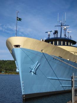 Ranger III at ISRO
Apostle Islands National Lakeshore (APIS) –
Alternatives Analysis for Operational Maritime Transportation
Volpe recently assisted APIS by analyzing alternatives for
meeting the park’s operational transportation needs. APIS, which consists of 12
miles of mainland and 21 islands in Lake Superior, relied on an amphibious landing
craft to transport equipment and materials to and from the park’s islands until
2012, when the vessel was put out of service due to poor condition. Since then,
APIS has relied on a contractor, but the park is bound to the contractor’s vessel
schedule and does not have a backup if its vessel is not available.
To help APIS decide how best to meet its operational needs,
Volpe analyzed seven transportation options that would allow APIS to accomplish
its mission. These options included acquiring a new or used landing craft,
contracting for landing craft services, and partnering with other parks to
share transportation services. Volpe estimated capital, operating, and labor
costs for each option over time periods of five to 25 years. Volpe’s
study showed that over the 25-year time frame, owning a landing craft would
be twice as cost effective as contracting for the service. This study will help
APIS make decisions for future operational transportation.
Lowell National
Historical Park (LOWE) – Vessel Procurement Support
Lowell National Historical Park, located in Lowell,
Massachusetts, features a system of historic, industrial locks and canals along
the Merrimack River. In 2012, Volpe supported the park to develop design
specifications for a boat and new docks for their boat tours. Volpe helped the
park determine whether there were appropriate vessels available via the General
Services Administration or the used boat market and assisted with identifying
and completing the environmental permitting required for the docks.
Project
contacts: Frances
Fisher
|