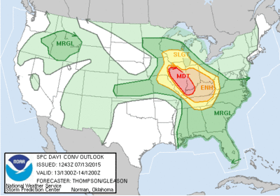
 Monday July 13, shows us under a risk of thunderstorms in the morning, which could
exacerbate already soggy ground and create more flash flooding and associated
hazards.
The main event is anticipated to hit the Louisville Metro area
sometime tomorrow afternoon/evening. The last estimate of timing was
between 6:00 PM and Midnight this (Monday) evening. This is predicted to
be a derecho event approaching from the North.
A derecho is a widespread, long-lived, straight-line wind
storm that is associated with a land-based, fast-moving group of severe
thunderstorms. Derechos can cause hurricane force winds, tornadoes,
heavy rains, and flash floods.
It is capable of producing devastation of trees, infrastructure
such as electrical utilities and have torrential rainfall in a short amount of
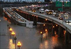
time creating extensive flash flooding.
The last such derecho in our area was in 2004 and resulted in
power outages that were very lengthy.
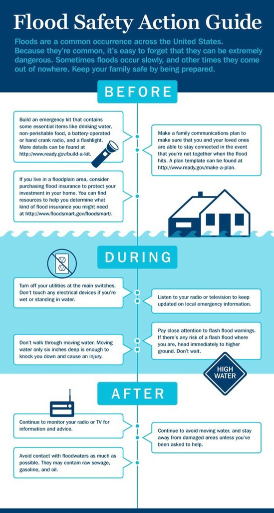
Fire Departments will have plans in place for possible multiple
water rescue scenarios.
Tuesday July 14, shows us under a general threat again for
thunderstorms with a greater severe risk to our South.
The National Weather Service will update the forecast at 1400
hours today. They have strong confidence in the current forecast package.
Emergency Services
MetroSafe Communications
Louisville, KY 40202
|