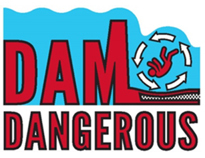
"Over, Under, Gone" Premieres Documentary Aims to Raise Awareness of Hazards of Low-Head Dams
(By Kenneth Smith, Manuela Johnson, and Sarah McCubbin-Cain)
As a result of multiple deaths at low-head dams in Indiana in 2014 and 2015, the Indiana Silver Jackets (ISJ) undertook a new, voluntary, multi-profession initiative: recreational safety at dams.
This topic crosses many professional disciplines and concerns a wide variety of stakeholders, including dam owners; manufacturing and retail organizations; multiple federal, state, and local agencies; law enforcement; first responders; educators; nonprofit, professional and recreational organizations; and anyone whose family or friends engage in recreational activities in rivers or streams.
As part of this effort, the ISJ participated making the documentary “Over, Under, Gone – The Killer in Our Rivers,” which premiered at a special event held Nov. 16 at WFYI, the PBS station in Indianapolis. Roughly 80 to 90 people attended a reception, the showing of the documentary, and follow-up Q&A led by Manuela Johnson and Kenneth Smith, who spearheaded the making of the half-hour program.
The documentary premiered to the general public on WFYI on Nov. 21. Later showings occurred on Nov. 22 and 30, and Dec. 1. The documentary will also be shown multiple times in the spring, just before outdoor water activities kick into high gear.
The release of this documentary was a result of a two-year effort that began at the culmination of a prior successful documentary effort by the ISJ called “When Every River turned Against Us,” about the historic flood of 1913.
The partnership with WFYI began through a casual introduction by an ISJ member. It grew from a team of people who conveyed the desire to advance education and awareness of low-head dams, geared to young recreational users, to Clayton Taylor, vice president of productions for WFYI, and producer Gary Harrison. The documentary, which can be viewed online and is the first product of that partnership.
Please help the ISJ and WFYI spread the awareness that low-head dams are Dam Dangerous.
For further information about being safe around dams, please visit the ASDSO’s Public Safety Awareness pages and watch the website for further information and resources.
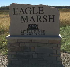 Eagle Marsh Gateway opening celebrated, all trails now open
(Information from Little River Wetlands Project Website)
More than 120 people joined LRWP, Ducks Unlimited and state and federal dignitaries to celebrate the opening of the new Gateway to Eagle Marsh entrance area and Continental Divide Trail on Oct. 8. The new Eagle Marsh sign made of Indiana limestone was unveiled and several brief presentations made. During one by John Goss, Asian carp director of the federal construction project to prevent problematic aquatic species from crossing between the Great Lakes and Mississippi River watersheds at Eagle Marsh, one of the preserve's resident bald eagles made an appearance overhead.
At 10:30 a.m., the new 5K Continental Divide trail was opened for about 80 people who joined an inaugural hike with Betsy Yankowiak, LRWP’s director of preserves and programs. Much of the trail is on top of the Graham-McCulloch Ditch berm, which was enlarged during last year’s construction, allowing visitors to view almost the entire preserve from above. This construction slightly moved the continental divide.
A number of other trails that had been closed due to the construction were also reopened at the event. Hikes on the Continental Divide Trail (Trail 5) and Eagle Marsh Trail 8 are part of the Allen County Trailblazers program.
|
COMMUNITY RATING SYSTEM
WHAT IS IT AND HOW DOES IT WORK FOR YOUR COMMUNITY?
(This is the first in a series of articles on CRS participation)
(By Debra J. Smith, DNR)
Each year flooding causes hundreds of millions of dollars in damage to homes and businesses across the country. Because a standard homeowner or commercial property policy does not cover flood losses, the Federal Emergency Management Agency (FEMA) created and administers the National Flood Insurance Program (NFIP).
The NFIP makes flood insurance available in participating communities that comply with minimum standards for safe, wise floodplain management. This is achieved by community adoption and enforcement of a local floodplain ordinance.
The NFIP’s Community Rating System (CRS) recognizes and rewards community efforts that go above and beyond the minimum standards by reducing flood insurance premiums for property owners.
CRS discounts on flood insurance premiums range from 5% to 45%, depending on the activities a community chooses to undertake. These discounts provide an incentive for new flood protection activities that can help save lives and drastically reduce property damage in the event of a flood. CRS participation may also benefit communities if federal grant monies become available.
Some of the higher standards for participation in CRS include dissemination of public information advising of the flood hazard, publicizing outreach projects that include providing examples of flood protection measures, the natural and beneficial function of the floodplains, and elevating the lowest floors of buildings higher than the minimum NFIP standards.
Community participation in the NFIP is voluntary, as is participation in CRS. However, CRS communities provide a better level of protection to their property owners while lowering flood insurance premiums throughout the community.
We will discuss the application process to enroll in CRS in the next issue.
 MAUMEE RIVER BASIN COMMISSION - REDUCING FLOOD DAMAGES IN NORTHEAST INDIANA 1986-2016
(Information provided by MRBC)
On Oct. 6, 2016, the Maumee River Basin Commission (MRBC) celebrated its 30th anniversary at the National Automotive & Truck Museum in Auburn. During the past 30 years, MRBC has been an excellent steward, leveraging funds to maximize outcomes. MRBC continues to identify needs and plan projects to benefit the communities within the watershed.
Some people may wonder how such a commission came about.
Indiana has a few River Basin Commissions that were formed for specific purposes. The MRBC was established by State Law (I.C. 36-7-6.1) to assist communities in the Indiana portion of the Maumee River Basin to reduce flood losses by exercising sound watershed management. The basin includes portions of Steuben, Noble, DeKalb, Allen, Wells, and Adams counties. The implementation of comprehensive structural and non-structural flood control measures basin-wide is critical to of reducing flooding in the basin.
The MRBC is composed of representatives from six counties. Each county is represented by the three county commissioners (or their official designee), the county surveyor, and a member of the Soil and Water Conservation District Board (or their official designee). These members play a critical role in the formulation of policy and program recommendations.
In 2001, the MRBC entered FEMA’s Cooperating Technical Partner (CTP) Program. The MRBC also coordinates all floodplain mapping activity in the basin and assists and guides its communities on numerous flood mitigation projects.
MRBC staff provide assistance in flood-mitigation project planning and administration, flood-mitigation assistance grant writing, FEMA Flood Insurance Rate Map updates, FEMA Multi-Hazard Mitigation Plan updates, the writing of 319 water-quality improvement grants, erosion and sediment control, flood insurance, floodplain ordinances, inventories of flood-prone properties, and stormwater and erosion control.
MRBC was the first “regional” Cooperative Technical Partner (CTP) in the nation. With more than 20,000 communities in the National Flood Insurance Program (NFIP), there is a significant challenge keeping flood hazard maps current. The CTP program is an innovative approach to creating partnerships between FEMA and participating NFIP communities, regional agencies, and state agencies that have the interest and capability to become more active in the FEMA flood hazard mapping program.
MRBC was the first basin in the state to achieve 100% stream studies. MRBC, in cooperation with its partners, the DNR Division of Water (DOW) and FEMA, have completed flood insurance studies on all streams having a drainage area greater than one square mile. The one-square-mile drainage area mapping standard is the limit of the DOW’s jurisdiction.
As a CTP, MRBC secured more than $131,500 in FEMA matching funds to perform updated detailed Flood Insurance Studies in the basin. In 2014, the DOW, also a FEMA CTP, committed more than $322,000 in matching funds from the Office of Community and Rural Affairs (OCRA) to perform a number of Flood Insurance Studies on unstudied streams in the basin. MRBC followed by committing more than $200,000 to perform Flood Insurance Studies on all remaining unstudied streams. Updated detailed Flood Insurance Studies typically result in improved flood map accuracy.
Through the MRBC, numerous successful acquisition projects have occurred. After the 2015 flood, more than 24 Decatur homeowners responded to the City’s plea to homeowners interested in a FEMA buyout. Acquisition projects have successfully been undertaken in Fort Wayne.
Although the preferred project is to completely remove a structure from harm’s way, retrofitting is an allowed project too, and is sometimes the most practicable approach. MRBC has been instrumental in dozens of retrofitting projects, including work on structures in Auburn, Decatur, Fort Wayne, Hamilton, Allen County and Noble counties.
One of the most distinctive mitigation projects was the NATMUS retrofitting project in Auburn. Acquisition of this historic building was not an attractive option. However, retrofitting door openings in the lower level by using stop-log structures provides greater protection for less work than sand bagging. Another example was the Messenger building, a funeral-supply printing company. Mitigation saved 100 jobs in Auburn.
MRBC also partners on projects that are critical to floodplain management and water quality. One prime example is a two-stage ditch project on the West Branch of Fish Creek. MRBC partnered with the Steuben County Surveyor, Steuben County Drainage Board, The Nature Conservancy, Steuben County Soil & Water Conservation District, Indiana Natural Resources Conservation Service, and the landowner for this project. Two-stage ditch projects are designed to reduce sediment, nutrients, herbicides, pesticides, and velocities of stormwater runoff in the watershed.
Although much work has been done, much remains. Other projects—and the communities and people on which they will have an impact—are still waiting. For more information about MRBC, visit mrbc.org.
|
 New Floodplain Management Staff Member
(By Darren Pearson and Julie Whitaker, DNR)
The division’s Floodplain Management Section welcomed a new planner in October, Julie Whitaker. She works with the National Flood Insurance Program (NFIP) communities of southern Indiana.
Julie received her Bachelor of Science degree in Human and Environmental Studies from Indiana State University in May 2013. She previously worked as a logistics specialist at an energy company. Julie coaches volleyball in her hometown of New Palestine. Julie also enjoys her backyard beehives, exploring Indy’s food scene, and discovering new music and movies.
Welcome Julie!
|
COMMUNITY RESPONSIBILITIES UNDER THE NFIP – WORKSHOP ON FEB. 9
(By Darren Pearson, DNR)
The DNR Division of Water will conduct a workshop on Feb. 9 that will focus on community responsibilities under the National Flood Insurance Program (NFIP). The workshop will be held from 9:30 a.m. to 3:30 p.m. EST in Indianapolis in Conference Room B in the Conference Center of the Indiana Government Center South, at 402 W. Washington Street. There is no fee. New community officials are strongly encouraged to attend. Other community officials are encouraged to attend as a refresher. Other individuals involved in floodplain management are also welcome. This workshop is eligible for Continuing Education Credits for Certified Floodplain Managers (CFMs). Register by Feb. 3 by contacting Darren Pearson at dpearson@dnr.IN.gov or (317) 234-1082 (direct) or 877-928-3755 (toll free). Seating will be limited to the first 80 registrations.
CONGRATULATIONS TO NEW CFMS
 (By Anita Nance, State NFIP Coordinator)
Eight new Certified Floodplain Managers (CFMs) from Indiana were added to the list of the growing number of floodplain management professionals across the nation. This national program for professional certification of floodplain managers was established by the Association of State Floodplain Managers. The program recognizes continuing education and professional development that enhance the knowledge and performance of local, state, federal and private-sector floodplain managers.
The most recent additions are Jared Lessor (Indianapolis), Patrick Manship (Anderson), Brad Newman (Anderson), Shirley Fitzwater (Westfield), Darrin Jacobs (Spiceland), Shawn Pabst (Brownsburg), Bart Schutz (Evansville), and Philip Morton (Huntington). All eight CFMs successfully completed the exam in September during the INAFSM annual conference. Congratulations!
|
CFM EXAM OFFERING – MARCH 28
(By Darren Pearson, DNR)
Are you ready to be Indiana’s next Certified Floodplain Manager (CFM)?
The DNR Division of Water will again proctor the CFM exam on Tuesday, March 28, at the Indiana Government Center South in Indianapolis (Conference Room 14) at 1 p.m. A short refresher session will be held in the same room from 8:30 a.m. until noon the same day.
To take the CFM exam, you must complete and submit the CFM Program Application Package to the Association of State Floodplain Managers (ASFPM). The forms are available on the ASFPM website and at floods.org, as well as under the Certification Program tab. The fee is $100 for ASFPM members and $450 for non-members.
You may submit an application for ASFPM membership at the same time you apply to take the exam. To be accepted to take the exam at this scheduled time, you must submit your completed application and pay the appropriate fee to ASFPM by March 14. No walk-ins will be allowed unless authorized by the ASFPM executive office. For specific information on the location and times, contact Darren Pearson at dpearson@dnr.IN.gov.
 2016 INAFSM Conference
(By Darren Pearson, DNR)
The 20th annual Indiana Association for Floodplain and Stormwater Management (INAFSM) Annual Conference was held Sept. 7-9 at Belterra Conference Center, near Florence. The focus was on the past and future of the association, and several awards were presented.
Robert Barr, research scientist at the IUPUI Center for Earth and Environmental Science, received the Excellence in Floodplain Management Award. The Excellence in Stormwater Management Award went to John Thomas, stormwater administrator for the City of Carmel. The Outstanding Floodplain Project Award went to the John Saltzman Regulated Drain: 2-stage Ditch Project. The Outstanding Stormwater Project Award went to the Butler University-Sunset Avenue Gateway Project. The City of Franklin Planning & Engineering Department-Flood Mitigation Program received the Excellent Strides in Floodplain Management Award. The Chair’s Award for Outstanding Service in Support of INAFSM went to Tonya Cottrell. The Education and Outreach Award went to Jason Donati, stormwater and recycling educator for the Muncie sanitary district. The Indiana Office of Community and Rural Affairs’ Green Infrastructure Curriculum and Training Project received the Education and Outreach Project Award.
Two Special Recognition Awards were presented. One went to Suzie Delay for her many years of service as audio visual coordinator for INAFSM conferences. The other was presented to Robert Bullock in recognition of his many years serving as photographer at the conferences.
2017 INAFSM CONFERENCE
(By Darren Pearson, DNR)
Planning for the 2017 INAFSM Conference is underway. The deadline to submit an abstract is Feb. 15. The 2017 INAFSM Conference will be held at the Century Center in South Bend, overlooking the St. Joseph River, Sept. 6-8. Mark your calendars. For more information about the INAFSM conference, abstract submittal requirements, and the organization, visit inafsm.net.
Indiana Training Opportunities – 2017
(Information provided by FEMA)
Indiana Department of Homeland Security
Please visit the Indiana Department of Homeland Security’s training calendar for upcoming courses and trainings at in.gov/dhs/emermgtngpgm.htm.
Association of State Floodplain Managers (ASFPM)
ASFPM has an online training program and training is added regularly. See http://www.floods.org/n-calendar/webinars.asp for more information.
FEMA’s Emergency Management Institute (EMI)
E0158: Hazard Mitigation Community Planner Specialist Qualifying Course. April 18-19, Emmitsburg, Md. This course will provide the opportunity for Hazard Mitigation (HM) Community Planner Specialists to attain the knowledge and skills needed to successfully demonstrate the behaviors/activities in their Position Task Books (PTBs) and to perform tasks that will be required during a disaster operation.
E0176: Hazus-MH for Floodplain Managers. March 27-30, Emmitsburg, Md. This course provides in-depth instruction and hands-on activities that develop the skills needed by floodplain managers and emergency planners to effectively use Geographic Information Systems (GIS) tools, with emphasis on Hazus-MH, for modeling the impacts on communities from riverine and coastal flooding. Those who complete this course will understand the roles that floodplain managers support as well as how geospatial technologies such as Hazus-MH can be used to protect communities beyond the minimum standards that floodplain managers are responsible for implementing.
E0190: ArcGIS for Emergency Managers. July 31-Aug. 3, Emmitsburg, Md. This course teaches new GIS users how to apply the ArcGIS for Desktop software to support disaster mitigation, response, recovery, and risk management. ArcGIS for Desktop allows users to analyze their data and create geographic knowledge to examine relationships, test predictions, and ultimately make better decisions. Course participants complete numerous hands-on activities that help them learn to develop informative maps as well as to use tools that answer questions based on where things are located and what is known about them. It also develops a variety of skills that can be used to create, edit, manage, and analyze both spatial and tabular data. While this course does not provide hands-on instruction specifically on Hazus-MH, all activities use Hazus-MH inventory and analysis outputs.
E0273: Managing Floodplain Development through the NFIP. May 22-23 and Aug. 21-24, Emmitsburg, Md. This is a basic NFIP four-day course that lays the foundation for working with the NFIP application within the field, and is targeted for local, tribal, state and federal floodplain managers. Topics covered include outreach, mapping (risk determination), rules and regulations, permitting, elevation certificate, substantial damage and substantial improvement, flood insurance and legal issues, as well as other important topics.
E0278: NFIP/Community Rating System. March 20-23, June 26-29 and Sept. 11-14. This course covers the CRS, a nationwide initiative of FEMA’s National Flood Insurance Program. It describes activities eligible for credit under CRS, how a community applies, and how a community modifies an application to improve its classification.
E0282: Advanced Floodplain Management Concepts II. April 24-27, Emmitsburg, Md. This course is designed to provide participants with the requisite knowledge to more effectively address issues concerning placement of manufactured homes and recreational vehicles in the floodplain, National Flood Insurance Program flood insurance principles for the floodplain manager, higher standards in floodplain management, and hydrology and hydraulics for the floodplain manager. See EMI website for recommended prerequisites.
EMI also offers many more courses in Emmitsburg, around the country and through webinar training opportunities online. For additional information on EMI classes and webinars, please visit EMI’s training calendar website and its course catalog.
Other Trainings and Conferences
Association of State Floodplain Managers. April 30 – May 5. Kansas City, Mo. The ASFPM annual conferences are recognized as the most important floodplain conference in the United States year after year. With more than 100 speakers and more than 1,200 participants, they are the national conferences all community, state and federal floodplain managers plan to attend. Please visit the ASFPM’s conference website for more information at http://www.asfpmconference.org/.
FEMA’s New Mitigation Grant Categories
(Information provided by FEMA)
Through its Hazard Mitigation Assistance (HMA), FEMA provides an average of $700 million annually in hazard mitigation grants. Now these grants can be used for a variety of climate resilient mitigation activities. In September 2015, FEMA added three new grant categories to the HMA portfolio. These changes were described as the Climate Resilient Mitigation Activities (CRMA) initiative. The three CRMA project types are Floodplain and Stream Restoration, Flood Diversion and Storage, and Aquifer Storage and Recovery.
FEMA’s grants are provided through its Hazard Mitigation Grant Program (HMGP), Flood Mitigation Assistance (FMA) and Pre-Disaster Mitigation (PDM) grants. The new grant-eligible categories address issues of climate adaptation, resilience, and mitigation. These new climate-resilient activities are consistent with a series of Presidential directives and FEMA plans, including Executive Order 13653, Preparing the United States for the Impacts of Climate Change; the President’s 2013 Climate Action Plan; FEMA’s Climate Change Adaption Policy; and FEMA’s 2014-2018 Strategic Plan.
CRMA projects are not the typical projects FEMA supports after a disaster, such as buying homes, building flood-control structures, and improving floodwater conveyance. The goal of a CMRA project is often the restoration of natural systems, protection of the environment, and the reduction of risk associated with significant changes in local climate conditions. CRMA projects, through their focus on green infrastructure, impacts to the ecosystem, and climate change, provide a community with viable alternatives to simply building more pipes, more pumps, and more treatment facilities.
The new grant categories address a series of issues that have been highlighted in state and local plans related to adaptation to changing weather conditions and changing risk patterns. The new grant categories include:
Floodplain and Stream Restoration (FSR) projects include re-establishing the function of ecosystems and floodplains as close to their original state as possible. The objective of the floodplain and stream restoration projects is restoring the hydrologic and biologic functions of environmentally sensitive properties. Typically these projects restore flood storage capacity of lands next to rivers and streams. They often restore the biological function of wetlands to filter pollutants out of storm and floodwaters.
As the name implies, Flood Diversion and Storage (FDS) projects involve diverting floodwaters into above-ground storage areas where the excess water will cause minimal impact on residents, property, and infrastructure. The key to FDS projects is that this is done with green infrastructure methods, including such improvements to rain gardens, bio swales, and areas for floodwater retention or detention. However, the goal is not simply temporary water storage for the sake of keeping it out of homes and businesses during a flood. FDS projects seek to take a long view and “re-use” that extra water for tomorrow’s needs by allowing it to slowly seep into the ground.
Finally, Aquifer Storage and Recovery (ASR), involves the capture and storage of excess water in an underground aquifer. The storage of water underground eliminates many of the problems and dangers associated with surface water storage. In areas of the dry and arid Southwest, the protection and restoration of natural aquifers and aquifer recharge areas is often a critical issue in community development and resilience. Holding the water underground protects this valuable resource from evaporation, most pollutants, and extreme weather. Furthermore, because the water is below the ground, there is generally less infrastructure to build and maintain, and there is no worry of the flooding that can occur in the event of a catastrophic dam or levee failure.
Fact sheets on all of the CRMA initiative project types may be found on FEMA’s website at fema.gov/media-library/assets/documents/110202.
CRMA proposals may be considered under the HMA program for those projects that are a result of a major disaster declared on or after Sept. 30, 2015, and for competitive Pre Disaster Mitigation and Flood Mitigation Assistance funding, for which the application period opened on or after Sept. 30, 2015.
Like other HMA projects, CRMA proposals must demonstrate that they reduce risk and are cost effective. Fortunately, FEMA has developed a benefit-cost analysis tool to be used in the development and implementation of CRMA projects. Additional information on the BCA tools may be found on FEMA’s website at fema.gov/media-library/assets/documents/110202.
In the long term, these grant categories reflect new priorities for FEMA’s mitigation grants. They should be discussed at mitigation planning meetings, public Risk MAP actions, and during other mitigation-related activities. In addition, CRMA projects and others like them should be incorporated into new and revised state and local hazard mitigation plans.
Additional information on CRMA and HMA may be found by visiting fema.gov/climate-resilient-mitigation-activities-hazard-mitigation-assistance and fema.gov/hazard-mitigation-grant-program.
THANK YOU
Thanks to those contributing to this issue: Debbie Smith, Anita Nance, Marty Benson, Don Kaczorowski, Ed Reynolds, Kenneth Smith, Manuela Johnson, Sarah McCubbin-Cain, Julie Whitaker, Laura Kannapel, and Betsy Yankowiak.
Editor – Darren Pearson
The work that provides the basis for this newsletter was supported by funding under a cooperative agreement with the Federal Emergency Management Agency (FEMA). The author and publisher are solely responsible for the accuracy of the statements and interpretations contained in the publication. Such interpretations do not necessarily reflect the views of the federal government.
Waterlines is produced biannually as a public service by the DNR Division of Water
Waterlines is available on the web at www.IN.gov/dnr/water
Having trouble viewing this email? View it as a Web page.
|