FOR IMMEDIATE RELEASE: Jan. 12, 2015
APALACHICOLA BAY WATER QUALITY AND WEATHER DATA NOW AVAILABLE IN REAL TIME
~New technology allows the public to view updated data every 15 minutes~
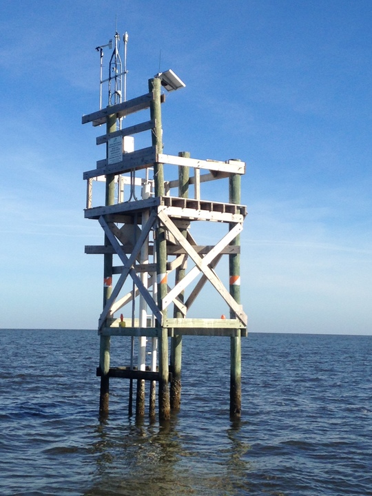 This is one of four new monitoring platforms that will provide real-time data.
TALLAHASSEE – Four new, real-time monitoring platforms have been
constructed in Apalachicola Bay to upgrade current data-collection sites
operated by the Apalachicola National Estuarine Research Reserve.
The Apalachicola National Estuarine Research Reserve has
been collecting water- quality data continuously in Apalachicola Bay since 1992
as part of the National Estuarine Research Reserve System-wide Monitoring
Program. All 29 reserves across the country participate in this effort to depict
the short-term and long-term variability in the conditions within our nation’s
estuaries.
In addition to water-quality parameters, such as temperature
and salinity, these four new stations collect water level and weather data
every 15 minutes.
“Real-time water quality and weather stations will benefit
commercial harvesters, recreational fishermen and the general public, as well
as inform the management of natural resources within Apalachicola Bay,” said
Jennifer Harper, manager of the Apalachicola National Estuarine Research
Reserve.
This real-time data is now available to be viewed online, here. Construction of the platforms was
funded through the Gulf of Mexico Alliance and instrumentation of the station
was completed by the Florida Department of Environmental Protection, Division
of State Lands, Bureau of Surveying and Mapping staff.
The four new water-quality and weather data stations are
located within East Bay, the Little St. Marks distributary, Dry Bar and Pilot’s
Cove. In 2015, money from the federal fisheries disaster declaration will be
used to upgrade the monitoring station currently on Cat Point to include water
level data, weather data and telemetry.
|